Ocracoke in Hyde County, North Carolina — The American South (South Atlantic)
Lake Company
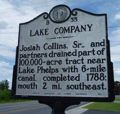
circa June 1999
1. Lake Company Marker
Erected 1955 by Archives Conservation and Highway Department. (Marker Number B-35.)
Topics and series. This historical marker is listed in these topic lists: African Americans • Colonial Era • Industry & Commerce • Waterways & Vessels. In addition, it is included in the North Carolina Division of Archives and History series list. A significant historical year for this entry is 1788.
Location. 35° 6.685′ N, 75° 58.858′ W. Marker is in Ocracoke, North Carolina, in Hyde County. It is on State Highway 12, on the right when traveling south. Touch for map. Marker is in this post office area: Ocracoke NC 27960, United States of America. Touch for directions.

Regionally, this marker is in the Coastal Plain and on the Outer Banks. It is also in the American South, specifically in the Upper South, in the Tidewater, and on the Eastern Seaboard. Globally, it is in the North Atlantic Region, North America, the Western Hemisphere, the Western World, and the
this page online
Other nearby markers. At least 8 other markers are within walking distance of this marker: Ocracoke Lighthouse (within shouting distance of this marker); The Island Inn Park Restoration Project (within shouting distance of this marker); Living at the Light (approx. 0.3 miles away); A Light for Ocracoke Inlet (approx. 0.3 miles away); Ocracoke’s Silent Sentinel (approx. 0.4 miles away); Growing More Resilient (approx. 0.4 miles away); British Cemetery - HMT Bedfordshire (approx. 0.4 miles away); USRC Mercury (approx. 0.4 miles away). Touch for a list and map of all markers in Ocracoke.
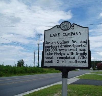
circa June 1999
2. Lake Company Marker
Credits. This page was last revised on February 1, 2025. It was originally submitted on September 12, 2008, by M. L. 'Mitch' Gambrell of Taylors, South Carolina. This page has been viewed 1,082 times since then and 19 times this year. Photos: 1, 2. submitted on September 13, 2008, by M. L. 'Mitch' Gambrell of Taylors, South Carolina. • Kevin W. was the editor who published this page.
