
Layhill in Silver Spring in Montgomery County, Maryland — The American Northeast (Mid-Atlantic)
Matthew Henson
A Lifetime of Exploration
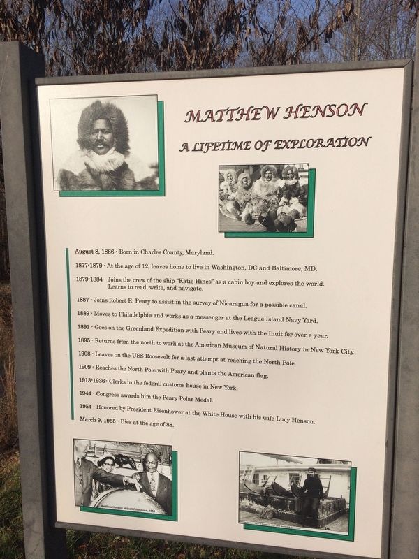
August 8, 1866 - Born in Charles County, Maryland.
1877-1879 - At the age of 12, leaves home to live in Washington, DC and Baltimore, MD.
1879-1884 - Joins the crew of the ship "Katie Hines" as a cabin boy and explores the world. Learns to read, write, and navigate.
1887 - Joins Robert E. Peary to assist in the survey of Nicaragua for a possible canal.
1889 - Moves to Philadelphia and works as a messenger at the League Island Navy Yard.
1891 - Goes to the Greenland Expedition with Peary and lives with the Inuit for over a year.
1895 - Returns from the north to work at the American Museum of Natural History in New York City.
1908 - Leaves on the USS Roosevelt for a last attempt at reaching the North Pole.
1909 - Reaches the North Pole with Peary and plants the American flag.
1913-1936 - Clerks in the federal customs house in New York.
1944 - Congress awards him the Peary Polar Medal.
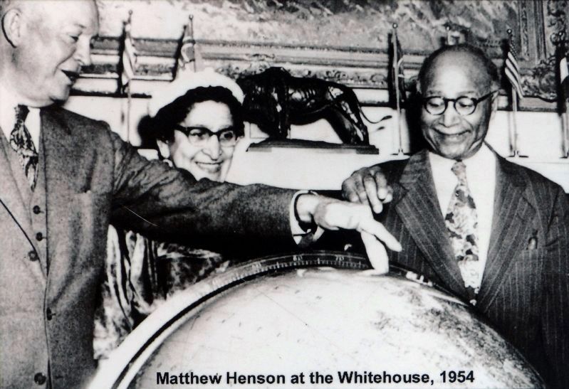
1954 - Honored by President Eisenhower at the White House with his wife Lucy Henson.
March 9, 1955 - Dies at the age of 88.
Erected by Montgomery Parks.
Topics and series. This historical marker is listed in these topic
this page online
Location. 39° 4.887′ N, 77° 2.849′ W. Marker is in Silver Spring, Maryland, in Montgomery County. It is in Layhill. It is on Layhill Road (Maryland Route 182) north of Middlevale Lane, on the left when traveling north. Touch for map. Marker is at or near this postal address: 13800 Layhill Road, Silver Spring MD 20906, United States of America. Touch for directions.

Regionally, this marker is in the Washington Metropolitan Area. It is also in the American Mid-Atlantic. Globally, it is in the North Atlantic Region, North America, the Western Hemisphere, the Western World, and the Anglosphere. Historically, it finds itself in what was once one of the original Thirteen Colonies and also the Antebellum South.
Other nearby markers. At least 8 other markers are within 2 miles of this marker, measured as the crow flies: A different marker
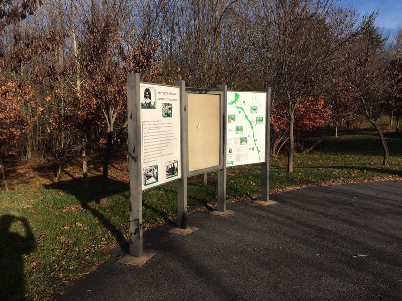
Related marker. Click here for another marker that is related to this marker. An identical marker is also along the trail a little over a mile away.
Also see . . . Matthew Henson Trail. (Submitted on November 26, 2017, by Devry Becker Jones of Washington, District of Columbia.)
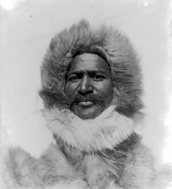
Library of Congress, circa 1910
3. Matthew Alexander Henson
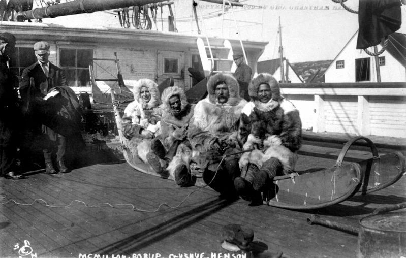
George Grantham Bain (courtesy of the Library of Congress), circa 1910
4. On the sledge that went to the North Pole
From left to right: Donald Baxter MacMillan, George Borup, Thomas Gushue (1st Mate of the Roosevelt), and Matthew Alexander Henson. Between 1906 and 1909.
Photographed by United Press, 1954
5. Matthew Henson at the Whitehouse, 1954
Matthew Henson shows President Eisenhower the location of the North Pole on a globe at the White House while his wife, Lucy Henson, watches.Close-up of photo on marker
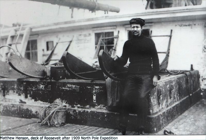
6. Matthew Henson on the Deck of the Roosevelt after 1909 expedition
Photographed by Allen C. Browne, June 26, 2018
8. Matthew Henson Trail Logo
Credits. This page was last revised on February 21, 2023. It was originally submitted on November 26, 2017, by Devry Becker Jones of Washington, District of Columbia. This page has been viewed 815 times since then and 24 times this year. Last updated on February 19, 2018, by Devry Becker Jones of Washington, District of Columbia. Photos: 1, 2. submitted on November 26, 2017, by Devry Becker Jones of Washington, District of Columbia. 3, 4, 5, 6. submitted on June 27, 2018, by Allen C. Browne of Silver Spring, Maryland. 7. submitted on November 26, 2017, by Devry Becker Jones of Washington, District of Columbia. 8. submitted on June 27, 2018, by Allen C. Browne of Silver Spring, Maryland. • Bill Pfingsten was the editor who published this page.
