Bayou Courtableau at Bayou Teche Headwaters
Port Barre Park
| — | Atchafalaya Water Heritage Trail | — |
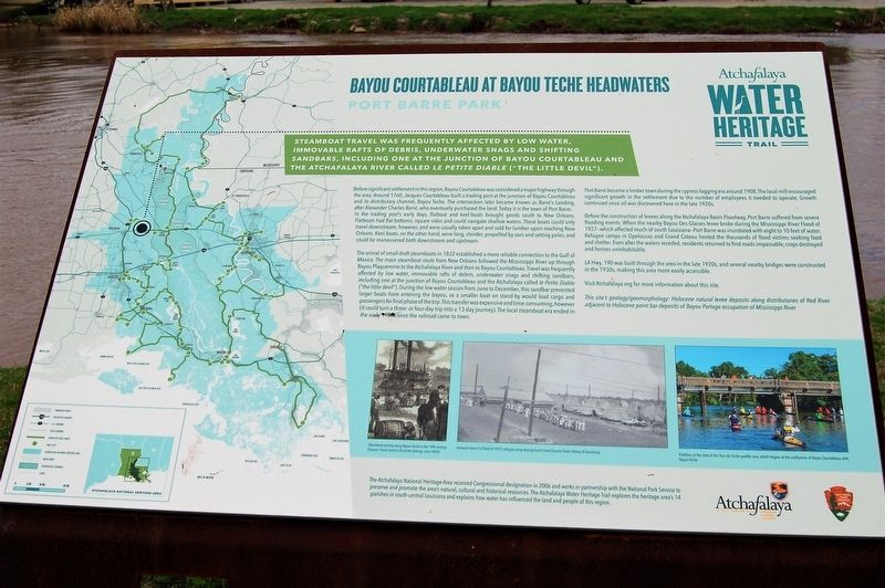
Steamboat travel was frequently affected by low water, immovable rafts of debris, underwater snags and shifting sandbars, including one at the junction of Bayou Courtableau and the Atchafalaya River called Le Petit Diable ("The Little Devil").
Before significant settlement in this region, Bayou Courtableau was considered a major highway through the area. Around 1760, Jacques Courtableau built a trading post at the junction of Bayou Courtableau and its distributary channel, Bayou Teche. The intersection later became known as Barre’s Landing, after Alexander Charles Barré, who eventually purchased the land. Today it is the town of Port Barre.
In the trading post’s early days, flatboat and keel-boats brought goods south to New Orleans. Flatboats had flat bottoms, square sides and could navigate shallow waters. These boats could only travel downstream, however, and were usually taken apart and sold for lumber upon reaching New Orleans. Keel-boats, on the other hand, were long, slender, propelled by oars and setting poles, and could be maneuvered both downstream and upstream.
The arrival of small draft steamboats in 1832
this page online
Port Barre became a timber town during the cypress logging era around 1908. The local mill encouraged significant growth in the settlement due to the number of employees it needed to operate. Growth continued once oil was discovered here in the late 1920s.
Before the construction
LA Hwy. 190 was built through the area in the late 1920s, and several nearby bridges were constructed in the 1930s, making this area more easily accessible.
Visit Atchafalaya.org for more information about this site.
This site’s geology/geomorphology: Holocene natural levee deposits along distributaries of Red River adjacent to Holocene point bar deposits of Bayou Portage occupation of Mississippi River.
Erected by State of Louisiana and National Park Service.
Topics and series. This historical marker is listed in these topic lists: Environment • Waterways & Vessels. In addition, it is included in the
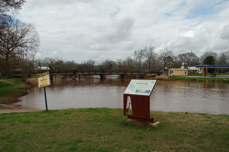
Location. 30° 33.496′ N, 91° 57.287′ W. Marker is in Port Barre, Louisiana, in St. Landry Parish. It is on Bayou Road (State Highway 741) near Third Street, on the left when traveling east. Touch for map. Marker is at or near this postal address: 227 Bayou Drive, Port Barre LA 70577, United States of America. Touch for directions.

Regionally, this marker is in Louisiana’s Acadiana — Cajun Country. It is also in the American South and specifically in the Deep South. Globally, it is in North America, a Gulf of Mexico state, the Western Hemisphere, the Western World, and the Anglosphere. Historically, it finds itself in what was once New Spain, Acadia, the territory of the Mississippian Culture, the Louisiana Purchase, one of the Confederate States of America, and the Antebellum South.
Other nearby markers. At least 8 other markers are within 7 miles of this marker, measured as the crow flies: Welcome to Port Barre (within shouting distance of this marker); Port Barre (about 700 feet away, measured in a direct line); a different marker also named Port Barre (approx. 1.1 miles away); Welcome to Leonville (approx. 6 miles away); Lettsworth Methodist Church (approx. 7 miles away); James Carriere House / Desaultels House (approx. 7.1 miles away); Washington School (approx. 7.1 miles away); Bayou Courtableau (approx. 7.1 miles away). Touch for a list and map of all markers in Port Barre.
Credits. This page was last revised on November 25, 2023. It was originally submitted on February 23, 2018, by Cajun Scrambler of Assumption, Louisiana. This page has been viewed 1,497 times since then and 127 times this year. Photos: 1. submitted on February 23, 2018, by Cajun Scrambler of Assumption, Louisiana. 2. submitted on February 23, 2018.
