
Near Louisa in Louisa County, Virginia — The American South (Mid-Atlantic)
First Contact
“a considerable fight”
| — | The Battle of Trevilian Station | — |
Photographed by Craig Swain, January 12, 2008
1. First Contact Marker
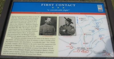
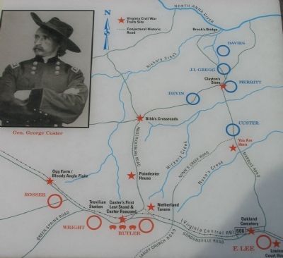
Having reached Louisa Court House on June 10, 1864, Gen. Wade Hampton’s cavalry divisions bivouacked around the Virginia Central Railroad and across Union Gen. Philip H. Sheridan’s route to Gordonsville. About 3 a.m. on June 11, Gen. William C. Wickham’s Virginia cavalry brigade left camp and rode up the Marquis Road (Rte. 669). The troopers captured a scouting party of the 7th Michigan Cavalry about a mile north of town and then continued north toward Clayton’s Store. At daybreak they encountered the 7th Michigan's pickets arrayed on the opposite bank of Nunn's Creek.
The Virginians attacked, firing the first shots of the Battle of Trevilian Station, and skirmished for about 45 minutes in what a member of the 4th Virginia Cavalry later described as “a considerable fight.” Gen. George A. Custer, camped a short distance to the north, heard the engagement and ordered the 1st Michigan to reinforce the 7th, causing the Virginians to break off the engagement and withdraw to Louisa Court House. By 8:45 a.m., Custer’s entire Michigan Brigade and Pennington's Battery of horse artillery were in motion, headed down Nunn’s
this page online
Erected by Virginia Civil War Trails.
Topics and series. This historical marker is listed in this topic list: War, US Civil. In addition, it is included in the Virginia Civil War Trails series list. A significant historical month for this entry is June 1870.
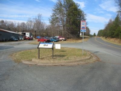
Location. 38° 2.568′ N, 78° 0.3′ W. Marker is near Louisa, Virginia, in Louisa County. It is on Ellisville Drive (County Route 669), on the right when traveling south. Located at stop two on the driving tour of Trevilian Station Battlefield. Touch for map. Marker is in this post office area: Louisa VA 23093, United States of America. Touch for directions.

Regionally, this marker is in the Piedmont and in Central Virginia. It is also in the American South and specifically in the Upper South. Globally, it is in North America, the Western Hemisphere, the Western World, and the Anglosphere. Historically, it finds itself in what was once the territory of the Mississippian Culture, one of the original Thirteen Colonies, one of the Confederate States of America, and the Antebellum South.
Other nearby markers. At
Photographed by Craig Swain, January 12, 2008
2. Battle Area Map
More about this marker. In the upper center the marker displays portraits of Gens. Williams Wickham and George Custer. A map on the right details the place names and roads mentioned in the marker's text.
Regarding First Contact. This is one of several markers interpreting the Battle of Trevilian Station, June 11-12, 1864. See the Battle of Trevilian Station Virtual Tour by Markers linked below for additional related markers.
Also see . . .
1. Trevilian Station Battlefield Foundation. The foundation has worked to preserve the remaining sections of the battlefield. A detailed
Photographed by Craig Swain, January 12, 2008
3. Trevilian Station Battlefield Driving Tour Stop Two
2. Battle of Trevilian Station Virtual Tour by Markers. A set markers that document the Battle of Trevilian Station, June 11-12, 1864. The order of appearance is generally aligned to the National Parks Service and Trevilian Station Foundation driving tours. (Submitted on January 21, 2008, by Craig Swain of Leesburg, Virginia.)
3. Trevilian Station Preservation Efforts. Civil War Preservation Trust continues efforts to set aside portions of the battlefield. Their site discussing the effort offers a wealth of background information about the battle, an article by noted historian Eric Wittenberg, and excellent maps of the battle. (Submitted on November 25, 2008, by Craig Swain of Leesburg, Virginia.)
Photographed by Craig Swain, January 12, 2008
4. Marquis Road
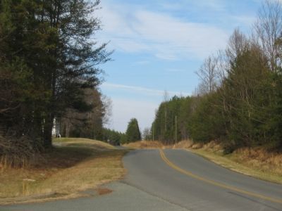
Looking north from the marker location down what is today Ellisville Drive, the road crosses typical rolling terrain of Virginia's Piedmont. Custer's command camped just north of here, and advanced down the road initially to make contact with Wickham's Virginians.
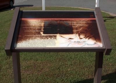
Photographed by J. J. Prats, September 15, 2012
5. First Contact Marker
Marker was seen in a damaged condition on this 2012 visit.
Credits. This page was last revised on February 28, 2018. It was originally submitted on January 20, 2008, by Craig Swain of Leesburg, Virginia. This page has been viewed 2,736 times since then and 31 times this year. Last updated on February 23, 2018, by Bradley Owen of Morgantown, West Virginia. Photos: 1, 2, 3, 4. submitted on January 20, 2008, by Craig Swain of Leesburg, Virginia. 5. submitted on September 16, 2012, by J. J. Prats of Powell, Ohio. • Bill Pfingsten was the editor who published this page.
