Crown Point in Essex County, New York — The American Northeast (Mid-Atlantic)
The French at Crown Point
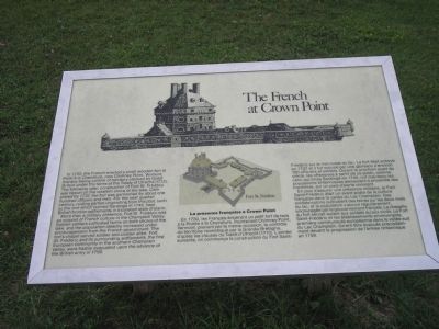
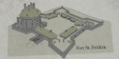
In 1730, the French erected a small wooden fort at Point a la Chevelure, now Chimney Point, Vermont, thereby taking control of territory claimed by Great Britain under the terms of the Treaty of Utrecht (1713). The following year, construction of Fort St. Frédéric was begun on the western shore of the lake. Completed by 1737, the fort was garrisoned by about one hundred officers and men. For the next quarter-century, raiding parties originating from this post, such as the one which burned Saratoga in 1745, kept British frontier settlements in a constant state of alarm.
More than a military presence, Fort St. Frédéric was an outpost of French culture in the Champlain Valley. Soldier-settlers cultivated farms on both shores of the lake, and the population steadily increased under the encouragement from the French government. The fort’s chapel served soldier and civilian alike. Fort St. Frédéric and its surrounding settlements, the first European community in the southern Champlain Valley, were hastily evacuated upon the advance of the British army in 1759.
Erected by Crown Point State Historic Site.
Topics. This historical marker is listed in these topic lists: Forts and Castles • Notable Places • War, French and Indian. A significant historical year for this entry is 1730.
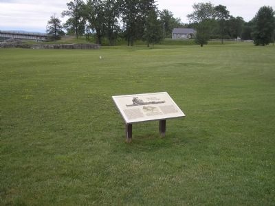
Location. 44° 1.796′ N, 73° 25.64′ W. Marker is in Crown Point, New York, in Essex County. Marker is on Grandview Drive, on the right when traveling west. Marker is in Crown Point State Historic Site, along the walking trail. Touch for map. Marker is in this post office area: Crown Point NY 12928, United States of America. Touch for directions.
Other nearby markers. At least 8 other markers are within walking distance of this marker. Crown Point: Military Focus (a few steps from this marker); Crown Point (within shouting distance of this marker); Gen. Henry Knox Trail (within shouting distance of this marker); Welcome To Crown Point State Historic Site (within shouting distance of this marker); Selecting a Bridge Location (within shouting distance of this marker); Welcome To The Lake Champlain Bridge Heritage Area (within shouting distance of this marker); Fort St. Frédéric (within shouting distance of this marker); Eastern Terminus (about 300 feet away, measured in a direct line). Touch for a list and map of all markers in Crown Point.
More about this marker. Two illustrations of Fort St. Frédéric appear on the marker, as well as the above text in French.
Also see . . .
1. Crown Point State Historic Site. New York State Parks, Recreation and Historic Preservation website entry (Submitted on September 13, 2008, by Bill Coughlin of Woodland Park, New Jersey.)
2. Fort Crown Point. Wikipedia entry (Submitted on May 1, 2021, by Larry Gertner of New York, New York.)
3. Fort Crown Point - National Park Service. Download National Register of Historic Places documentation (Submitted on February 5, 2024, by Anton Schwarzmueller of Wilson, New York.)
Credits. This page was last revised on February 5, 2024. It was originally submitted on September 13, 2008, by Bill Coughlin of Woodland Park, New Jersey. This page has been viewed 1,695 times since then and 36 times this year. Photos: 1, 2, 3, 4, 5, 6. submitted on September 13, 2008, by Bill Coughlin of Woodland Park, New Jersey.
