Cypress in Suffolk, Virginia — The American South (Mid-Atlantic)
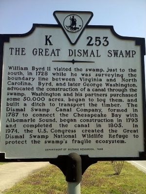
The Great Dismal Swamp
Erected 1998 by Department of Historic Resources. (Marker Number K-253.)
Topics and series. This historical marker is listed in these topic lists: Environment • Man-Made Features • Patriots & Patriotism • Waterways & Vessels. In addition, it is included in the Virginia Department of Historic Resources (DHR) series list. A significant historical year for this entry is 1728.
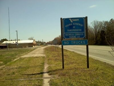
Location. 36° 44.818′ N, 76° 32.276′ W. Marker is in Suffolk, Virginia. It is in Cypress. Marker is at the intersection of Portsmouth Boulevard (U.S. 58 bus) and B Street, on the right when traveling west on Portsmouth Boulevard . Marker is both east and west of B Street, which forms an arc around it. Touch for map. Marker is in this post office area: Suffolk VA 23434, United States of America. Touch for directions.
Other nearby markers. At least 8 other markers are within 3 miles of this marker, measured as the crow flies. Nansemond Industrial Institute (approx. 2.1 miles away); Nansemond Collegiate Institute (approx. 2.1 miles away); Remembrance Garden Monuments (approx. 2.4 miles away); Siege of Suffolk (approx. 2.4 miles away); Confederate Monument (approx. 2.4 miles away); Watering Fountain (approx. 2.4 miles away); Cedar Hill Cemetery (approx. 2˝ miles away); Civil War Militia of Suffolk and Nansemond County (approx. 2˝ miles away). Touch for a list and map of all markers in Suffolk.
Related markers. Click here for a list of markers that are related to this marker. Dismal Swamp Canal
Credits. This page was last revised on February 1, 2023. It was originally submitted on March 23, 2011, by James Thomson of Chesapeake, United States. This page has been viewed 1,224 times since then and 36 times this year. Last updated on March 1, 2018, by Cosmos Mariner of Cape Canaveral, Florida. Photos: 1, 2. submitted on March 23, 2011, by James Thomson of Chesapeake, United States. • Bernard Fisher was the editor who published this page.

