Pleasant Grove West in Chesapeake, Virginia — The American South (Mid-Atlantic)
North West Canal
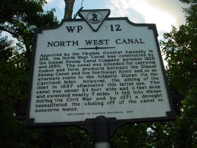
Photographed by Chris Bieber, September 14, 2010
1. North West Canal Marker
Erected 2003 by Department of Historic Resources. (Marker Number WP-12.)
Topics and series. This historical marker is listed in these topic lists: Man-Made Features • Waterways & Vessels. In addition, it is included in the Virginia Department of Historic Resources (DHR) series list. A significant historical year for this entry is 1818.
Location. 36° 36.313′ N, 76° 22.883′ W. Marker is in Chesapeake, Virginia. It is in Pleasant Grove West. It is on Old U.S. 17, on the right when traveling south. Travel south from Chesapeake
this page online

Regionally, this marker is in Hampton Roads, specifically in Coastal Virginia, and in the Hampton Roads Metropolitan Area. It is also in the American South, specifically in the Upper South, in the Tidewater, and on the Eastern Seaboard. Globally, it is in the North Atlantic Region, North America, the Western Hemisphere, the Western World, and the Anglosphere. Historically, it finds itself in what was once the territory of the Mississippian Culture, one of the original Thirteen Colonies, one of the Confederate States of America, and the Antebellum South.
Other nearby markers. At least 8 other markers are within 6 miles of this marker, measured as the crow flies: Wallaceton (within shouting distance of this marker); The Superintendent's House… from Tolls to Tea (approx. 0.6 miles away); Dismal Swamp Canal (approx. 2.3 miles away); Outliers (approx. 2.6 miles away); Stone Mileposts along the Dismal Swamp Canal
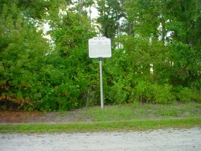
Photographed by Chris Bieber, September 14, 2010
2. North West Canal Marker
Another marker is no longer nearby. Glencoe (was within shouting distance of this marker but has been replaced with another marker now near it).
Related markers. Click here for a list of markers that are related to this marker. Dismal Swamp Canal Trail
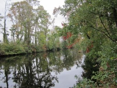
Photographed by Bernard Fisher, October 28, 2011
3. Great Dismal Swamp - North West Canal
Credits. This page was last revised on May 28, 2023. It was originally submitted on November 10, 2010, by Chris Bieber of Chesapeake, Virginia. This page has been viewed 1,482 times since then and 47 times this year. Last updated on March 1, 2018, by Cosmos Mariner of Cape Canaveral, Florida. Photos: 1, 2. submitted on November 10, 2010, by Chris Bieber of Chesapeake, Virginia. 3. submitted on October 30, 2011, by Bernard Fisher of Richmond, Virginia. • Bernard Fisher was the editor who published this page.
