Memphis in Shelby County, Tennessee — The American South (East South Central)
The Mississippi Riverwalk
Photographed by Jason Voigt, August 2, 2024
1. The Mississippi Riverwalk Marker
Marker was later replaced by this one
Inscription.
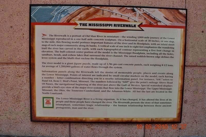
The Mississippi Riverwalk. . , The Riverwalk is a portrait of Old Man River in the miniature-the winding 1.000-mile journey of the lower Mississippi reproduced in a one-half mile concrete sculpture. On a horizontal scale of 30 inches, or one step, to the mile, this flowing model portrays important features of the river and its floodplain, with an inlaid street map of each major community along its banks. A vertical scale of one inch to eight feet emphasizes the wandering trail the river has carved in the earth, with each topographical contour representing a five-foot change in elevation. The buff-colored center portion of the model is the Mississippi floodplain, including all the holes, sandbars, bends, and oxbow lakes that surround the river channel. The raised reddish-brown edge defines the levee system and the bluff that enclose the floodplain., The river model is a giant jigsaw puzzle, made up of 1,745 pre-cast concrete panels, each weighing 8½ tons. An average of 1,200,000 gallons of water flows through the system., Information panels along the Riverwalk tell the stories of memorable people places and events along the Lower Mississippi. Points of interest are indicated by small circular markers on the model, each having a number-letter combination directing you to a nearby information panel. For instance, "64C" refers to Panel 64, Item C: Bird's Point, Missouri. The number followed by "AHP" give the point's mileage Above Head Of Passes, the navigational beginning of the river just above the Gulf of Mexico. Special watershed displays provide a bird's-eye view of the major river systems that flow into the Lower Mississippi: The Upper Mississippi-Missouri, the Ohio, the Tennessee-Cumberland, and the Arkansas-White. All but the last are located in the North Courtyard., The Lower Mississippi River is a living organism. As it has changed, it has altered the lives of its people and those people have changed the river. The riverwalk presents the of that sometimes triumphant, sometimes tragic relationship-the human relationship between those ancient protagonists, man, and the river.
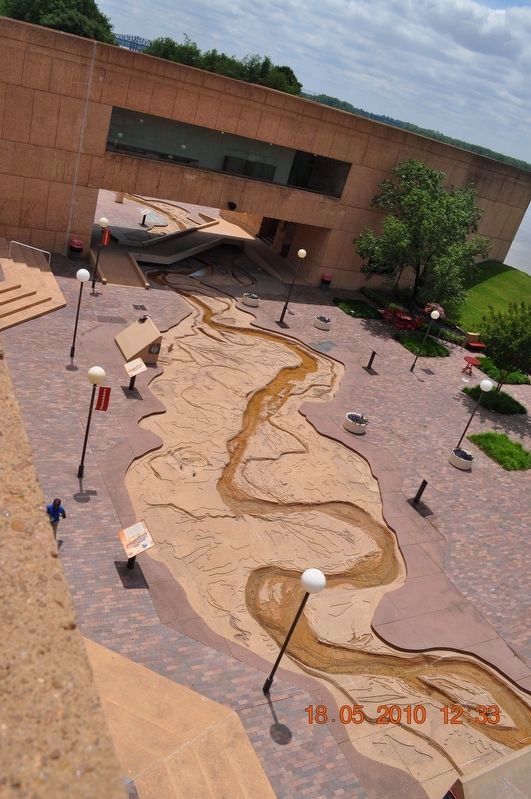
The Riverwalk is a portrait of Old Man River in the miniature-the winding 1.000-mile journey of the lower Mississippi reproduced in a one-half mile concrete sculpture. On a horizontal scale of 30 inches, or one step, to the mile, this flowing model portrays important features of the river and its floodplain, with an inlaid street map of each major community along its banks. A vertical scale of one inch to eight feet emphasizes the wandering trail the river has carved in the earth, with each topographical contour representing a five-foot change in elevation. The buff-colored center portion of the model is the Mississippi floodplain, including all the holes, sandbars, bends, and oxbow lakes that surround the river channel. The raised reddish-brown edge defines the levee system and the bluff that enclose the floodplain.
The river model is a giant jigsaw puzzle, made up of 1,745 pre-cast concrete panels, each weighing 8½ tons. An average of 1,200,000 gallons of water flows through the system.
Information panels along the Riverwalk tell the stories of memorable people places and events along the Lower Mississippi. Points
Click or scan to see this page online
of interest are indicated by small circular markers on the model, each having a number-letter combination directing you to a nearby information panel. For instance, "64C" refers to Panel 64, Item C: Bird's Point, Missouri. The number followed by "AHP" give the point's mileage Above Head Of Passes, the navigational beginning of the river just above the Gulf of Mexico. Special watershed displays provide a bird's-eye view of the major river systems that flow into the Lower Mississippi: The Upper Mississippi-Missouri, the Ohio, the Tennessee-Cumberland, and the Arkansas-White. All but the last are located in the North Courtyard.
The Lower Mississippi River is a living organism. As it has changed, it has altered the lives of its people and those people have changed the river. The riverwalk presents the of that sometimes triumphant, sometimes tragic relationship-the human relationship between those ancient protagonists, man, and the river.
90° 3.523′ W. Marker is in Memphis, Tennessee, in Shelby County. It can be reached from Island Drive. Marker is located at Mud Island Park. Touch for map. Marker is at or near this postal address: 125 N Front St, Memphis TN 38103, United States of America. Touch for directions.
Regionally, this marker is in West Tennessee. It is also in the American South, specifically in the Deep South, in the Upper South, in the Mississippi Delta, and in the Great River Road Region. Globally, it is in North America, the Western Hemisphere, the Western World, and the Anglosphere. Historically, it finds itself in what was once the territory of the Mississippian Culture, one of the Confederate States of America, and the Antebellum South.
Credits. This page was last revised on September 14, 2024. It was originally submitted on March 8, 2018, by Sandra Hughes Tidwell of Killen, Alabama, USA. This page has been viewed 837 times since then and 91 times this year. Photos:1. submitted on September 14, 2024, by Jason Voigt of Glen Carbon, Illinois. 2. submitted on April 27, 2018. 3. submitted on March 8, 2018, by Sandra Hughes Tidwell of Killen, Alabama, USA. • Bernard Fisher was the editor who published this page.