Memphis in Shelby County, Tennessee — The American South (East South Central)
New Madrid, Missouri/Cates Casting Field/Island No. 10
Panel #61 Mississippi Riverwalk
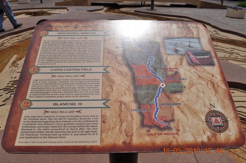
Inscription.
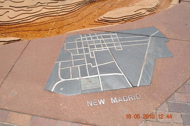
A) New Madrid, Missouri
Mile 888.7 AHP
The New Madrid townsite was laid out in 1788 by Colonel George Morgan, who had brought settlers, hoping to make it the capital of an independent Spanish-allied state. The expected land grant from Spain did not come through, and Morgan returned to his home in New Jersey, abandoning the tiny settlement to its fate. The Spanish maintained Fort Celeste there until it became U.S. territory in 1803. New Madrid was near the center of the greatest earthquakes ever recorded in the U.S. in 1811-1812. The town was forced northward as the river steadily washed away its riverfront. Some townspeople kept their buildings mounted on log rollers to facilitate the frequent retreats, but most of the populations fled. Poorly fortified during the Civil War, New Madrid was abandoned by the Confederacy as Union forces advanced downriver. Modern revetments have stabilized the waterfront and New Madrid is now an active river port.
B) Cates Casting Field
Mile 900.5 AHP
Large concrete blocks used in modern revetment work are produced here at Cates Landing, Tennessee, one of eight such facilities on the river. Revetments are constructions that protect river banks and levees from erosion. The 4 foot by 1 foot concrete slabs manufactured here are assembled into large flexible “mattresses” and installed where they are needed along the banks by special mat-sinking barges. It has been estimated that the river can erode as much as 600 feet of soil a year from an unprotected bank, and theses modern revetments protect much of the shoreline.
C) Island No. 10
Mile 901.0 AHP
Early maps show Island No. 10 lying off Donaldson Point close to the Tennessee shore. After the fall of Columbus, Kentucky, a fort on the island and supporting shore batteries were the northernmost Confederate river defenses. Union gunboats sneaked past these fortifications, and troops waded into swamps behind the island. Hemmed in, the rebels surrendered in March 1862. The river channel later shifted, and the island became part of the right bank. The Winchester Towhead built up below it, and Island No. 10 is now landlocked on the Missouri shore.
Photo Credit: (1) Mat Casting Field Vicksburg District, USACE (2) Mat Sinking Plants, USACE
Erected by Mississippi Riverwalk. (Marker Number 61.)
Topics. This historical marker is listed in these topic lists: Settlements & Settlers • War, US Civil • Waterways & Vessels. A significant historical year for this entry is 1803.
Location. 35° 8.968′ N, 90° 3.507′ W. Marker is in Memphis, Tennessee, in Shelby County. Marker can be reached from Island Drive, 0.8 miles south of West A.W. Willis Avenue when traveling south. Located in Mud Island River Park. Touch for map. Marker is at or near this postal address: 125 N Front Street, Memphis TN 38103, United States of America. Touch for directions.
Other nearby markers. At least 8 other markers are within walking distance of this marker. The Mississippi Riverwalk (here, next to this marker); Island No. 20/Cottonwood Point/Booth Point, Tennessee/Linwood Bend (here, next to this marker); Head of Passes/Pilottown, Louisiana (here, next to this marker); Venice Louisiana/Fort Jackson, Louisiana/Fort St. Phillip (here, next to this marker); Ostrica Lock/Buras, Louisiana/Empire Lock/Nairn, Louisiana (here, next to this marker); Point a La Hache, Louisiana/Magnolia Plantation, Louisiana (here, next to this marker); Junior Crevasse/Poverty Point, Louisiana/Jesuits Bend (here, next to this marker); Belle Chasse, Louisiana/English Turn Bend/Caernarvon Crevasse/Poydras Crevasse (here, next to this marker). Touch for a list and map of all markers in Memphis.
Credits. This page was last revised on March 8, 2018. It was originally submitted on March 8, 2018, by Sandra Hughes Tidwell of Killen, Alabama, USA. This page has been viewed 279 times since then and 18 times this year. Photos: 1, 2. submitted on March 8, 2018, by Sandra Hughes Tidwell of Killen, Alabama, USA. • Bernard Fisher was the editor who published this page.
Editor’s want-list for this marker. Wide shot of marker and its surroundings • Can you help?

