Memphis in Shelby County, Tennessee — The American South (East South Central)
Venice Louisiana/Fort Jackson, Louisiana/Fort St. Phillip
Mississippi River Walk
Photographed by Jason Voigt, August 2, 2024
1. Venice Louisiana/Fort Jackson, Louisiana/Fort St. Phillip Marker
Marker was replaced with a newer one placed by Mud Island Park.
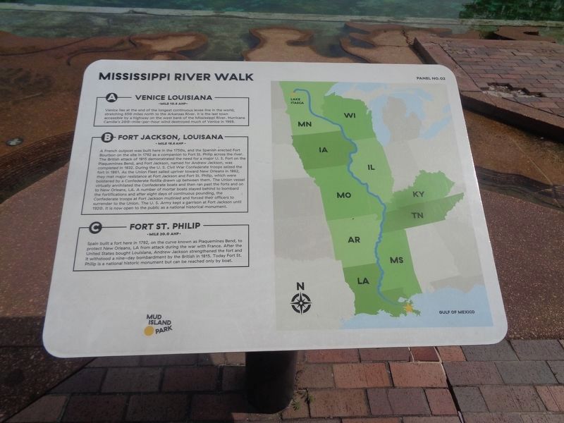
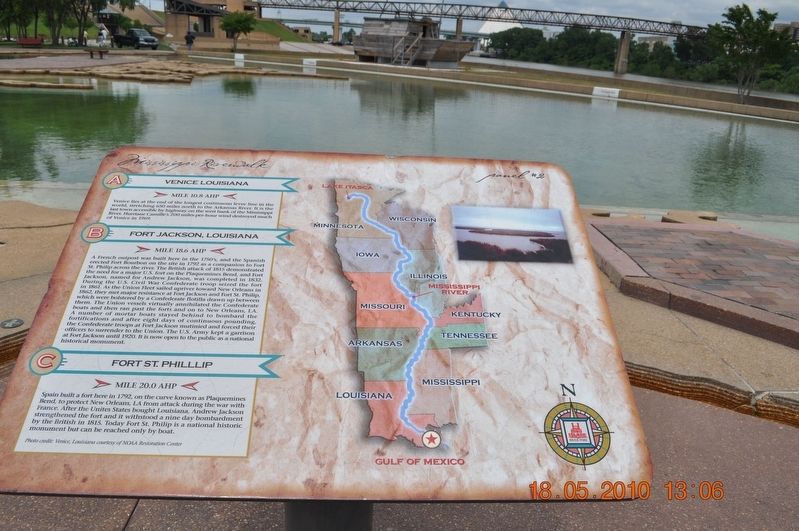
A) Venice Louisiana
Mile 10.8 AHP
Venice lies at the end of the longest continuous levee line in the world, stretching 650 miles north to the Arkansas River. It is the last town accessible by a highway on the west bank of the Mississippi River. Hurricane Camille’s 200-mile-per-hour wind destroyed much of Venice in 1969.
B) Fort Jackson, Louisiana
Mile 18.6 AHP
A French outpost was built here in the 1750’s, and the Spanish erected Fort Bourbon on the site in 1792 as a companion to Fort St Philip across the river. The British attack of 1815 demonstrated the need for a major U. S. Fort on the Plaquemines Bend, and Fort Jackson, named for Andrew Jackson, was completed in 1832. During the U. S. Civil War Confederate troops seized the fort in 1861. As the Union Fleet sailed upriver toward New Orleans in 1862, they met major resistance at Fort Jackson and Fort St. Philip, which were bolstered by a Confederate flotilla drawn up between them. The Union vessel virtually annihilated the Confederate boats and then ran past the forts and on to New Orleans, LA. A number of mortar boats stayed behind to bombard the fortifications
this page online
C. Fort St. Phillip
Mile 20.0 AHP
Spain built a fort here in 1792, on the curve known as Plaquemines Bend, to protect New Orleans, LA from attack during the war with France. After the United States bought Louisiana, Andrew Jackson strengthened the fort and it withstood a nine-day bombardment by the British in 1815. Today Fort St. Philip is a national historic monument but can be reached only by boat.
Erected by Mississippi Riverwalk. (Marker Number 2.)
Topics and series. This historical marker is listed in these topic lists: Disasters • Forts and Castles • War, US Civil • Waterways & Vessels. In addition, it is included in the Former U.S. Presidents: #07 Andrew Jackson series list. A significant historical year for this entry is 1792.
Location. 35° 8.761′ N, 90° 3.512′ W. Marker is in Memphis, Tennessee, in Shelby County. It can be reached from
Photographed by Sandra Hughes, May 18, 2010
2. Venice Louisiana/Fort Jackson, Louisiana/Fort St. Phillip Marker

Regionally, this marker is in West Tennessee. It is also in the American South, specifically in the Deep South, in the Upper South, in the Mississippi Delta, and in the Great River Road Region. Globally, it is in North America, the Western Hemisphere, the Western World, and the Anglosphere. Historically, it finds itself in what was once the territory of the Mississippian Culture, one of the Confederate States of America, and the Antebellum South.
Other nearby markers. At least 8 other markers are within walking distance of this marker: Ostrica Lock/Buras, Louisiana/Empire Lock/Nairn, Louisiana (a few steps from this marker); Head of Passes/Pilottown, Louisiana (a few steps from this marker); Point a La Hache, Louisiana/ Magnolia Plantation, Louisiana (a few steps from this marker); Junior Crevasse/Poverty Point, Louisiana/Jesuits Bend (within shouting distance of this marker);
Photographed by Jason Voigt, August 2, 2024
3. Venice Louisiana/Fort Jackson, Louisiana/Fort St. Phillip Marker
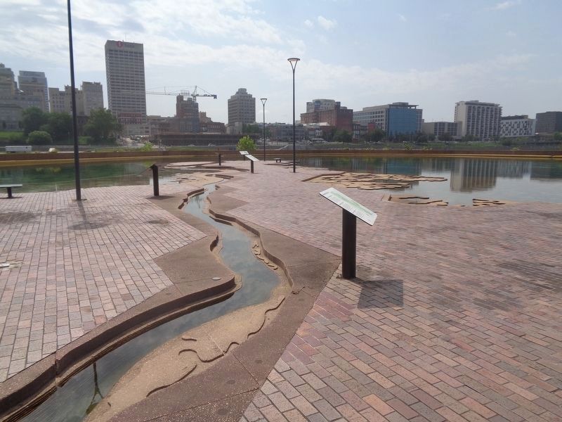
Marker is in the back, facing the Memphis skyline
Also see . . .
1. Hurricane Camille. The pressure fell to 27.80 inches of mercury (941 hPa) at Garden Island. Winds gusted to 125 miles per hour (201 km/h) at Slidell as their pressure sank to 28.75 inches of mercury (974 hPa) on 19 August. Almost total destruction was seen from Venice to Buras. Ostrica Lock measured a storm surge of 16 feet (4.9 m). Water overwashed U.S. Highway 90 to a depth of 10 feet (3.0 m). (Submitted on March 12, 2018, by Sandra Hughes Tidwell of Killen, Alabama, USA.)
2. Fort Jackson, Louisiana. The fort was occupied off and on for various military purposes from its completion until after World War I, when it served as a training station. It is now a National Historic Landmark and historical museum owned and operated by Plaquemines Parish. (Submitted on March 12, 2018, by Sandra Hughes Tidwell of Killen, Alabama, USA.)
3. Battle of Forts Jackson and St. Philip. The Battle of Forts Jackson and St. Philip (April 18–28, 1862) was the decisive battle for possession of New Orleans in the American Civil War. The two Confederate forts on the Mississippi River south of the city were attacked by a Union Navy fleet. As long as the forts could keep the Federal forces from moving on the city, it was safe, but if they were negated, there were no fall-back positions to impede the enemy advance. (Submitted on March 12, 2018, by Sandra Hughes Tidwell of Killen, Alabama, USA.)
Credits. This page was last revised on August 10, 2024. It was originally submitted on March 12, 2018, by Sandra Hughes Tidwell of Killen, Alabama, USA. This page has been viewed 1,132 times since then and 83 times this year. Photos: 1. submitted on August 10, 2024, by Jason Voigt of Glen Carbon, Illinois. 2. submitted on March 12, 2018, by Sandra Hughes Tidwell of Killen, Alabama, USA. 3. submitted on August 10, 2024, by Jason Voigt of Glen Carbon, Illinois. • Bernard Fisher was the editor who published this page.
