
Memphis in Shelby County, Tennessee — The American South (East South Central)
Commercial Barge Traffic
Panel # 66
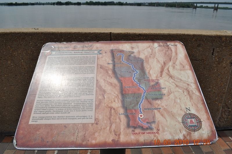
Photographed by Sandra Hughes, May 18, 2010
1. Commercial Barge Traffic Marker
The first wooden barges were towed behind steamboats, but crosswinds and currents made the almost impossible to control. Through the name is the same, modern towing is really … Towboats push its group of barges, all to form a rigid unit. In the 1930’s steamboats were replaced by diesel-powered propellers. This arrangement is coordinated with the pick-up and delivery schedule, and sometimes the tow must during the trip in an intricate jigsaw puzzle fashion. The bow is lashed into a rigid unit using “wire” (2-inch steel cable) and “iron” (chains and lockhooks stretched tight). This hardwired is often called “river jewelry”.
Modern towboats
this page online
Topics. This historical marker is listed in these topic lists: Railroads & Streetcars • War, US Civil • Waterways & Vessels.
Location. 35° 8.968′ N, 90° 3.507′ W. Marker is in Memphis, Tennessee, in Shelby County. It is on Island Drive. Mud Island Mississippi Riverwalk. Touch for map. Marker is at or near this postal address: 125 N Front St, Memphis TN 38103, United States of America. Touch for directions.

Regionally, this marker is in West Tennessee. It is also in the American South, specifically in the Deep South, in the Upper South, in the Mississippi Delta, and in the Great River Road Region. Globally, it is in North America, the Western Hemisphere, the Western World, and the Anglosphere. Historically, it finds itself in what was once the territory of the Mississippian Culture, one of the Confederate States of America, and the Antebellum South.
Other nearby markers. At least 8 other markers are within walking distance of this marker: Ohio River (here, next to this marker); Island No. 20/Cottonwood Point/Booth Point, Tennessee/Linwood Bend (here, next to this marker); Caruthersville, Missouri/Gayoso, Missouri/Little Cypress Bend (a few steps from this marker); Reelfoot Lake (a few steps from this marker); Obion River/Hale's Point, Tennessee/Needham Cutoff (a few steps from this marker); Tiptonville, Tennessee/Bixby Towhead (a few steps from this marker); Island No. 25/Forked Deer River/Tomato, Arkansas (within shouting distance of this marker); Golddust, Tennessee/Daniel's Point, Arkansas/Ashport, Tennessee/Canadian Reach (within shouting distance of this marker). Touch for a list and map of all markers in Memphis.
Credits. This page was last revised on April 14, 2018. It was originally submitted on March 18, 2018, by Sandra Hughes Tidwell of Killen, Alabama, USA. This page has been viewed 446 times since then and 32 times this year. Photo 1. submitted on March 18, 2018, by Sandra Hughes Tidwell of Killen, Alabama, USA. • Bill Pfingsten was the editor who published this page.
