Near Garysville in Prince George County, Virginia — The American South (Mid-Atlantic)
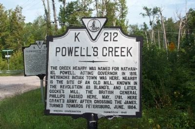
Powell's Creek
Erected 1948 by Virginia Conservation Commission. (Marker Number K-212.)
Topics and series. This historical marker is listed in these topic lists: Colonial Era • War, US Civil • War, US Revolutionary • Waterways & Vessels. In addition, it is included in the Virginia Department of Historic Resources (DHR) series list. A significant historical month for this entry is May 1781.
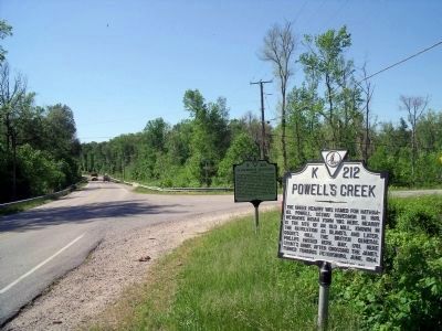
Location. 37° 14.874′ N, 77° 9.015′ W. Marker is near Garysville, Virginia, in Prince George County. Marker is at the intersection of James River Drive (Virginia Route 10) and Flowerdew Hundred Road (County Route 639), on the right when traveling west on James River Drive. Located in a marker "cluster" with Flowerdew Hundred marker (K 214). Touch for map. Marker is in this post office area: Hopewell VA 23860, United States of America. Touch for directions.
Other nearby markers. At least 8 other markers are within 5 miles of this marker, measured as the crow flies. Flowerdew Hundred (a few steps from this marker); The Cattle Raid (approx. 2.1 miles away); Merchant's Hope Church (approx. 2.9 miles away); Westover (approx. 4.4 miles away); Westover Plantation (approx. 4.4 miles away); Richmond Condita (approx. 4.4 miles away); Hood's (approx. 4.4 miles away); Capt. John Woodliffe (approx. 4.8 miles away).
Credits. This page was last revised on June 16, 2016. It was originally submitted on September 21, 2008, by Kathy Walker of Stafford, Virginia. This page has been viewed 1,494 times since then and 70 times this year. Photos: 1. submitted on September 21, 2008, by Kathy Walker of Stafford, Virginia. 2. submitted on April 29, 2010, by Bernard Fisher of Richmond, Virginia. • Craig Swain was the editor who published this page.

