
Liberty in Liberty County, Texas — The American South (West South Central)
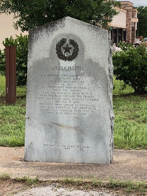
Atascosito

Photographed by Jeff Leichsenring, May 30, 2025
1. Atascosito Marker
Erected 1936 by State of Texas. (Marker Number 15587.)
Topics and series. This historical marker is listed in these topic lists: Colonial Era • Exploration • Roads & Vehicles • Settlements & Settlers. In addition, it is included in the Texas 1936 Centennial Markers and Monuments series list. A significant historical year for this entry is 1757.
Location. 30° 5.437′ N, 94° 45.548′ W. Marker is in Liberty, Texas, in Liberty County. It is at the intersection of Farm to Market Road 1011 and North Main Street (State Highway 146), on the right when traveling north on Road 1011. Touch for map. Marker is in this post office area: Liberty TX 77575, United States of America. Touch for directions.

Regionally, this marker is in the Houston Metropolitan
this page online
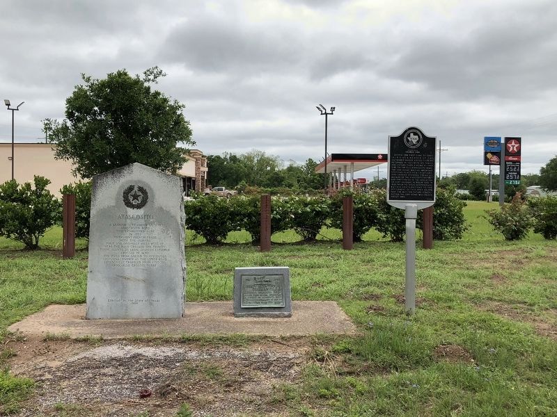
Other nearby markers. At least 8 other markers are within walking distance of this marker: Liberty Bicentennial Observance (here, next to this marker); Homesite of George Orr (here, next to this marker); Gillard-Duncan House (approx. 0.6 miles away); Sam Houston Regional Library and Research Center (approx. 0.6 miles away); Price Daniel (approx. 0.7 miles away); Benjamin Watson Hardin (approx. 0.8 miles away); Augustine Blackburn Hardin (approx. 0.8 miles away); William Hardin (approx. 0.8 miles away). Touch for a list and map of all markers in Liberty.
Also see . . . Atascosito Road - The Handbook of Texas Online. Texas State Historical Association (TSHA) (Submitted on May 7, 2018, by Brian Anderson of New Albany, Ohio.)
Photographed by Brian Anderson, April 22, 2018
2. Atascosito Marker
Photographed by Brian Anderson, April 22, 2018
3. Three Markers Located at Hwy. 146 & FM 1011

Photographed by Jeff Leichsenring, May 30, 2025
4. Atascosito Marker
Credits. This page was last revised on June 3, 2025. It was originally submitted on April 22, 2018, by Brian Anderson of New Albany, Ohio. This page has been viewed 1,575 times since then and 146 times this year. Photos: 1. submitted on June 3, 2025, by Jeff Leichsenring of Garland, Texas. 2. submitted on April 22, 2018, by Brian Anderson of New Albany, Ohio. 3. submitted on May 2, 2018, by Brian Anderson of New Albany, Ohio. 4. submitted on June 3, 2025, by Jeff Leichsenring of Garland, Texas. • Bernard Fisher was the editor who published this page.
