Near Twin Bridges in Madison County, Montana — The American West (Mountains)
The Jefferson Valley
Photographed by Cosmos Mariner, July 17, 2016
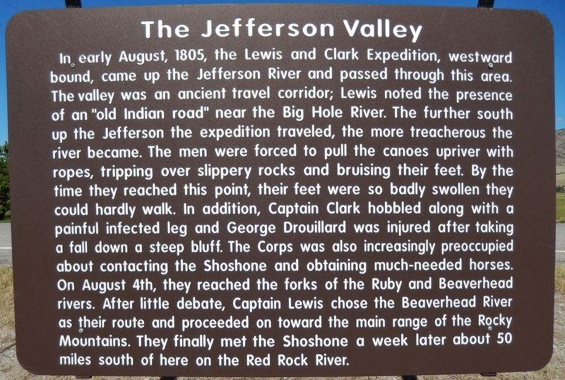
1. The Jefferson Valley Marker
In, early August, 1805, the Lewis and Clark Expedition, westward bound, came up the Jefferson River and passed through this area. The valley was an ancient travel corridor; Lewis noted the presence of an "old Indian road" near the Big Hole River. The further south up the Jefferson the expedition traveled, the more treacherous the river became. The men were forced to pull the canoes upriver with ropes, tripping over slippery rocks and bruising their feet. By the time they reached this point, their feet were so badly swollen they could hardly walk. In addition, Captain Clark hobbled along with a painful infected leg and George Drouillard was injured after taking a fall down a steep bluff. The Corps was also increasingly preoccupied about contacting the Shoshone and obtaining much-needed horses. On August 4th, they reached the forks of the Ruby and Beaverhead rivers. After little debate, Captain Lewis chose the Beaverhead River as their route and proceeded on toward the main range of the Rocky Mountains. They finally met the Shoshone a week later about 50 miles south of here on the Red Rock River.
Topics and series.
this page online
Location. 45° 35.733′ N, 112° 19.043′ W. Marker is near Twin Bridges, Montana, in Madison County. It is on State Highway 41 3.6 miles north of 10th Avenue, on the right when traveling south. Marker is located in a large pull-out and rest area on the west side of the highway, overlooking the Jefferson River. Touch for map. Marker is in this post office area: Twin Bridges MT 59754, United States of America. Touch for directions.

Regionally, this marker is in Southwest Montana, in Gold West Country, in Mining Country and in Greater Bozeman. It is also in the American Mountain West and in the Lewis & Clark Corridor. Globally, it is in North America, the Rocky Mountains, the Western Hemisphere, the Western World, and the Anglosphere. Historically, it finds itself in what was once Rupert’s Land and also the Louisiana Purchase.
Other nearby markers. At least 8 other markers are
Photographed by Cosmos Mariner, July 17, 2016
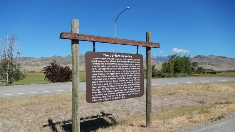
2. The Jefferson Valley Marker (wide view; looking west toward Jefferson River)
More about this marker. Marker is a large, composite "billboard-style" marker, suspended from a heavy wooden frame, and in good condition.
Also see . . . Madison County Lewis and Clark Interpretive Park. Montana website entry:
In August 1805, the Corps of Discovery under Captains Meriwether Lewis and William Clark traveled up the Jefferson River to the confluences of four rivers, the Jefferson, Beaverhead (Philosophy), Big Hole (Wisdom) and Ruby (Philanthropy) near present day Twin Bridges. The park offers the public insight into the five days the Corps spent in this area. (Submitted on May 2, 2018, by Cosmos Mariner of Cape Canaveral, Florida.)
Credits. This page was last revised on May 25, 2025. It was originally submitted on May 2, 2018, by Cosmos Mariner of Cape Canaveral, Florida. This page has been viewed 1,803 times since then and 112 times this year. Photos: 1, 2. submitted on May 2, 2018, by Cosmos Mariner of Cape Canaveral, Florida. • Andrew Ruppenstein was the editor who published this page.
