Guadalajara, Jalisco, Mexico — The Pacific Coast (and Central Highlands)
Calle de la Soledad
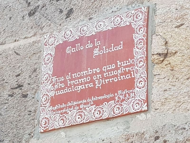
Photographed by J. Makali Bruton, April 7, 2018
1. Calle de la Soledad Marker

Fue el nombre que tuvo este tramo en nuestra Guadalajara Virreinal
Instituo Jaliscience de Antropologia e Historia
Universidad de Guada I.N.A.H.
This was the name of this part of the street in our Viceregal Guadalajara
Jalisco Institute of Anthropology and History
University of Guadalajara INAH
Erected by Instituo Jaliscience de Antropologia e Historia, Universidad de Guadalajara, INAH.
Topics. This historical marker is listed in these topic lists: Colonial Era • Roads & Vehicles.
Location. 20° 40.637′ N, 103° 20.823′ W. Marker is in Guadalajara, Jalisco. It is on Avenida Miguel Hidalgo y Costilla just east of Avenida Fray Antonio Alcalde, on the right when traveling east. Touch for map. Marker is in this post office area: Guadalajara JAL 44100, Mexico. Touch for directions.

Regionally, this marker is in Western Mexico, in the Bajío, on the Pacific Coast, and in the Sierra Madre. Globally, it is in North America, on the Ring of Fire, on the Pacific Rim, and in the Western Hemisphere. Historically,
this page online
Other nearby markers. At least 8 other markers are within walking distance of this marker: The New Cathedral of Guadalajara (here, next to this marker); The Cathedral Basilica of the Assumption (within shouting distance of this marker); Rotunda of Jalisco’s Illustrious (within shouting distance of this marker); The Street of Royal Tobacco Shops (within shouting distance of this marker); Regional Museum of Guadalajara (within shouting distance of this marker); The Episcopal Palace and City Council (about 90 meters away, measured in a direct line); Plaza of the Constitution (about 90 meters away); Miguel Hidalgo’s Edict Against Slavery (about 120 meters away). Touch for a list and map of all markers in Guadalajara.
Regarding Calle de la Soledad. The Viceregal Period of Mexico spans from 1535 to 1821, or roughly the entire Colonial Period of Mexican history.
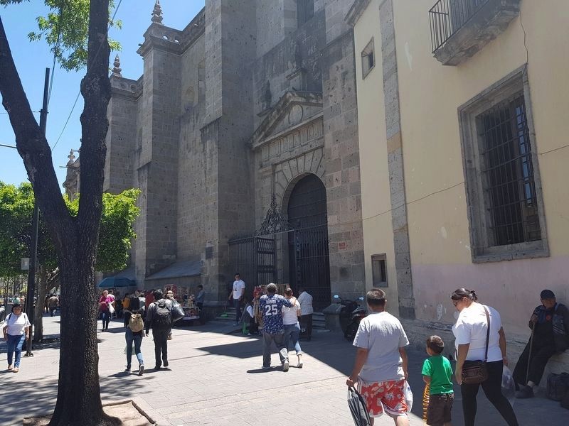
Photographed by J. Makali Bruton, April 7, 2018
2. Calle de la Soledad Marker
The marker is to the right of the Cathedral's northern entrance in this view.
Credits. This page was last revised on March 15, 2026. It was originally submitted on May 7, 2018, by J. Makali Bruton of Washington, District of Columbia. This page has been viewed 218 times since then and 16 times this year. Photos: 1, 2. submitted on May 7, 2018, by J. Makali Bruton of Washington, District of Columbia.
