Corvallis in Benton County, Oregon — The American West (Northwest)
Madison Avenue
A Place For People
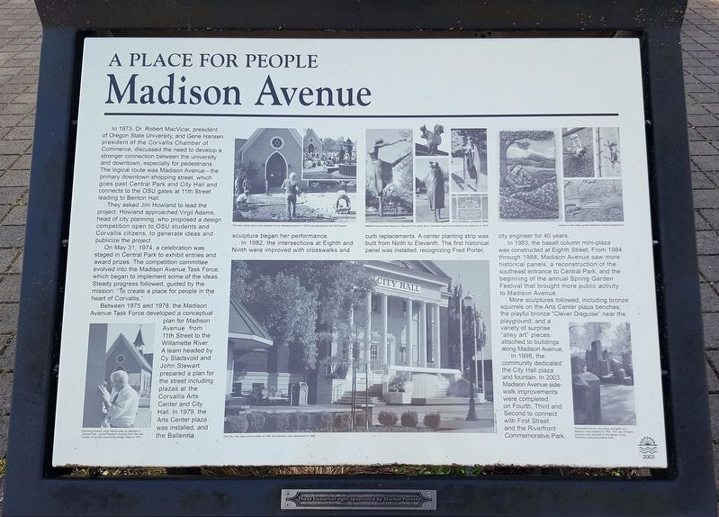
In 1973, Dr. Robert MacVicar, president of Oregon State University, and Gene Hansen, president of the Corvallis Chamber of Commerce, discusses the need to develop a stronger connection between the university and downtown, especially for pedestrians. The logical route was Madison Avenue—the primary downtown shopping street, which goes past Central Park and City Hall and connects to the OSU gates at 11th Street leading to Benton Hall.
They asked Jim Howland to lead the project. Howland approached Virgil Adams, head of city planning, who proposed a design competition open to OSU students and Corvallis citizens, to generate ideas and publicize the project.
On May 31, 1974, a celebration was staged in Central Park to exhibit entries and award prizes. The competition committee evolved into the Madison Avenue Task Force, which began to implement some of the ideas. Steady progress followed, guided by the mission: “To create a place for people in the heart of Corvallis.”
Between 1975 and 1978, the Madison Avenue Task Force developed a conceptual plan for madison Avenue from 11th Street to the Willamette River. A team headed by Cy Stadsvold and John Stewart prepared a plan for the street including plazas at the Corvallis Arts Center and City Hall. In 1979, the Arts Center plaza was installed, and the Ballerina sculpture began her performance.
In 1982, the intersections at Eighth and Ninth were improved with crosswalks and curb replacements. A center planting strip was built from Ninth to Eleventh. The first historical panel was installed, recognizing Fred Porter, city engineer for 40 years.
In 1983, the basalt column mini-plaza was constructed at Eighth Street. From 1984 through 1988, Madison Avenue saw more historical panels, a reconstruction of the southeast entrance to Central Park, and the beginning of the annual Spring Garden Festival that brought more public activity to Madison Avenue.
More sculptures followed, including bronze squirrels on the Arts Center plaza benches; the playful bronze “Clever Disguise” near the playground; and a variety of surprise “alley art” pieces attached to buildings along Madison Avenue.
In 1998, the community dedicated the City Hall plaza and fountain. In 2003, Madison Avenue sidewalk improvements were completed on Fourth, Third, and Second to connect with First Street and the Riverfront Commemorative Park.
Erected 2003 by Madison Avenue Task Force; Starker Forests.
Topics. This historical marker is listed in these topic lists: Arts, Letters, Music • Parks & Recreational Areas • Roads & Vehicles. A significant historical date for this entry is May 31, 1974.
Location.
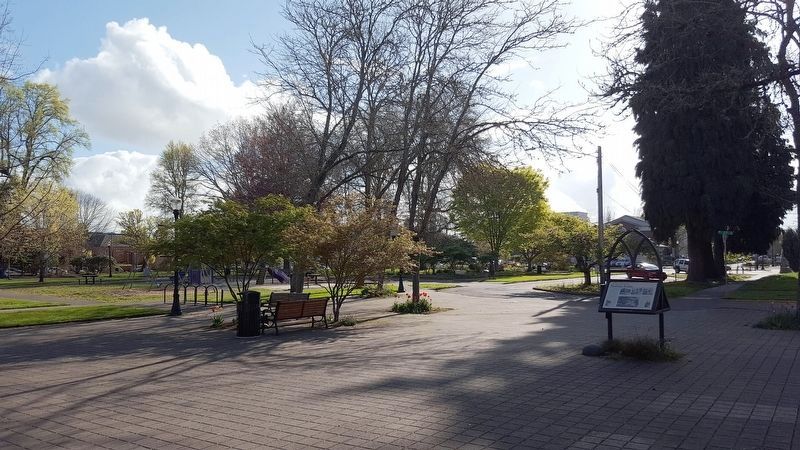
44° 33.864′ N, 123° 15.952′ W. Marker is in Corvallis, Oregon, in Benton County. Marker is on SW Madison Ave, on the left when traveling north. Touch for map. Marker is in this post office area: Corvallis OR 97333, United States of America. Touch for directions.
Other nearby markers. At least 8 other markers are within walking distance of this marker. The Corvallis Arts Center (here, next to this marker); First Congregational Church (within shouting distance of this marker); Elementary Schools (within shouting distance of this marker); Site of Corvallis Public Schools (about 300 feet away, measured in a direct line); Home of Fred J. Porter (about 300 feet away); The Opera House (approx. 0.2 miles away); The Whiteside Theatre (approx. 0.2 miles away); City Hall (approx. 0.2 miles away). Touch for a list and map of all markers in Corvallis.
Credits. This page was last revised on August 10, 2021. It was originally submitted on May 14, 2018, by Douglass Halvorsen of Klamath Falls, Oregon. This page has been viewed 204 times since then and 32 times this year. Photos: 1, 2. submitted on May 14, 2018, by Douglass Halvorsen of Klamath Falls, Oregon. • Andrew Ruppenstein was the editor who published this page.

