Rockville in Montgomery County, Maryland — The American Northeast (Mid-Atlantic)
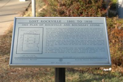
1803 Plan of Rockville and Boundary Stone
Lost Rockville - 1801 to 1850
Photographed by Tom Fuchs, January 7, 2006
1. 1803 Plan of Rockville and Boundary Stone Marker
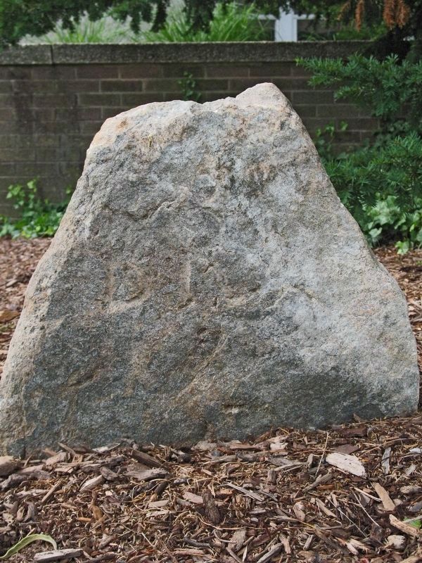
This boundary stone, with the letters "B.R." incised, marks the "Beginning of Rockville" shown in the lower right of the plan at the southeast corner of Block I, lot 1. The plan has a grid pattern of six streets, 19 blocks, and a total of 85 lots. The Court House lot fits into the notch on the right border in Block VIII.
For many years, the boundary stone was neglected, half-buried in the weeds of an undeveloped lot. It resurfaced when the Rockville Library was built in the 1950s. It was placed near its original location in
this page online
Erected 2001 by City of Rockville, Maryland and The Rockville Historic District Commission.
Topics and series. This historical marker is listed in these topic lists: Colonial Era • Political Subdivisions • Settlements & Settlers. In addition, it is included in the Maryland, Lost Rockville – 1801 to 1850 series list. A significant historical month for this entry is November 1801.
Location. This marker has been replaced by another marker nearby. It was located near 39° 4.925′ N, 77° 9.099′ W. Marker was in Rockville, Maryland, in Montgomery County. It was at the intersection of Vinson Street and Maryland Avenue, on the right when traveling west on Vinson Street. Touch for map. Marker was in this post office area: Rockville MD 20850, United States of America. Touch for directions.

Regionally, this marker was in the Washington Metropolitan Area. It was also in the American Mid-Atlantic. Globally, it was in North America, the Western Hemisphere, the Western World, and the Anglosphere. Historically, it found itself in what was once one
Photographed by Allen C. Browne, June 10, 2007
2. Boundary Stone Marker
Other nearby markers. At least 8 other markers are within walking distance of this location: Boundary Stone (here, next to this marker); Boundary Stone of Rockville (here, next to this marker); Montgomery County Jail (within shouting distance of this marker); Mr. Sidney Randolph (within shouting distance of this marker); Mr. John Diggs-Dorsey (within shouting distance of this marker); Christ Episcopal Church (about 300 feet away); “Out of Robb’s Window, Montgomery County Court House.” (about 300 feet away); Richard Montgomery (about 400 feet away). Touch for a list and map of all markers in Rockville.
Another marker is no longer nearby. Montgomery County Jail (was about 300 feet away, measured in a direct line but has been replaced with another marker now near it).
More about this marker. One of the "Lost Rockville – 1801 to 1850" series of markers.
Related marker. Click here for another marker that is related to this marker. This marker has been replaced with the linked marker.
Credits. This page was last revised on March 20, 2026. It was originally submitted on January 11, 2006, by Tom Fuchs of Greenbelt, Maryland. This page has been viewed 4,016 times since then and 51 times this year. Last updated on May 28, 2018, by Allen C. Browne of Silver Spring, Maryland. Photos: 1. submitted on January 11, 2006, by Tom Fuchs of Greenbelt, Maryland. 2. submitted on March 26, 2017, by Allen C. Browne of Silver Spring, Maryland. • J. J. Prats was the editor who published this page.
