Near Rice in Prince Edward County, Virginia — The American South (Mid-Atlantic)
Ewell’s Line of Defense
The Confederates Dig In
Photographed by Bill Coughlin, April 26, 2007
1. Ewell’s Line of Defense Marker
Marker is located along the Route of the Lee's Retreat Driving Tour.
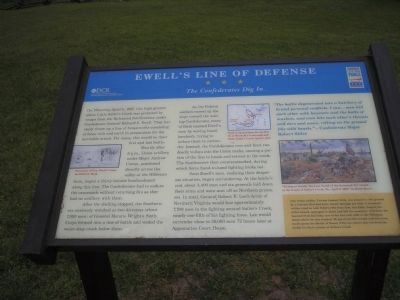
Shortly after 5 p.m., Union artillery under Major Andrew Cowan, positioned directly across the valley at the Hillsman farm, began a thirty minute bombardment along this line. The Confederates had to endure the cannonade without returning fire as they had no artillery with them.
After the shelling stopped, the Southerners anxiously watched as two divisions (about 7,000 men) of General Horatio Wright’s Sixth Corps formed into a line of battle and waded the waist-deep creep below them.
As the Federal soldiers moved up the slope toward the waiting Confederates, many of them taunted Ewell’s men by waving handkerchiefs, trying to induce them to surrender. Instead, the Confederates rose and fired two deadly volleys into the Union ranks, causing a portion of the line to break and retreat
this page online
Soon Ewell’s men, realizing their desperate situation, began surrendering. At the battle’s end, about 3,400 men and six generals laid down their arms and were sent off as Northern prisoners. In total, General Robert E. Lee’s Army of Northern Virginia would lose approximately 7,700 men in the fighting around Sailor’s Creek, nearly one-fifth of his fighting force. Lee would surrender close to 30,000 men 72 hours later at Appomattox Court House.
“The battle degenerated into a butchery of brutal personal conflicts. I saw … men kill each other with bayonets and the butts of muskets, and even bite each other’s throats and ears and noses, rolling on the ground like wild beasts.”
- Confederate Major Robert Stiles
Sidebar: One Union soldier, Private Samuel Eddy, was pinned to the ground by a bayonet that had been thrust through his body. A Southern soldier tried to take Eddy’s rifle from him, but Eddy, despite his awful wound, managed to shoot and kill his assailant, withdraw the bayonet from his body, rise to his feet and walk to the Hillsman
Photographed by Craig Swain, April 18, 2010
2. Close Up of the Map
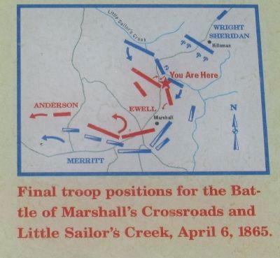
Final troop positions for the Battle of Marshall's Crossroads and Little Sailor's Creek, April 6, 1865.
Erected by Virginia Civil War Trails, Department of Conservation and Recreation.
Topics. This historical marker is listed in these topic lists: Notable Events • Notable Places • War, US Civil. A significant historical date for this entry is April 6, 1865.
Location. Marker has been reported permanently removed. It was located near 37° 18.194′ N, 78° 13.631′ W. Marker was near Rice, Virginia, in Prince Edward County. It was on Saylers Creek Road (Virginia Route 617), on the left when traveling south. Marker is in Sailor’s Creek Battlefield State Park. Touch for map. Marker was in this post office area: Rice VA 23966, United States of America.
We have been informed that this marker is no longer there and will not be replaced. This page is an archival view of what was.
Regionally, this marker was in Virginia’s Piedmont, in Southside Virginia, and specifically in Central Virginia. It was also in the American South and specifically in the Upper South.

Photographed by Bill Coughlin, April 26, 2007
3. Marker in Sailor’s Creek Battlefield State Park
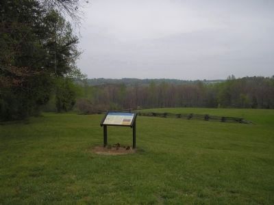
This photo looks north in the direction of Little Sailor's Creek. Union troops under Gen. Wright forded the creek and advanced up this hill towards Ewell's line of troops(near the marker). The Union troops were repulsed, but a Union artillery barrage forced the Confederates to surrender.
Other nearby markers. At least 8 other markers are within 2 miles of this location, measured as the crow flies: General Wheaton's First Division Assault (approx. 0.3 miles away); Battles of Sailor's Creek (approx. 0.4 miles away); Rock Formations At Sailor's Creek (approx. 0.4 miles away); Marshall’s Crossroads (approx. half a mile away); The Federal Artillery Barrage (approx. half a mile away); Battle of Sailor's (Sayler's) Creek (approx. 0.6 miles away); a different marker also named Overton/Hillsman House (approx. 0.6 miles away); a different marker also named Holt's Corner (approx. 1½ miles away). Touch for a list and map of all markers in Rice.
Other markers no longer nearby. The Final Clash: With Fate Against Them (was within shouting distance of this marker but has been permanently removed); Victory or Death (was about
Photographed by Bill Coughlin, April 26, 2007
4. Hillsman House
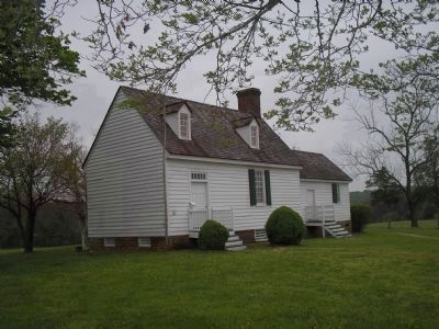
Hillsman House, located about a ½ mile from the marker, served as a hospital after the April 6, 1865 Battle of Sailor's Creek. Private Samuel Eddy walked to this house after being seriously wounded in the battle.
More about this marker. The left of the marker contains a drawing of the “Surrender of Gen. Ewell’s Corps, by Alfred R. Waud.” The center features a map showing the “Final troop positions for the Battle of Marshall’s Crossroads and Little Sailor’s Creek, April 6, 1865.” The right of the marker has a Keith Rocco painting of the battle entitled “Victory or Death, the Last Stand of the Savannah Vol. Guard at the Battle of Sailor’s Creek, VA., April 6, 1865”.
Also see . . .
1. Sailor's Creek State Park. Virginia State Parks website. (Submitted on September 26, 2008, by Bill Coughlin of Woodland Park, New Jersey.)
2. Lee's Retreat to Appomattox.
Photographed by Bill Coughlin, April 26, 2007
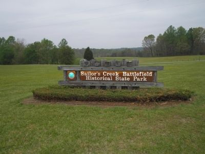
5. Sailor’s Creek Battlefield State Park
This park preserves the site of the last major battle of Gen. Robert E. Lee's Army of Northern Virginia.
3. Sailor’s Creek. CWSAC Battle Summaries. (Submitted on September 26, 2008, by Bill Coughlin of Woodland Park, New Jersey.)
Credits. This page was last revised on February 8, 2026. It was originally submitted on September 26, 2008, by Bill Coughlin of Woodland Park, New Jersey. This page has been viewed 2,909 times since then and 65 times this year. Last updated on February 7, 2026, by Evan Dwyer of Richmond, Virginia. Photos: 1. submitted on September 26, 2008, by Bill Coughlin of Woodland Park, New Jersey. 2. submitted on June 12, 2010, by Craig Swain of Leesburg, Virginia. 3, 4, 5. submitted on September 26, 2008, by Bill Coughlin of Woodland Park, New Jersey. • Bernard Fisher was the editor who published this page.
