Main/Military Plaza in San Antonio in Bexar County, Texas — The American South (West South Central)
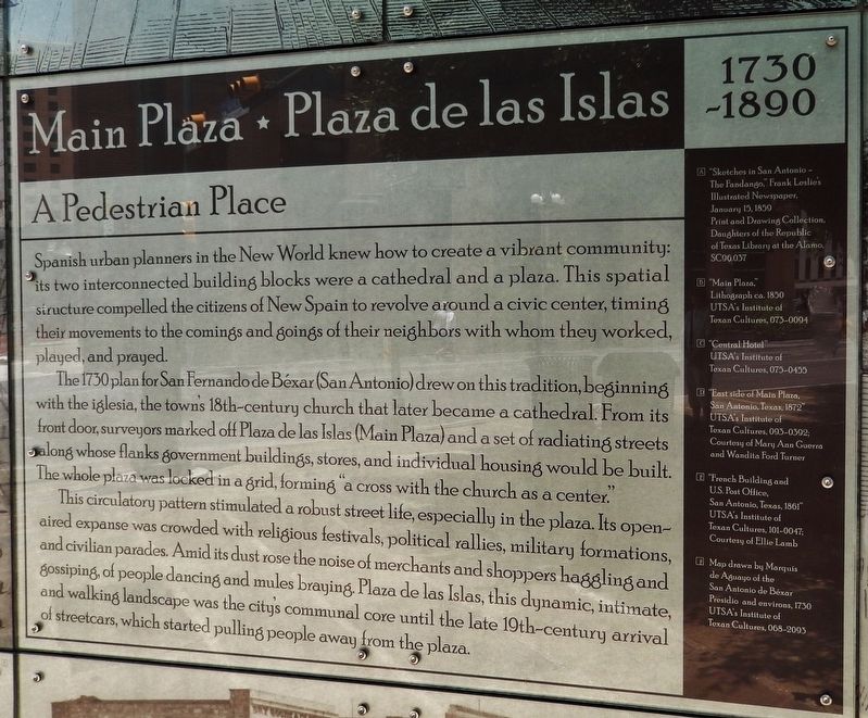
Main Plaza - Plaza de las Islas
1730 - 1890
| — | A Pedestrian Place | — |
Photographed by Cosmos Mariner, May 21, 2018
1. Main Plaza - Plaza de las Islas Marker
Spanish urban planners in the New World knew how to create a vibrant community: its two interconnected building blocks were a cathedral and a plaza. This spatial structure compelled the citizens of New Spain to revolve around a civic center, timing their movements to the comings and goings of their neighbors with whom they worked, played, and prayed.
The 1730 plan for San Fernando de Bexar (San Antonio) drew on this tradition, beginning with the iglesia, the town’s 18th-century church that later became a cathedral. From its front door, surveyors marked off Plaza de las Islas (Main Plaza) and a set of radiating streets along whose flanks government buildings, stores, and individual housing would be built. The whole plaza was locked in a grid, forming "a cross with the church as a center.”
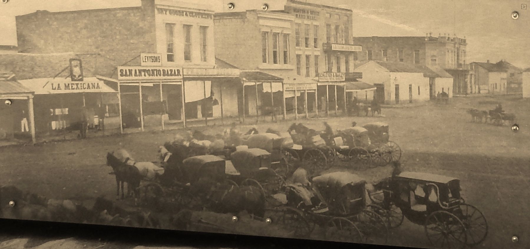
This circulatory pattern stimulated a robust street life, especially in the plaza. Its open-aired expanse was crowded with religious festivals, political rallies, military formations, and civilian parades. Amid its dust rose the noise of merchants and shoppers haggling and gossiping, of people dancing and mules braying. Plaza de las Islas, this dynamic, intimate, and walking landscape was the city’s communal core until the late 19th-century arrival of streetcars, which started pulling people away from the plaza.
Topics.
this page online
Location. 29° 25.489′ N, 98° 29.589′ W. Marker is in San Antonio, Texas, in Bexar County. It is in Main/Military Plaza. It is at the intersection of East Commerce Street and Soledad Street, on the left when traveling west on East Commerce Street. Marker is located at the northeast corner of Main Plaza, by the sidewalk, near the intersection. Touch for map. Marker is at or near this postal address: 115 North Main Avenue, San Antonio TX 78205, United States of America. Touch for directions.

Regionally, this marker is in South Texas. It is also in the American South. Globally, it is in North America, a Gulf of Mexico state, the Western Hemisphere, the Western World, and the Anglosphere. Historically, it finds itself in what was once New Spain, the Republic of Texas, and one of the Confederate States of America.
Other nearby markers. At least 8 other markers are within walking distance of this marker: American Dancers (a few steps from this marker); Perote Prisoners (within shouting distance of this marker); Plaza Principal (within shouting distance of this marker); White Elephant (within shouting distance
Photographed by Cosmos Mariner, May 21, 2018
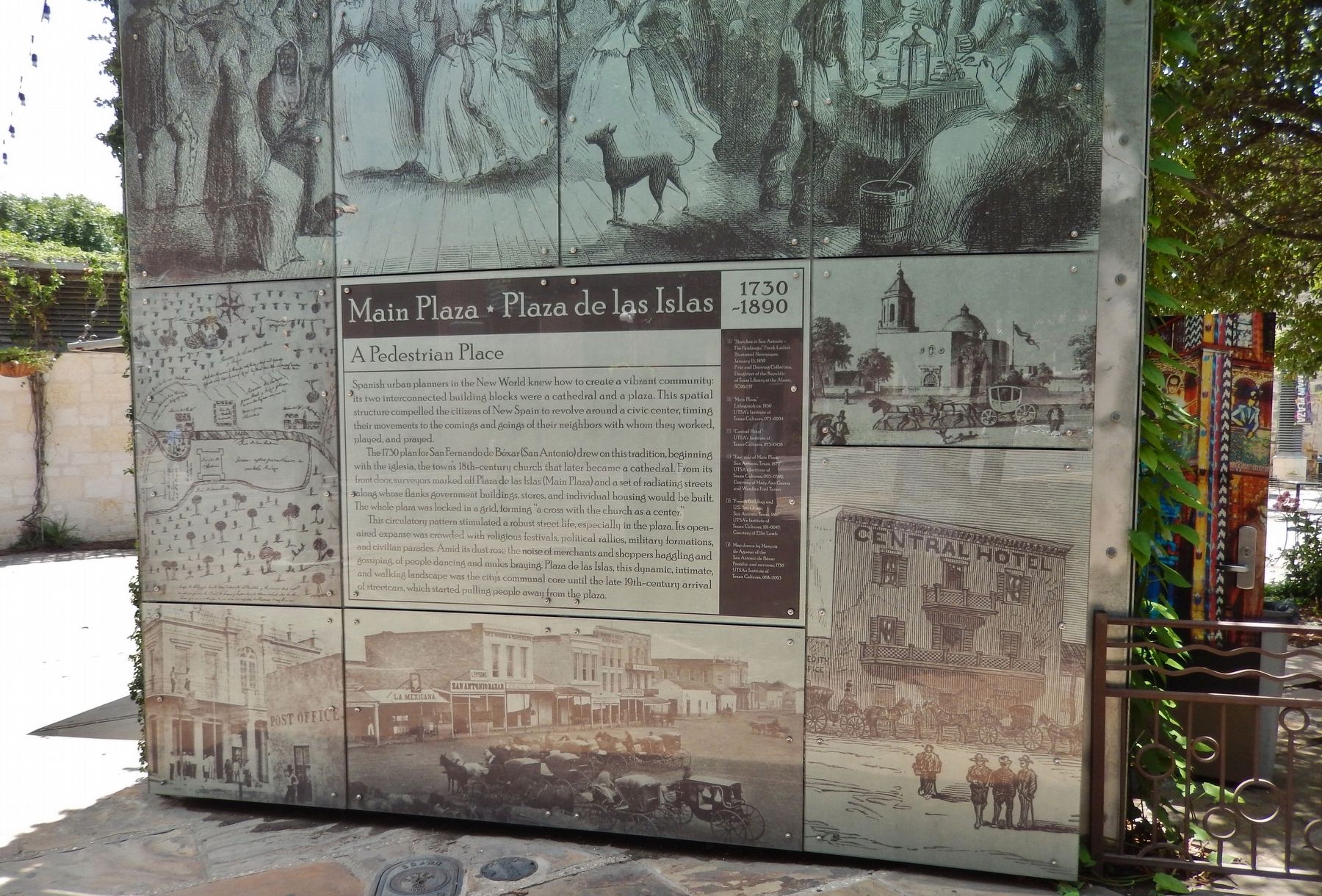
2. Main Plaza - Plaza de las Islas Marker & Mural (wide view)
More about this marker. Marker consists of a large, multi-paneled historical mural with text, mounted on the north side of the building at the northeast corner of Main Plaza.
Also see . . . Main Plaza: San Antonio, Texas.
Main Plaza was the site of the first civil settlement in Texas. The plaza was locked in a grid, with plans to build government buildings, and housing along radiating streets with the cathedral in the center. Established in 1731 as "the Villa de San Fernando" by the Spanish Settlers from the Canary Islands. On the northeast side of the plaza is a plaque that marks the exact location where women and children were taken to safety during the Battle of the Alamo. Two buildings bordering Main Plaza are a part of the National Register of Historical Places : San Fernando Cathedral (1755), and Bexar County Courthouse (1896). (Submitted on June 3, 2018, by Cosmos Mariner of Cape Canaveral, Florida.)
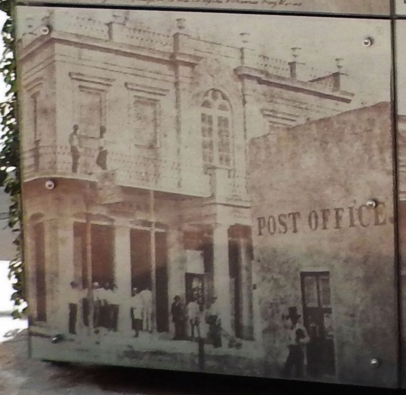
UTSA:s Institute of Texan Cultures, 101-0047; Courtesy of Ellie Lamb
3. Marker detail: French Building and U.S. Post Office, San Antonio, Texas, 1861
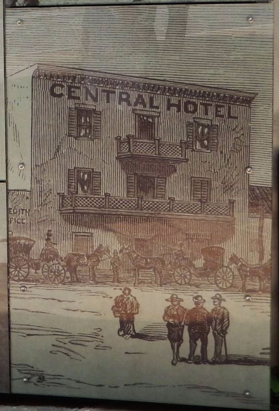
Photographed by UTSA's Institute of Texan Cultures, 075-0455
4. Marker detail: Central Hotel
UTSA's Institute of Texan Cultures, 093-0392; Courtesy of Mary Ann Guerra and Wandita Ford Turner, May 21, 2018
5. Marker detail: East side of Main Plaza, San Antonio, Texas, 1872
Photographed by Cosmos Mariner, May 21, 2018
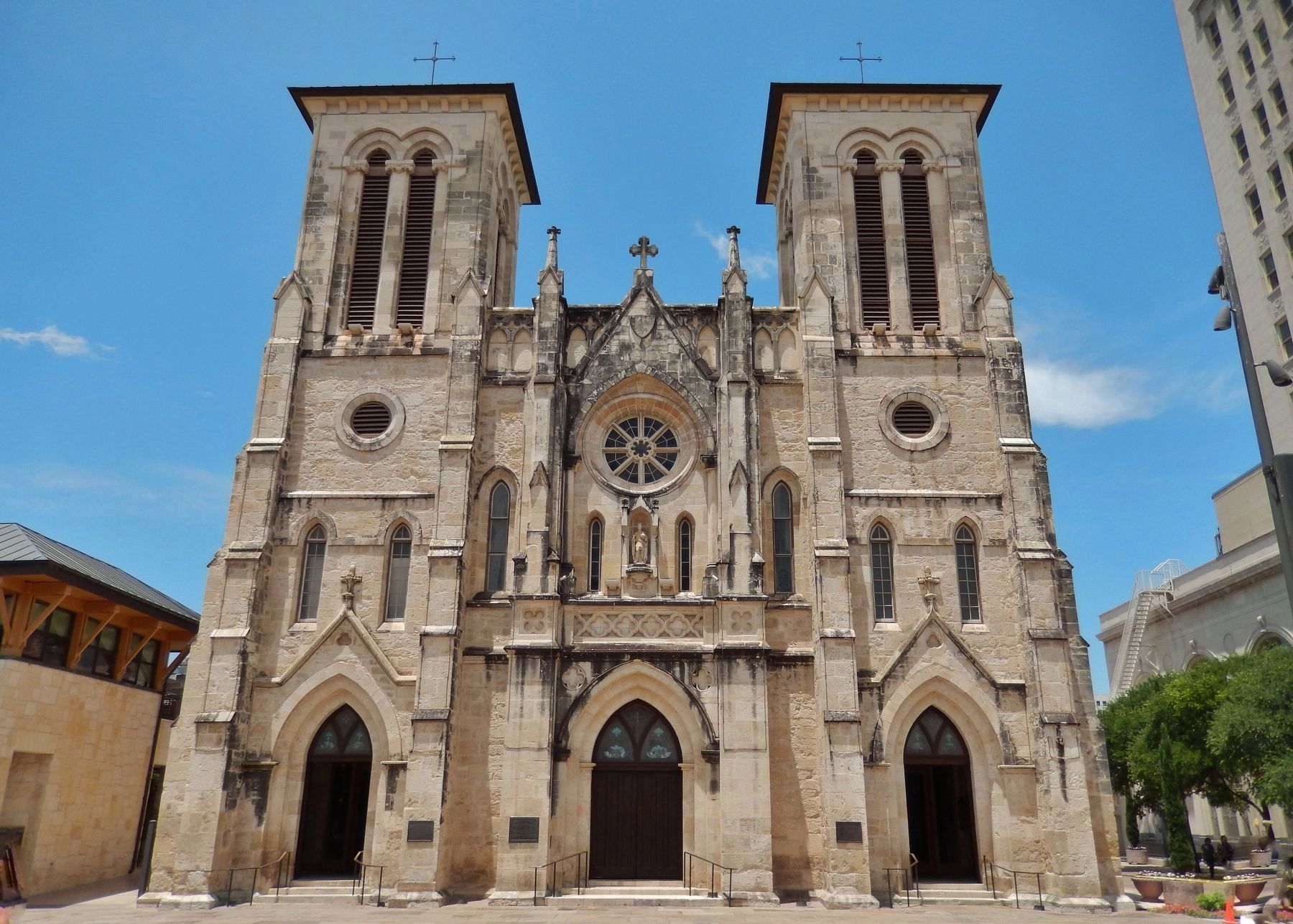
6. San Fernando Cathedral, Main Plaza, San Antonio, Texas (near marker)
Credits. This page was last revised on September 9, 2024. It was originally submitted on June 3, 2018, by Cosmos Mariner of Cape Canaveral, Florida. This page has been viewed 1,348 times since then and 56 times this year. Photos: 1, 2, 3, 4, 5, 6. submitted on June 3, 2018, by Cosmos Mariner of Cape Canaveral, Florida. • Andrew Ruppenstein was the editor who published this page.
