Near Boise in Ada County, Idaho — The American West (Mountains)
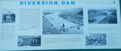
Diversion Dam

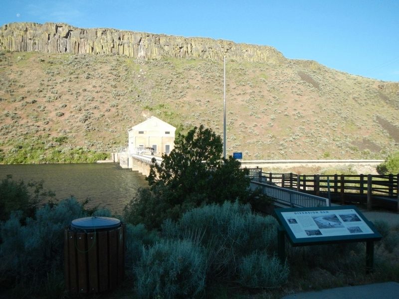
Photographed By Barry Swackhamer, May 3, 2018
1. Diversion Dam Marker
Captions: (upper left) A.J. Wiley and Harry Thompkins in office during construction of the New Yourk Canal, 1889.; (bottom center) Opening of New York Canal, February 22, 1909; (upper right) Relining canal with reinforced concrete; (lower left) Diversion Dam under construction, 1905.
In the late 1800s, Idaho Territory needed to attract homesteaders to farm the Boise Valley. At the time, the area was dry sagebrush desert. A young engineer, Arthur Foote, designed a great canal system that was to allow the Boise River to irrigate the valley. A dam was proposed to divert river water into miles of canals that extended all the way to Canyon County. Today, the lush green farmland in the valley is a result of this early planning. However, it was not accomplished for many years after many financial and technical obstacles.
The New York Canal Project was begun in 1882. It was not completed for eighteen years and when it was finally opened in 1900, its volume was only 300 cfs (cubic feet per second). As originally planned, volume would have feen 4500 cfs. In 1904, the U.S, Reclamation Service (now Bureau of Reclamation), took control of the project. The canal was rebuilt, lined with concrete, and a reservoir and head gate were added.
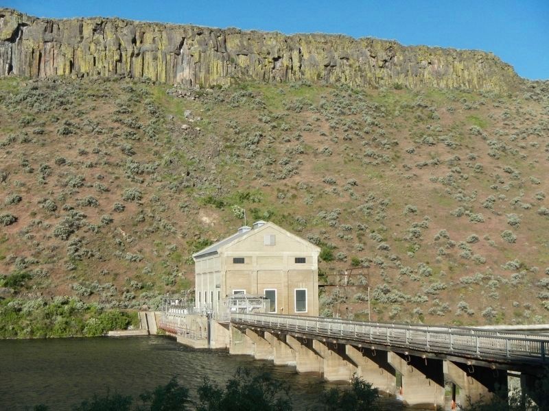
The Diversion Dam complex was opened in 1909, but that year the drought was so severe that the reservoir was inadequate. As a result, the Arrowrock Dam was begun, 17 miles upriver. The gravel pit behind you was what they used to build Arrowrock. Diversion Dam was built from a series of excavations that you can see about a quarter mile west of the dam site.
When Diversion Dam was built, the hydroelectric was not included. This was added in 1912 to provide power to the Arrowrock Dam. After Arrowrock Dam was completed in 1915, the Diversion Dam electric plane was sold as surplus.
To move gravel from the Diversion Dam pit to the Arrowrock site, the government built and operated The Boise & Arrowrock Railroad from 1911 through 1915. It was abandoned in 1916 and became a part of the Intermountain Railway which operated until 1935.
Erected by Ada County Centennial Committee.
Topics. This historical marker is listed in these topic lists: Agriculture • Industry & Commerce • Waterways & Vessels. A significant historical year for this entry is 1882.
Location. 43° 32.298′ N, 116° 5.562′ W. Marker is near Boise, Idaho, in Ada County. Marker is at the intersection of State Highway 21 and East Warm Springs Avenue, on the right when traveling east on State Highway 21. Touch for map. Marker is in this post office area: Boise ID 83716, United States of America. Touch for directions.
Other nearby markers. At least 8 other markers are within walking distance of this marker. A different marker also named Diversion Dam (within shouting distance of this marker); Fort Boise (approx. 0.9 miles away); Kelton Road (approx. 0.9 miles away); Idaho's Emigrant Trails (approx. 0.9 miles away); Ezra Meeker (approx. 0.9 miles away); Bonneville Point (approx. 0.9 miles away); The Oregon Trail (approx. 0.9 miles away); Beaver Dick's Ferry (approx. 0.9 miles away). Touch for a list and map of all markers in Boise.
Credits. This page was last revised on August 19, 2020. It was originally submitted on June 20, 2018, by Barry Swackhamer of Brentwood, California. This page has been viewed 257 times since then and 36 times this year. Photos: 1, 2, 3. submitted on June 20, 2018, by Barry Swackhamer of Brentwood, California.

