Rome in Oneida County, New York — The American Northeast (Mid-Atlantic)
Erie Canal
Photographed by Howard C. Ohlhous, August 17, 2008
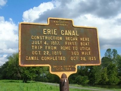
1. Erie Canal Marker - Rome, New York
July 4, 1817. First boat
trip from Rome to Utica
Oct. 22, 1819. 363 Mile
Canal completed Oct. 20, 1825
Erected 1969 by Oneida County D.P.W.
Topics and series. This historical marker is listed in these topic lists: Man-Made Features • Notable Places • Waterways & Vessels. In addition, it is included in the Erie Canal series list. A significant historical month for this entry is July 1965.
Location. 43° 13.546′ N, 75° 30.442′ W. Marker is in Rome, New York, in Oneida County. It is on Rome New London Road (New York State Route 46 & 49), on the right when traveling east. Touch for map. Marker is in this post office area: Rome NY 13440, United States of America. Touch for directions.

Regionally, this marker is in Upstate New York and in the Mohawk Valley. It is also in the American Northeast and in the Mid-Atlantic. Globally, it is in North America, the Great North Woods, the Western Hemisphere, the Western World, and the Anglosphere. Historically, it finds itself in what was once the Haudenosaunee (Iroquois) Confederacy, New Netherland, and one of the original Thirteen Colonies.
this page online
Other nearby markers. At least 8 other markers are within 3 miles of this marker, measured as the crow flies: Fort Bull (approx. ¼ mile away); Erie Canal Enlargement (approx. ¼ mile away); Clinton's Ditch (approx. 0.3 miles away); a different marker also named Fort Bull (approx. 0.3 miles away); Rome Cemetery (approx. 2.1 miles away); The Grave of Francis Bellamy (approx. 2.1 miles away); U.S. Arsenal (approx. 2.1 miles away); Francis Bellamy (approx. 2.2 miles away). Touch for a list and map of all markers in Rome.
Another marker is no longer nearby. The Erie Canal - July 4, 1817 (was approx. ¼ mile away but has been confirmed missing).
More about this marker. This marker is roadside just west of the Erie Canal Village, posted beside a section of the enlarged Erie Canal that is currantly maintained to hold water. The Erie Canal Village is an "outdoor living history museum" which offers boat rides on a replica canal boat in this section of the canal. Therefore this marker can be seen not only from the road, but also from a canal boat, on the right, while traveling west!
Photographed by Howard C. Ohlhous, August 17, 2008
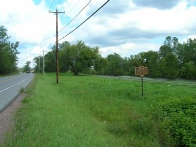
2. Erie Canal Marker
View is looking east. Route 46 & Route 49 are together on the left. The Erie Canal is the area of water to the right and beyond the marker.
Photographed by Howard C. Ohlhous, August 17, 2008
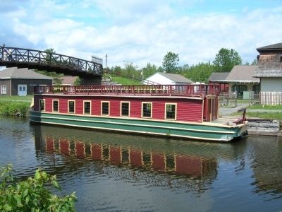
3. Canal Boat on the Erie Canal
This replica canal boat is "The Chief Engineer of Rome", afloat in a section of the enlarged Erie Canal at The Erie Canal Village.
Photographed by Dale K. Benington, July 29, 2011
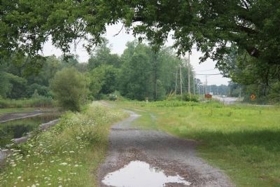
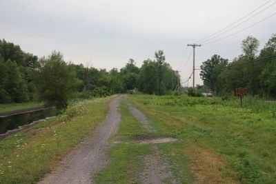
4. Erie Canal Marker
Distant view of the historical marker to the right of the picture along the Rome-New London Road, while to the left is the old Erie Canal and the site of the early initial construction.
Photographed by Dale K. Benington, July 29, 2011
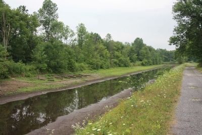
5. Erie Canal Marker
A closer view of the historical marker and the Rome-New London Road to the right and the old Erie Canal to the left.
Photographed by Dale K. Benington, July 29, 2011
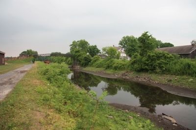
6. Erie Canal Marker
View looking west of the Erie Canal as seen from about midway between the historical marker and the historic Erie Canal Village. Also, on the far side of the canal a canal boat dry dock can be seen.
Photographed by Dale K. Benington, July 29, 2011
7. Erie Canal Marker
View looking east along the old Erie Canal from midway between the historical marker and the historic Erie Canal Village. In the distance is the village bridge across the canal.
Credits. This page was last revised on June 16, 2016. It was originally submitted on September 30, 2008, by Howard C. Ohlhous of Duanesburg, New York. This page has been viewed 2,524 times since then and 53 times this year. Photos: 1, 2, 3. submitted on September 30, 2008, by Howard C. Ohlhous of Duanesburg, New York. 4, 5, 6, 7. submitted on April 7, 2012, by Dale K. Benington of Toledo, Ohio. • Kevin W. was the editor who published this page.
