Lone Star in Morris County, Texas — The American South (West South Central)
Iron Bluff Cemetery
Photographed by Mark Hilton, June 25, 2018
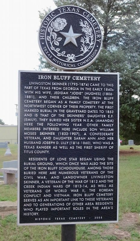
1. Iron Bluff Cemetery Marker
Residents of Lone Star began using the burial ground, which once was also the site of the Iron Bluff Schoolhouse. Among those buried here are numerous veterans of the Civil War, and landowner Livingston Skinner, a veteran of the War of 1812 and the Creek Indian Wars of 1813-14, as well as veterans of World War II, the Korean Conflict and Vietnam. Iron Bluff Cemetery serves as an important link to these veterans and to generations of other area residents who played important roles in the area's history.
Erected 2005 by Texas Historical Commission. (Marker Number 13788.)
Topics. This historical marker is listed in these topic lists: Cemeteries & Burial Sites • Settlements & Settlers • War of 1812 • War, US Civil. A significant historical year for this entry is 1853.
Location. 32° 56.314′ N, 94° 42.666′ W. Marker is in Lone Star, Texas, in Morris County. It can be reached from the intersection of East Industrial Boulevard (Farm to Market Road 250) and North Main Street (U.S. 259) when traveling south. Located within the Iron Bluff Cemetery. Touch for map. Marker is at or near this postal address: East Industrial
this page online

Regionally, this marker is in the American South, specifically in the Deep South, and in the Piney Woods. Globally, it is in North America, a Gulf of Mexico state, the Western Hemisphere, the Western World, and the Anglosphere. Historically, it finds itself in what was once New Spain, the Republic of Texas, one of the Confederate States of America, and the Antebellum South.
Other nearby markers. At least 8 other markers are within 7 miles of this marker, measured as the crow flies: Old Hughes Furnace (approx. 1.4 miles away); In Appreciation (approx. 1.4 miles away); Site of Old Spearman's Ferry (approx. 2 miles away); Riley Cemetery (approx. 3.9 miles away); Caddo Trace (approx. 5.4 miles away); Hughes Springs (approx. 6.3 miles away); Chalybeate Springs (approx. 6.3 miles away); Trammel's Trace (approx. 6.3 miles away). Touch for a list and map of all markers in Lone Star.
Photographed by Mark Hilton, June 25, 2018
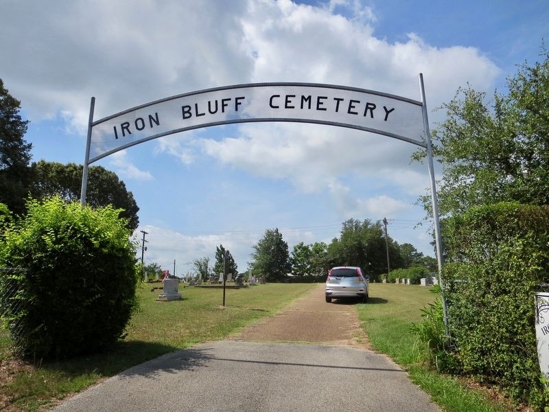
2. Iron Bluff Cemetery Marker, on left, just past cemetery entrance.
Photographed by Mark Hilton, June 25, 2018
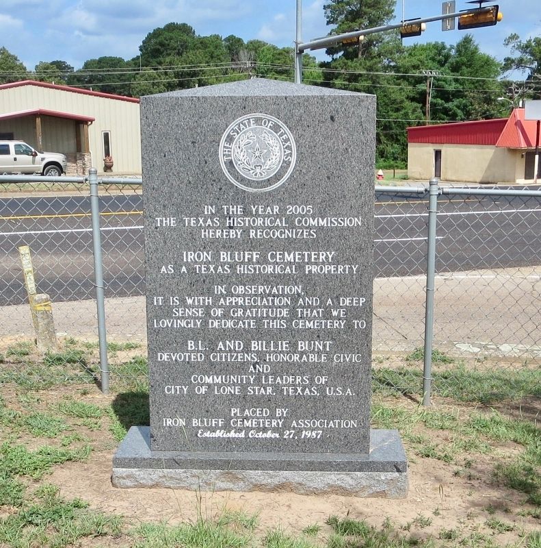
3. Another nearby marker noting historic significance of cemetery.
Photographed by Mark Hilton, June 25, 2018
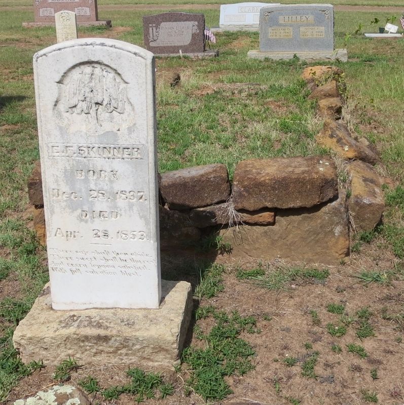
4. First marked burial, Skinners' daughter E.F. (Emily), mentioned on marker.
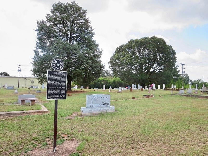
Photographed by Mark Hilton, June 25, 2018
5. View of marker and graves in background.
Emily Skinner's grave can be seen just to left of right-side power pole.
Credits. This page was last revised on July 6, 2018. It was originally submitted on July 6, 2018, by Mark Hilton of Montgomery, Alabama. This page has been viewed 856 times since then and 89 times this year. Photos: 1, 2, 3, 4, 5. submitted on July 6, 2018, by Mark Hilton of Montgomery, Alabama.
