
Arcadia in Oklahoma County, Oklahoma — The American South (West South Central)
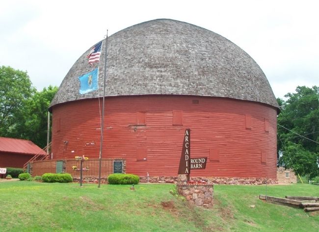
Arcadia Round Barn, Arcadia, Oklahoma
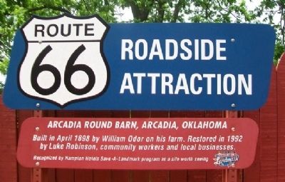
Route 66 Roadside Attraction
Photographed by William Fischer, Jr., May 6, 2015
1. Arcadia Round Barn, Arcadia, Oklahoma Marker
Built in April 1898 by William Odor on his farm. Restored in 1992 by Luke Robinson, community workers and local businesses.
Erected by Hampton Hotels.
Topics and series. This historical marker is listed in these topic lists: Agriculture • Man-Made Features. In addition, it is included in the Route 66 Roadside Attractions, and the U.S. Route 66 series lists. A significant historical month for this entry is April 1898.
Location. 35° 39.742′ N, 97° 19.572′ W. Marker is in Arcadia, Oklahoma, in Oklahoma County. It can be reached from Oklahoma 66. Touch for map. Marker is at or near this postal address: 107 East Highway 66, Arcadia OK 73007, United States of America. Touch for directions.

Regionally, this marker is in Central Oklahoma — Frontier Country and in Greater Oklahoma City. It is also in the American South, specifically on the prairies, and on the Southern Plains. Globally, it is in North America, the Western Hemisphere, the Western World, and the Anglosphere. Historically, it finds itself in what was once the territory of the Mississippian Culture and also the Louisiana Purchase.
Other nearby markers. At
this page online
Also see . . .
1. Arcadia Round Barn. Official website for the attraction. (Submitted on December 8, 2021, by Jason Voigt of Glen Carbon, Illinois.)
2. Arcadia Round Barn. National Park Service website entry (Submitted on December 8, 2021, by Jason Voigt of Glen Carbon, Illinois.)
3. History of Arcadia, Oklahoma. Town website entry (Submitted on May 7, 2015, by William Fischer, Jr. of Reynoldsburg, Ohio.)
4. Route 66 in Oklahoma. Travel Oklahoma website entry (Submitted on May 7, 2015, by William Fischer, Jr. of Reynoldsburg, Ohio.)
Additional commentary.
1.
Photographed by William Fischer, Jr., May 6, 2015
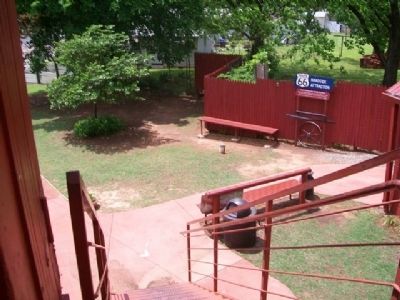
2. Arcadia Round Barn, Arcadia, Oklahoma Marker
The name should be Luke Robison, not Luke Robinson.
— Submitted July 14, 2020, by Devry Becker Jones of Washington, District of Columbia.
Photographed by William Fischer, Jr., May 6, 2015
3. The Arcadia Round Barn
Credits. This page was last revised on November 28, 2025. It was originally submitted on May 7, 2015, by William Fischer, Jr. of Reynoldsburg, Ohio. This page has been viewed 873 times since then and 33 times this year. Last updated on July 9, 2018, by Craig Baker of Sylmar, California. Photos: 1, 2, 3. submitted on May 7, 2015, by William Fischer, Jr. of Reynoldsburg, Ohio. • Syd Whittle was the editor who published this page.
