Lava Shadows in Albuquerque in Bernalillo County, New Mexico — The American Mountains (Southwest)
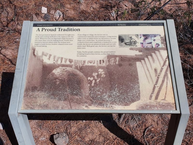
A Proud Tradition
Photographed by J. Makali Bruton, August 26, 2021
1. A Proud Tradition Marker
The first permanent Spanish settlement brought new foods and cooking methods to the region in the late 1500s. Wheat became an important staple because it was easier than corn for making bread. Pueblo men learned to harvest wheat while the woman were taught to build hornos, beehive-shaped ovens used for bread-making.
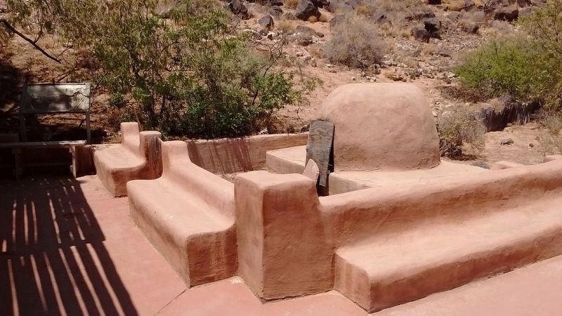
From village to village, the hornos vary in construction materials and techniques. Using mortar, either rocks or adobe bricks are layered in a circular shape over a stone base. An arched doorway is created in front and a small hole is formed for a vent. Finally the hornos are plastered inside and out with adobe mud. With great care, the hornos can last for many years.
Today Pueblo people continue the proud tradition of baking bread in their hornos, as they have done for centuries.
Erected by National Park Service, U.S. Department of the Interior.
Topics. This historical marker is listed in these topic lists: Anthropology & Archaeology • Indigenous Peoples and Communities.
Location. 35° 8.345′ N, 106° 42.665′ W. Marker is in Albuquerque, New
this page online

Regionally, this marker is in the American Southwest. Globally, it is in North America, the Western Hemisphere, the Western World, and the Anglosphere. Historically, it finds itself in what was once New Spain and also the Republic of Texas.
Other nearby markers. At least 8 other markers are within 2 miles of this marker, measured as the crow flies: The Legacy of the Atrisco Land Grant (a few steps from this marker); The Measuring Lady (within shouting distance of this marker); One of the Largest Petroglyph Sites (within shouting distance of this marker); Mesa Point Trail (approx. 1½ miles away); a different marker also named Mesa Point Trail (approx. 1½ miles away); a different marker also named Mesa Point Trail (approx. 1½ miles away); Boca Negra Canyon (approx. 1½ miles
Photographed by Tom Bosse, May 20, 2018
2. A Proud Tradition Marker and Horno
Marker is visible at the far left and the horno is visible on the right.
Credits. This page was last revised on February 2, 2023. It was originally submitted on July 15, 2018, by Tom Bosse of Jefferson City, Tennessee. This page has been viewed 575 times since then and 26 times this year. Photos: 1. submitted on September 17, 2021, by J. Makali Bruton of Washington, District of Columbia. 2. submitted on July 15, 2018, by Tom Bosse of Jefferson City, Tennessee. • Syd Whittle was the editor who published this page.
