Courtland in Southampton County, Virginia — The American South (Mid-Atlantic)
Virginia Native Tribes/First Americans
Inscription.
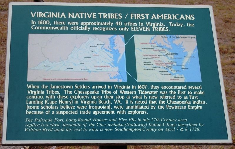
In 1600, there were approximately 40 tribes in Virginia. Today, the Commonwealth officially recognizes only eleven tribes.
When the Jamestown Settlers arrived in Virginia in 1607, they encountered several Virginia Tribes. The Chesapeake Tribe of Western Tidewater was the first to make contract with these explorers upon their stop at what is now referred to as First Landing (Cape Henry) in Virginia Beach, VA. It is noted that the Chesapeake Indian, (some scholars believe were Iroquoian), were annihilated by the Powhatan Empire because of a suspected trade agreement with explorers.
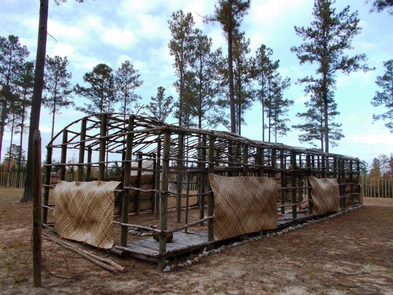
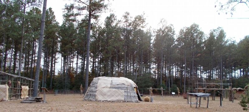
The Palisade fort, long/round houses and fire pits in this 17th Century area replica is a close facsimile of the Cheroenhaka (Nottoway) Indian Village described by William Byrd upon his visit to what is now Southampton County on April 7 & 8, 1728.
(left map legend, listed here alphabetically)
Cheroenhaka (Nottoway), Cherokee, Manahoac, Meherrin, Mohetan, Monacan, Nahyssam, Occaneechi, Saponi, Tauxenent, Tutelo
(right map legend, listed here alphabetically)
Accohannock, Accomac, Appamattuck, Arrohatock, Chesapeake, Chickahominy, Chiskiack, Cuttatawomen, Eastern Chickahominy, Kecoughtan, Mattaponi, Moraughtacund, Nansemond, Nantaughtacund, Onawmanient, Opiscopank, Pamunkey, Paspahegh, Patawomeck (Potomac), Piankatank, Pissaseck, Powhatan, Rappahannock, Sekakawton, Tapahanock, Upper Mattaponi, Warraskoyack, Werowocomoco, Weyanock, Wiccocomico, Youghtanund
Erected by Cheroenaka (Nottoway) Indian Tribe.
Topics. This historical marker is listed in these topic lists: Colonial Era • Native Americans.
Location. 36° 41.178′ N, 77° 2.581′ W. Marker is in Courtland, Virginia, in Southampton County. Marker can be reached from Aquia Path, half a mile west of Old Bridge Road (Virginia Route 742), on the right when traveling east. Touch for map. Marker is at or near this postal address: 27345 Aquia Path, Courtland VA 23837, United States of America. Touch for directions.
Other nearby markers. At least 8 other markers are within 4 miles of this marker, measured as the crow flies. General Thomas' Birthplace (approx. 0.8 miles away); The Rebecca Vaughan House (approx. 1.9 miles away); Southampton County Veterans Memorial (approx. 2.3 miles away); Mahone’s Tavern (approx. 2.3 miles away); Courtland School — Rosenwald Funded (approx. 2.8 miles away); The Hand Site (approx. 3 miles away); Helping Hand Cemetery (approx. 3.1 miles away); Marle Hill (approx. 3.1 miles away). Touch for a list and map of all markers in Courtland.
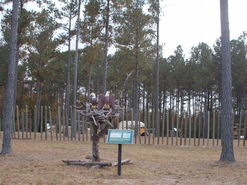
More about this marker. The marker stands outside the
Native Palisade Fort in Palisade Village. It is reachable by two walking trails that support vehicle travel also. A wooded area separates the village from Cattashowrock Town. The area is opened to the public for special tours and events.
Related markers. Click here for a list of markers that are related to this marker. Read about archaeological finds related to the Cheroenhaka (Nottoway) and Cheseapake Indians.
Also see . . . Cheroenhaka (Nottoway) website. (Submitted on July 18, 2018, by Cynthia L. Clark of Suffolk, Virginia.)
Photographed By Cynthia L. Clark, November 5, 2017
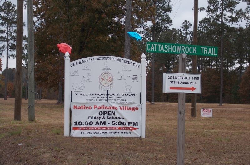
6. The main entrance sign to Cheroenhaka (Nottoway) Indian Territory.
This sign stands at the intersection of Route 742 and Cattashowrock Trail. Mascots for nine clans are listed: Bear, Beaver, Deer, Eel, Hawk (Southampton County), Heron, Snipe, and Wolf.
Credits. This page was last revised on July 19, 2018. It was originally submitted on July 18, 2018, by Cynthia L. Clark of Suffolk, Virginia. This page has been viewed 639 times since then and 40 times this year. Photos: 1, 2, 3, 4, 5, 6. submitted on July 18, 2018, by Cynthia L. Clark of Suffolk, Virginia. • Bernard Fisher was the editor who published this page.
