Tancama in Jalpan de Serra, Querétaro, Mexico — The Central Highlands (North America)
Plaza Santiago
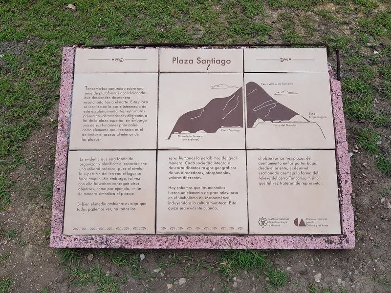
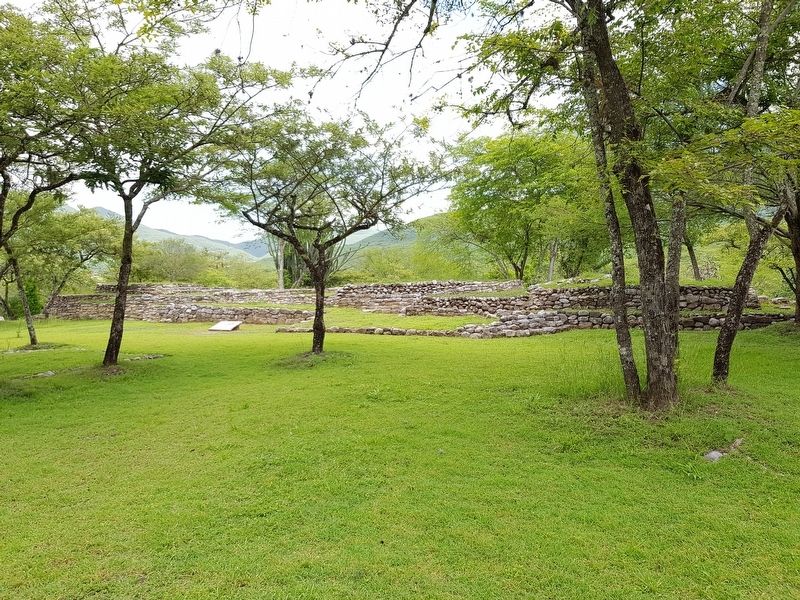
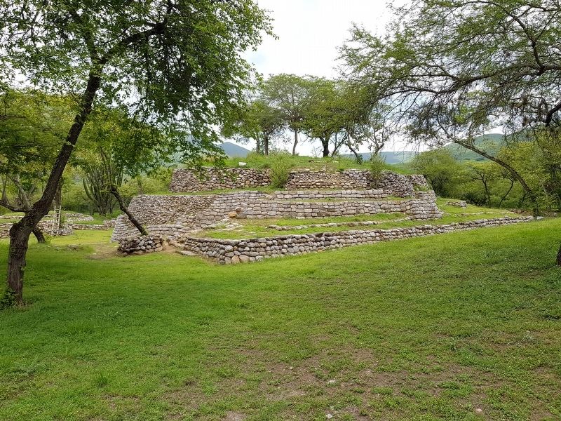
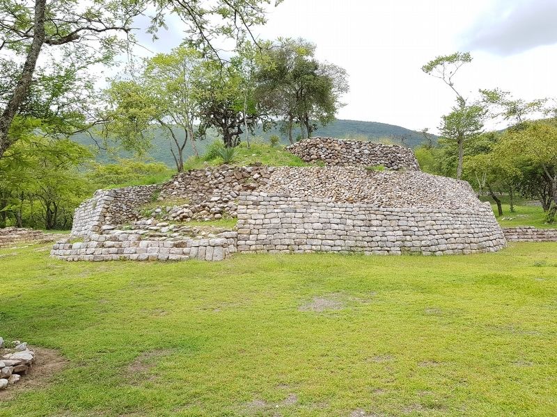
Tancama fue construida sobre una serie de plataformas acondicionadas que descienden de manera escalonada hacia el norte. Esta plaza se localiza en la parte intermedia de este escalonamiento. Sus estructuras características diferentes a las de la plaza superior, sin embargo una de sus funciones principales como elemento arquitectónico es el de limitar el acceso al interior de las plazas.
Es evidente que esta forma de organizar y planificar el espacio tiene una utilidad práctica, pues al nivelar la superficie del terreno el lugar se hace amplio. Sin embargo, tal vez con ello buscaban conseguir otros objetivos, como por ejemplo, imitar de manera simbólica el paisaje.
Si bien el medio ambiente es algo que todos podemos ver, no todos los seres humanos lo percibimos de igual manera. Cada sociedad integra o descarta distintos rasgos geográficas de sus alrededores, ortorgándoles valores diferentes.
Hoy sabemos que las montañas fueron un elemento de gran relevancia en el simbolismo de Mesoamérica, incluyendo a la cultura huasteca. Esto quizá sea evidente cuando al observar las tres plazas del asentamiento en las partes bajas desde el oriente, el desnivel escalonado asemeja la forma del relieve del cerro Tancama, mismo que tal vez trataron de representar.
Pie de dibujos
Cerro Alto o de Tancama
Plaza de la Promesa (por explorar)
Plaza Santiago
Plaza del Mirador
Zona Arqueológica
Plaza Santiago
Tancama was built on a series of constructed platforms that descend in a staggered form to the north. This square is located in the intermediate part of this staircase. Its characteristic structures differ from those of the upper plaza, however one of its main functions as an architectural element is to limit access to the interior of the squares.
It is evident that this way of organizing and planning the space has a practical utility, because when leveling the surface of the land the entire place becomes wider. However, perhaps with that the inhabitants sought to achieve other objectives, such as, for example, symbolically imitating the landscape.
Although the environment is something that we can all see, not all human beings perceive it in the same way. Each society integrates or discards different geographical features of its surroundings, giving them different values.
Today we know that the mountains were an element of great relevance in the symbolism of Mesoamerica,
including the Huastecan culture. This may be evident when observing the three squares of the settlement in the lower parts from the east, where the stepped differences resembles the shape of the relief of the Tancama hill, which perhaps they tried to represent.
Captions:
Cerro Alto (High Hill) or Tancama Hill
Plaza of the Promise (to be explored)
Santiago Square
Plaza del Mirador
Archaeological Site
Erected by Instituto Nacional de Antropología e Historia y el Consejo Nacional para la Cultura y las Artes.
Topics. This historical marker is listed in these topic lists: Anthropology & Archaeology • Architecture • Man-Made Features • Native Americans.
Location. 21° 9.62′ N, 99° 23.789′ W. Marker is in Tancama, Querétaro, in Jalpan de Serra. Marker can be reached from Jalpan de Serra - Xijitla Highway (Route 120), on the left when traveling east. The marker is at the north end of the Plaza Santiago at the Tancama Archaeological Site. Touch for map. Marker is in this post office area: Tancama QUE 76347, Mexico. Touch for directions.
Other nearby markers. At least 8 other markers are within 8 kilometers of this marker, measured as the crow flies. The Building of the Attached Room (a few steps from this marker); The Small Ballcourt (within shouting distance of this marker); Corporal Deformation
(within shouting distance of this marker); Buildings for the Elite (within shouting distance of this marker); The Copper Butterfly Building (within shouting distance of this marker); The Four Huastecans (within shouting distance of this marker); Tancama (within shouting distance of this marker); Tribute to Benito Juárez (approx. 8.2 kilometers away). Touch for a list and map of all markers in Tancama.
Credits. This page was last revised on July 24, 2018. It was originally submitted on July 24, 2018, by J. Makali Bruton of Accra, Ghana. This page has been viewed 119 times since then and 11 times this year. Photos: 1, 2, 3, 4. submitted on July 24, 2018, by J. Makali Bruton of Accra, Ghana.


