Laurens in Laurens County, South Carolina — The American South (South Atlantic)
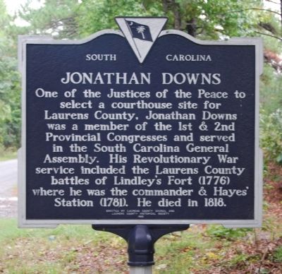
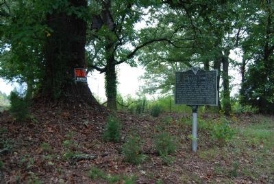
Lindley's Fort / Jonathan Downs
Erected 1990 by Laurens County Council and Laurens County Historical Society. (Marker Number 30-8.)
Topics and series. This historical marker is listed in these topic lists: Colonial Era • Forts and Castles • Man-Made Features • Native Americans • Patriots & Patriotism • Settlements & Settlers • War, US Revolutionary. In addition, it is included in the South Carolina, Laurens County Historical Society series list. A significant historical month for this entry is July 1780.
Location. 34° 27.667′ N, 82° 7.004′ W. Marker is in Laurens, South Carolina, in Laurens County. Marker is on Fort Lindley Road north of Old Fort Road, on the left when traveling south. Touch for map. Marker is in this post office area: Laurens SC 29360, United States of America. Touch for directions.
Other nearby markers. At least 10 other markers are within 7 miles of this marker, measured as the crow flies. Watts-Todd-Dunklin House (approx. 5.9 miles away); A.I. (Gus) Mason Bridge (approx. 6.1 miles away); American Legion Post 25 Veterans Monument (approx. 6.2 miles away); Martin's Store (approx. 6.3 miles away); Laurens County Veterans Monument (approx. 6.3 miles away); Laurens County World Wars I & II Veterans Monument (approx. 6.4 miles away); Western Laurens Volunteer Fire Department (approx. 6.4 miles away); Laurens County Confederate Monument (approx. 6.4 miles away); Vietnam War (approx. 6.4 miles away); Korean Conflict (approx. 6.4 miles away). Touch for a list and map of all markers in Laurens.
Also see . . . Lindley's Fort Site. Lindley’s Fort played a small but significant role in the Revolutionary War history of the Saluda River in the old Ninety-Six district. (Submitted on October 5, 2008, by Brian Scott of Anderson, South Carolina.)
Additional commentary.
1. Battle of Lindley's Fort
Date: July 15, 1776
Location: Near Laurens, Laurens County
Commanders: Majors Andrew Williamson, Jonathan Downs
Casualties: British -- 3k, 13c
While British strategy in the South Carolina upcountry depended largely on their ability to recruit Loyalist Americans, they wasted no time in allying Indians to the Crown. To counter this effort, a group of Patriots under the command of Maj. Andrew Williamson moved gradually throughout the back-country, gathering various detachments as they went along. On the night of July 15, a party of 150 soldiers on their way to join Williamson stopped to fortify a small group of settlers who had taken refuge at Lindley's Fort. The next morning, the fort was attacked by 88 Indians and 102 white Loyalists, some of whom were dressed and disguised as Indians and who were unaware of the soldiers within. Not only were the attackers repulsed, but the Patriots, led by Maj. Jonathan Downs, pursued and captured a number of them. (Source: South Carolina's Revolutionary War Battlefields: A Tour Guide (2002), R.L. Barbour, page 19)
— Submitted November 14, 2008, by Brian Scott of Anderson, South Carolina.
2. Lindley's Fort Site
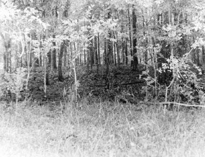
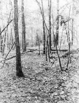
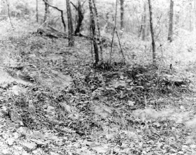
The site is located on a wooded hill, the highest rise of land surrounded mostly by open fields. The rise is approximately 25-35 feet above the adjacent land. On the top of the rise, evidence of a ditch approximately three feet in width is present...There is considerable stone scattered throughout, with what appears to be two rock lined pits within the area encompassed by the ditch...
Significance
Lindley's Fort played a small but significant role tn the Revolutionary history of the Saluda River in the old Ninety Six district.
As yet, the fort's actual construction date has not been determined; however, there are indications that it was considered an "old fort" in 1776. Since no public record has been found, it is believed that the fort was constructed by a private individual for needed protection in the backcountry. It is possible that the fort was built during the early 1760s since there were Indian disturbances tn the area during that time.
Captain James Lindley, owner of the fort at the time of the Revolution, was a Loyalist. He was in Colonel Thomas Fletchall's regiment and held at least one meeting of Loyalists at his home.
Part of the British plan of attack was to encourage Indian uprisings tn the backcountry. At this point, Lindley's Fort became very important to the area residents. In Drayton's Memoirs of the American Revolution it is reported:
"... the inhabitants along Saluda River and Rayborn's Creek, had taken refuge in an old fort called Lyndley's [Lindley's], near where, on the morning of the 15th of July, they were attacked by eighty-eight Indians, and one hundred and two white men; many of them painted, and dressed as Indians. Their object, was to surprise the fort; for which purpose, their attack was commenced about one o'clock in the morning. Fortunately, Major Downes [Downs], with one hundred and fifty men, had arrived at the fort the evening before, in his way, to join Major Williamson; and whose assistance effected the preservation of the fort. Not calculating on this accession of strength, the enemy fought fiercely; expecting every moment, an opportunity of stoning the fort. The fire of rifles and musketry was so well delivered from it, that at daylight the enemy gave way, retreating with precipitation: leaving two of their Chief Warriors, and several men, dead upon the field. The garrison, immediately pursued; and took thirteen white men prisoners: some of whom, were painted and dressed after the Indian manner; and they were immediately sent to Ninety-Six gaol, for safe keeping.
If excavated, Lindley's Fort may supply a ground plan of a frontier fort of this period. It can also provide an archeological site that may yield artifacts and clues of the people that lived, worked and died in the area.
There is a great deal of local interest in this site. On July 25, 1976, a marker dedication was sponsored by the Laurens County Historical Society and the Laurens County Bicentennial Commission in order to commemorate the battle of Lindley's Fort. (Source: National Register nomination form.)
— Submitted October 11, 2009, by Brian Scott of Anderson, South Carolina.
3. Jonathan Downs
As it is sometimes said that Laurens county was named for Col. John Laurens, I give the following: Dr. John A. Barksdale, of Laurens county, was the son of Allen Barksdale, who lived from 1783 to 1870, and his wife Nancy Downs, who lived from 1787 to 1866. Nancy Downs was a niece of Major Jonathan Downs of the Revolution, who died about 1818. For this information and that which follows I am indebted to C.D. Barksdale, Esq., of Laurens, son of Dr. John A. Barksdale. An editorial in the Laurensville Herald of March 15, 1907, quotes Dr. Barksdale as follows:
"Dr. Barksdale further stated that Jonathan Downs—a blood relation of the Doctor's—was one of the commissioners appointed soon after the close of the American Revolution to lay off and name the several subdivisions of the State, then called Districts; that in the course of the procedure in the convention, when it came to name this County, some member of the Commission moved that it be called Downs District, in honor of Jonathan Downs. To this Mr. Downs objected, and moved to amend by offering as a substitute the name of Laurens, in honor of Henry Laurens—and it was so done."
This quotation manifests some confusion regarding Legislature, Convention, and Commission. The counties were named by the Legislature, not by any convention. Also notice the common error of supposing that the counties were at first called districts, as they were in fact only from 1798 to 1868. Major Downs was not named by the act as one of the commissioners to lay off the counties, though it is not impossible that he may have been later appointed by coôptation to fill a vacancy. His suggestions were probably made in the Legislature. (Source: The Life of Henry Laurens: With a Sketch of the Life of Lieutenant Colonel John Laurens by David Duncan Wallace pgs 422-423.)
— Submitted October 11, 2009, by Brian Scott of Anderson, South Carolina.
Credits. This page was last revised on December 14, 2019. It was originally submitted on October 5, 2008, by Brian Scott of Anderson, South Carolina. This page has been viewed 4,144 times since then and 114 times this year. Photos: 1, 2. submitted on October 5, 2008, by Brian Scott of Anderson, South Carolina. 3. submitted on April 2, 2018, by Randy Tucker of Greenville, South Carolina. 4. submitted on November 14, 2008, by Brian Scott of Anderson, South Carolina. 5, 6, 7. submitted on December 23, 2010, by Brian Scott of Anderson, South Carolina.

