Lamartine in Columbia County, Arkansas — The American South (West South Central)
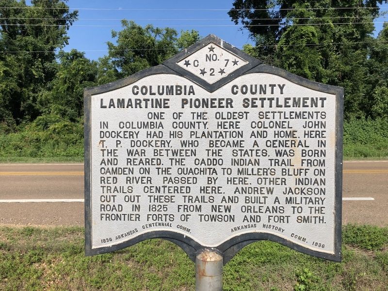
Columbia County Lamartine Pioneer Settlement
Erected 1936 by 1836 Arkansas Centennial Comm. - Arkansas History Comm. 1936. (Marker Number C-27.)
Topics and series. This historical marker is listed in these topic lists: Forts and Castles • Native Americans • Roads & Vehicles • Settlements & Settlers. In addition, it is included in the Arkansas Centennial Commission, and the Former U.S. Presidents: #07 Andrew Jackson series lists. A significant historical year for this entry is 1825.
Location. 33° 23.607′ N, 93° 17.332′ W. Marker is in Lamartine, Arkansas, in Columbia County. Marker is at the intersection of U.S. 371 and East Columbia Road (County Road 60), on the right when traveling north on U.S. 371. Touch for map. Marker is at or near this postal address: 4920 US-371, Waldo AR 71770, United States of America. Touch for directions.
Other nearby markers. At least 4 other markers are within 15 miles of this marker, measured as the crow flies. Columbia County Courthouse (approx. 9.2 miles away); a different marker also named Columbia County Courthouse (approx. 9.2 miles away); Gen. John Porter McCown (approx. 9.6 miles away); Columbia County Calhoun Pioneer Settlement (approx. 14.3 miles away).
Also see . . . Encyclopedia of Arkansas History article on Lamartine. (Submitted on August 5, 2018, by Mark Hilton of Montgomery, Alabama.)
Credits. This page was last revised on September 3, 2020. It was originally submitted on August 5, 2018, by Mark Hilton of Montgomery, Alabama. This page has been viewed 513 times since then and 34 times this year. Photos: 1, 2. submitted on August 5, 2018, by Mark Hilton of Montgomery, Alabama.

