
Thurmont in Frederick County, Maryland — The American Northeast (Mid-Atlantic)
Blue Blazes Whiskey Trail
Catoctin Mountain Park
| — | National Park Service, U.S. Department of the Interior | — |
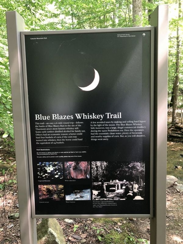
A few avoided taxes by making and selling hard liquor by the light of the moon. The Blue Blazes Whiskey Still, however, was a large, illegal commercial distillery during the 1920s Prohibition era. Here the operators had the essentials: clean water, plenty of firewood, and nearby supplies of corn. But, as you will discover, things went awry.
[Image caption:]
Marylanders opposed Prohibition because they believed it violated state's rights, and Maryland became known as the "Free State."
Erected by National Park Service, U.S. Department of the Interior.
Topics. This historical marker is listed in these topic lists: Agriculture • Industry & Commerce • Waterways & Vessels. A significant historical year for this entry is 1920.
Location. 39° 38.065′ N, 77° 27.073′ W.
this page online

Regionally, this marker is in the Washington Metropolitan Area and in Central Maryland. It is also in the American Mid-Atlantic. Globally, it is in North America, the Western Hemisphere, the Western World, and the Anglosphere. Historically, it finds itself in what was once one of the original Thirteen Colonies and also the Antebellum South.
Other nearby markers. At least 8 other markers are within walking distance of this marker: A Tradition of Conservation (about 300 feet away, measured in a direct line); A Fatal Shootout (about 800 feet away); Blue Blazes Still (approx. ¼ mile away); Making Whiskey (approx. 0.4 miles away); Preparing the Hearth (approx. ¾ mile away); Making Charcoal (approx. 0.8 miles away); Wood Hauler's Sled (approx. 0.8 miles away); Collier's Hut (approx. 0.9 miles

Credits. This page was last revised on March 19, 2019. It was originally submitted on August 5, 2018, by Devry Becker Jones of Washington, District of Columbia. This page has been viewed 321 times since then and 15 times this year. Photos: 1, 2, 3. submitted on August 5, 2018, by Devry Becker Jones of Washington, District of Columbia. • Bill Pfingsten was the editor who published this page.
