Near Leola in Dallas County, Arkansas — The American South (West South Central)
Skirmish at Guesses Creek
Front
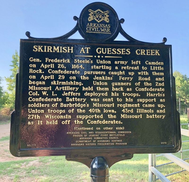
Gen. Frederick Steele’s Union army left Camden on April 26, 1864, starting a retreat to Little Rock. Confederate pursuers caught up with them on April 29 on the Jenkins’ Ferry Road and began skirmishing. Union gunners of the 2nd Missouri Artillery held them back as Confederate Col. W.L. Jeffers deployed his troops. Harris’s Confederate Battery was sent to his support as soldiers of Burbridge’s Missouri regiment came up. Union troops of the 40th Iowa, 43rd Illinois and 27th Wisconsin supported the Missouri battery as it held off the Confederates.
Erected 2015 by Arkansas Civil War Sesquicentennial Commission, Friends of Jenkins’ Ferry Battlefield, Arkansas Humanities Council, Department of Arkansas Heritage, Arkansas Historic Preservation Program. (Marker Number 117.)
Topics and series. This historical marker is listed in these topic lists: War, US Civil • Waterways & Vessels. In addition, it is included in the Arkansas Civil War Sesquicentennial Commission series list. A significant historical date for this entry is April 26, 1864.
Location. 34° 8.598′ N, 92° 36.462′ W. Marker is near Leola, Arkansas, in Dallas County. Marker is on County Road 409, 1.6 miles south of Cunningham Street, on the left when traveling south. Located on a rough dirt road, 1.6 miles south of where the paved Grant County 1 Road ends. Touch for map. Marker is in this post office area: Leola AR 72084, United States of America. Touch for directions.
Other nearby markers. At least 8 other markers are within 6 miles of this marker, measured as the crow flies. Officers Killed / Union Wounded (approx. 3 miles away); Tulip (approx. 4.8 miles away); Old Tulip School House (approx. 4.8 miles away); Arkansas Military Institute / Tulip in the Civil War (approx. 4.8 miles away); Red River Campaign (approx. 5.8 miles away); Jenkins Ferry / Pontoon Bridge (approx. 5.8 miles away); General Samuel Rice / Confederate Cannons Captured (approx. 5.8 miles away); Battle of Jenkins' Ferry (approx. 5.9 miles away). Touch for a list and map of all markers in Leola.

Photographed By Mark Hilton, August 2, 2018
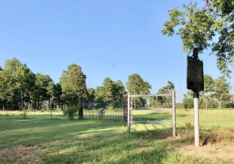
3. Skirmish at Guesses Creek Marker looking east.
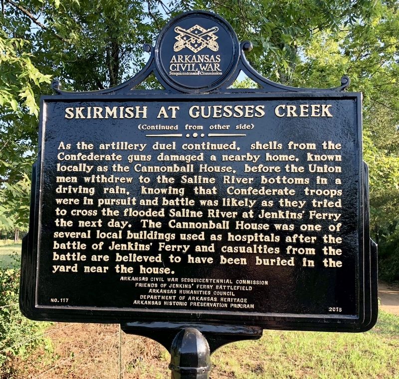
Note the cannon motif on the gate. Site of the Confederate hospital south of Leola that served the Jenkins' Ferry wounded. Local people called it the Cannonball house because it was hit by a cannon shell before the soldiers got into the river bottoms and caught by the Confederates. It was located about 3 to 5 miles south of where most of the fighting occurred.
Credits. This page was last revised on August 5, 2018. It was originally submitted on August 5, 2018, by Mark Hilton of Montgomery, Alabama. This page has been viewed 624 times since then and 45 times this year. Photos: 1, 2, 3. submitted on August 5, 2018, by Mark Hilton of Montgomery, Alabama.

