Grangeville in Idaho County, Idaho — The American West (Mountains)
Nimiipuu Cycle of Life
Photographed by Barry Swackhamer, May 5, 2018
1. Nimiipuu Cycle of Life Marker
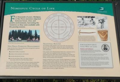
Captions: (upper left) Nez Perce riders at camas feels near Lolo Pass.; (upper right) Nez Perce women gathering root and firewood.; (middle right) The long curved stick of the túuk'es is used for loosening the soil and gently removing the roots, bulbs, and other plants from the ground. This one is made of fire-hardened yew and the handle of bone, however, historically they could also be made from the horns of the bighorn sheep (Ovis canadensis).
The Nimiipuu daily rhythms and cycle of life were attuned to the land. For the Nimiipuu, along with other Columbia River Plateau tribes, the seasons of the year defined major activities and celebrations.
Every activity and cultural practice fitted into a seasonal cycle or round. There was a pattern to this movement. It was a purposeful journey rather than random wandering. Families and bands traveled to their usual and accustomed places for hunting, fishing, and harvesting roots and plants.
Seasons varied from year to year. Activities depended on weather conditions, when plants matured, and when fish ran. The Nimiipuu lived on dried foods through the winter. In spring, they gathered the early plants and roots growing in the low river valleys. As the spring run of the Chinook salmon started, the men began to fish. As the snow melted in the mountains and the early run of salmon ended, bands moved to higher elevations.
this page online
Today, the Nez Perce Tribe provides forest management expertise and woodland fire protection to:
• promote healthy ecosystems
• produce forest products and income
• provide educational services
• serve the Nez Perce Tribe, and other owners of the trust lands within the Nez Perce Reservation.
The Nez Perce Tribal Forestry Program strives to build a reservation environment that is clean, diverse, and rich with wholesome populations of plants, animals, and human beings. In so doing, a resilient, working forest can meet current needs of the Tribe while preserving the land base for future generations.
(side-bar on lower right:)
Hunters and Gatherers
Local food sources were plentiful and varied. Families traveled seasonally to collect food for immediate needs, and to prepare and store for the winter.
Fish, especially salmon, formed a major part of the Nimiipuu diet. Men hunted elk, deer, bear, beaver, game birds and other animals.
Different plants were gathered through the seasons, Roots, such as kouse, camas, bitterroot, and wild carrot, were an important

Photographed by Barry Swackhamer, May 5, 2018
2. Nimiipuu Cycle of Life Marker (detil)
Today the Nez Perce Tribe and their Northwest Tribal partners are leading the effort to preserve and revitalize wild salmon runs of the Columbia River drainage. Root diggers are also taking a proactive role to protect the remaining areas where root foods can still be found.
Topics. This historical marker is listed in these topic lists: Anthropology & Archaeology • Indigenous Peoples and Communities.
Location. 45° 57.348′ N, 115° 59.664′ W. Marker is in Grangeville, Idaho, in Idaho County. It is on Harpster Grade Road (State Highway 13) near State Highway 14, on the right when traveling east. Touch for map. Marker is in this post office area: Grangeville ID 83530, United States of America. Touch for directions.

Regionally, this marker is in North Idaho — Idaho’s Panhandle. It is also in the American Mountain West, specifically in the Pacific Northwest, and in the Lewis & Clark Corridor. Globally, it is in North America, the

Photographed by Barry Swackhamer, May 5, 2018
3. Nimiipuu Cycle of Life Marker
Other nearby markers. At least 8 other markers are within 7 miles of this marker, measured as the crow flies: Elk City Wagon Road (approx. 2.6 miles away); Harpster (approx. 2.6 miles away); Mount Idaho (approx. 5.6 miles away); The ADVANCE Steam Traction Engine (approx. 6.6 miles away); Tolo, Alab-lemot (approx. 6.8 miles away); The Eimers Legacy (approx. 6.8 miles away); Home on the Grange (approx. 6.8 miles away); The Camas Prairie Mammoth (approx. 6.8 miles away). Touch for a list and map of all markers in Grangeville.
Credits. This page was last revised on August 9, 2018. It was originally submitted on August 7, 2018, by Barry Swackhamer of Brentwood, California. This page has been viewed 514 times since then and 78 times this year. Photos: 1, 2, 3. submitted on August 7, 2018, by Barry Swackhamer of Brentwood, California.
