Watervliet in Albany County, New York — The American Northeast (Mid-Atlantic)
Erie Canal
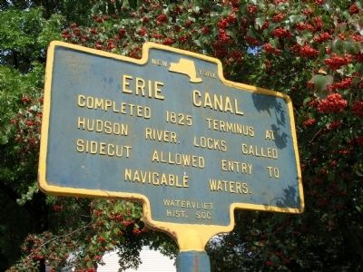
Photographed by Howard C. Ohlhous, October 6, 2008
1. Erie Canal Marker - Watervliet, New York
Erected by Watervliet Historical Society.
Topics and series. This historical marker is listed in these topic lists: Industry & Commerce • Man-Made Features • Notable Places • Waterways & Vessels. In addition, it is included in the Erie Canal series list. A significant historical year for this entry is 1825.
Location. 42° 43.967′ N, 73° 42.065′ W. Marker is in Watervliet, New York, in Albany County. It is at the intersection of 2nd Avenue (New York State Route 32) and 23rd Street, on the right when traveling north on 2nd Avenue. Touch for map. Marker is at or near this postal address: 201 23rd St, Watervliet NY 12189, United States of America. Touch for directions.

Regionally, this marker is in Upstate New York, in the Capital District, and in the Albany Metropolitan Area. It is also in the American Northeast and in the Mid-Atlantic. Globally, it is in North America, the Western Hemisphere, the Western World, and the Anglosphere. Historically, it finds itself in what was once New Netherland and
this page online
Other nearby markers. At least 8 other markers are within walking distance of this marker: Erie Canal Upper Side-Cut (approx. 0.2 miles away); Mayor James F. Cavanaugh (approx. ¼ mile away); United Methodist Church Bell (approx. ¼ mile away); The Weighlock Building (approx. ¼ mile away); Maplewood Historic Park (approx. ¼ mile away); The Nalle Rescue (approx. 0.3 miles away); U.S. Army 3 Inch M5 Antitank Gun (approx. 0.3 miles away); Peter J. Dalessandro (approx. 0.3 miles away). Touch for a list and map of all markers in Watervliet.
Regarding Erie Canal. Construction of the Erie Canal began on July 4th, 1817, and the canal was officially opened on October 26, 1825. It was 363 miles long, from Albany to Buffalo with 83 locks and 18 aqueducts.
The question of where to locate the eastern terminal of the Erie Canal provoked great controversy between the cities of Albany and Troy. The route which was finally selected went from Schenectady to Cohoes and then south along the west bank of the Hudson River to Albany. This plan to have the last stretch of the canal terminate in Albany and thus
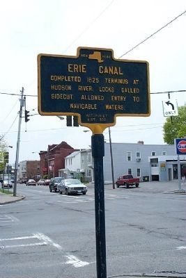
Photographed by Howard C. Ohlhous, April 30, 2004
2. Erie Canal Marker at Second Ave. and Twenty-Third Street
In order to provide equally convenient access to the Erie Canal for Troy commerce and west-bound freight that did not need to stop at the Port of Albany, a short lateral canal was constructed to connect the City of West Troy (now Watervliet) with the tide waters of the Hudson River. This short cut (Side Cut) to the Erie Canal ran about where present day 23rd Street is.
The location of the Erie Canal marker is near the former West Troy Side-cut. The West Troy Side Cut was also known as the "Upper Side cut" since there was also a Lower Side cut located just south of the Watervliet Arsenal. The character of the neighborhoods surrounding these side cuts earned it the nickname of "Barbary Coast of the East" (Buffalo being the "Barbary Coast of the West"). Since the Canalers were paid at the end of their trip they often had money in their pockets and a few days off to go looking for a good time. There were more than 25 saloons within two blocks of the side cut locks. Paddy Ryan, a famous prize fighter, began his boxing career at the side-cut. He worked as a lock
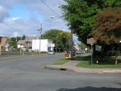
Photographed by Howard C. Ohlhous, October 2, 2008
3. Erie Canal Marker
View is to the North looking along Route 32 in Watervliet, NY.
Source: Amelia T. O'Shea (2006) "Canals of Albany County" Freehold, New York O'Shea ISBN# 1-57256-953-0
Also see . . . Watervliet Side Cut Locks - National Archives. National Register of Historic Places documentation (Submitted on November 21, 2023, by Anton Schwarzmueller of Wilson, New York.)
Additional keywords. Erie Canal Sidecut Side Cut Hudson River West Troy Watervliet
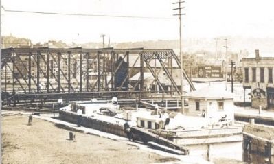
Collection of J. Connor
4. West Troy Side Cut
This old photo post card shows a canal boat in the upper lock of the West Troy Side cut.
New York State Office of Parks Recreation & Historic Preservation, 1970
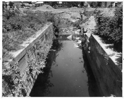
5. Remains of the West Troy Side Cut Locks
This photo was taken of the remains of one of the locks of the West Troy Side Cut in 1970 for documentation that was submitted to nominate the site for National Registger of Historic Places status, which it attained in 1971. These remains were reportedly filled in and covered up for preservation at that time.
Collection of H.C. Ohlhous
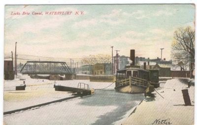
6. West Troy Side Cut Lower Locks
A steam boat spends the winter between the upper and lower locks of the West Troy Side cut. Postcard circ 1907
Credits. This page was last revised on November 21, 2023. It was originally submitted on October 7, 2008, by Howard C. Ohlhous of Duanesburg, New York. This page has been viewed 5,034 times since then and 79 times this year. Photos: 1, 2, 3, 4, 5, 6. submitted on October 7, 2008, by Howard C. Ohlhous of Duanesburg, New York. • Kevin W. was the editor who published this page.
