Cranbury in Middlesex County, New Jersey — The American Northeast (Mid-Atlantic)
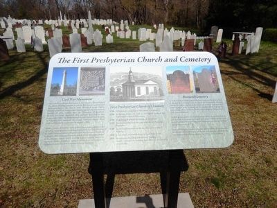
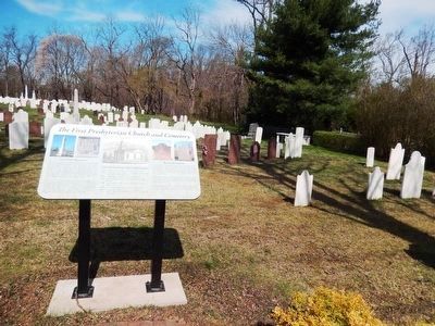
The First Presbyterian Church and Cemetery
American Presbyterian and Reformed Historical Site
Seventy names of soldiers from several New Jersey regiments are carved on the monument, including soldiers from Company H of the NJ 14th Volunteer Infantry Regiment that was formed in Cranbury in August 1862. Company H was the unit in which the largest number of Cranburians served, and it had the larges casualty rate in its regiment. Other Cranbury soldiers enlisted in units such as Company B of the NJ 28th Volunteer Infantry Regiment.
*1740 A Meeting House was built on the highest point of land in the oldest section of this cemetery.
*1750 King George II granted the church a Royal Charter.
*1759 One hundred fifty acres were purchased for the Parsonage Plantation.
*1788 A new church was built on the site of the present church building.
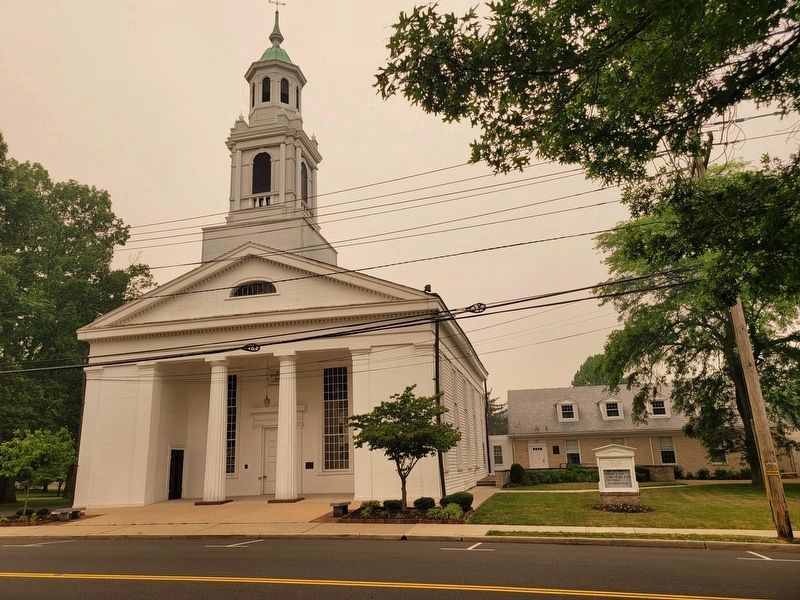
*1839 It was rebuilt, as pictured above, in Greek Revival style.
*1859 An extensive rebuilding, referred to as “building a new church,” enlarged the building from three to five windows on each side.
In 1858, as the need for more cemetery space grew, the western section was laid out in a formal landscaped grid pattern. The cemetery was named for David Brainerd who preached to the local Lenape Indians during the summer of 1745.
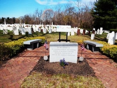
Brainerd Cemetery contains, among its grave markers, the monuments and headstones of pastors of the church, early settlers, and those who served our country during and since the American Revolution. (Marker Number 238.)
Topics and series. This memorial is listed in these topic lists: Cemeteries & Burial Sites • Churches & Religion • War, US Civil • War, US Revolutionary. In addition, it is included in the American Presbyterian and Reformed Historic Sites series list.
Location. 40° 18.479′ N, 74° 31.079′ W. Marker is in Cranbury, New Jersey, in Middlesex County. Memorial is on South Main Street. Touch for map. Marker is in this post office area: Cranbury NJ 08512, United States of America. Touch for directions.
Other nearby markers. At least 8 other markers are within 3 miles of this marker, measured as the crow flies. Cranberry Mills (about 500 feet away, measured in a direct line); Site of Encampment (about 700 feet away); The Cranbury Dam (about 800 feet away); Site of House of Dr. Hezekiah Stites (approx. 0.2 miles away); Parsonage Barn (approx. ¼ mile away); Todd Beamer (approx. 0.4 miles away); The Second Presbyterian Church of Cranbury (approx. half a mile away); Hightstown (approx. 2.6 miles away). Touch for a list and map of all markers in Cranbury.
Regarding The First Presbyterian Church and Cemetery. First Presbyterian Church is a contributing structure within the Cranbury Historic District which was listed in the National Register of Historic Places in 1980. This church is also one of 445 American Presbyterian and Reformed Historical Sites registered between 1973 and 2003 by the Presbyterian Historical Society (PHS), headquartered in Philadelphia. Approved sites received a metal plaque featuring John Calvin’s seal and the site’s registry number (PHS marker location unknown).
The following text is taken from the Presbyterian Historical Society website:
Organized by 1734, the Cranbury congregation built its first meeting house in 1740 in the present cemetery. David Brainerd, noted missionary to Native Americans in nearby Jamesburg during the 1740s, often exchanged pulpits with Charles McKnight, pastor at Cranbury. A building was constructed on the present site in 1788, replaced in 1839 by the present Greek Revival structure designed by Charles Steadman of Princeton. It was enlarged in 1859, remodeled in 1888, and renovated in 1953. A chapel was added in 1878 and enlarged to become the Parish House in 1959. Cranbury became the mother church of six other congregations in the area.
Credits. This page was last revised on June 9, 2023. It was originally submitted on April 12, 2016, by Don Morfe of Baltimore, Maryland. This page has been viewed 561 times since then and 48 times this year. Last updated on August 22, 2018, by Douglass Halvorsen of Klamath Falls, Oregon. Photos: 1, 2, 3. submitted on April 12, 2016, by Don Morfe of Baltimore, Maryland. 4. submitted on June 7, 2023, by Diana Maurer of Ewing, New Jersey. • Bill Pfingsten was the editor who published this page.


