Marker Logo
THE HISTORICAL
MARKER DATABASE
“Bite-Size Bits of Local, National, and Global History”
Dauphin Island in Mobile County, Alabama — The American South (East South Central)
 

Energy from the Sands of Time
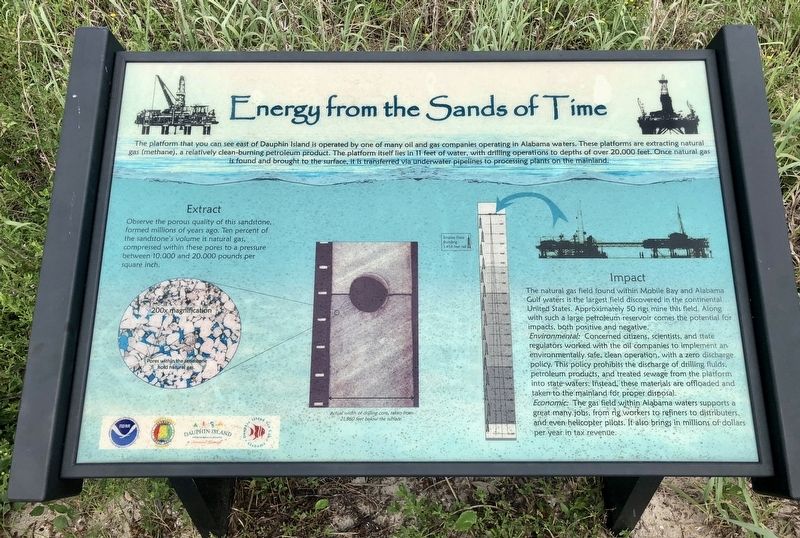
 
 
Energy from the Sands of Time Marker image. Click for full size.
Photographed by Mark Hilton, August 22, 2018
1. Energy from the Sands of Time Marker
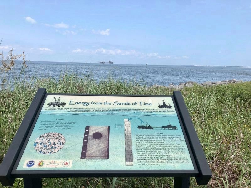
Inscription. The platform that you can see east of Dauphin Island is operated by one of many oil and gas companies operating in Alabama waters. These platforms are extracting natural gas (methane), a relatively clean-burning petroleum product. The platform itself lies in 11 feet of water, with drilling operations to depths of over 20,000 feet. Once natural gas is found and brought to the surface, it is transferred via underwater pipelines to processing plants on the mainland.

Extract
Observe the porous quality of this sandstone, formed millions of years ago. Ten percent of the sandstone's volume is natural gas, compressed within these pores to a pressure between 10.000 and 20.000 pounds per square inch.

Impact
The natural gas field found within Mobile Bay and Alabama Gulf waters is the largest field discovered in the continental United States. Approximately 50 rigs mine this field. Along with such a large petroleum reservoir comes the potential for impacts, both positive and negative.
Environmental: Concerned citizens, scientists, and state regulators worked with the oil companies to implement an environmentally safe, clean operation, with a zero discharge policy. This policy prohibits the discharge of drilling fluids petroleum products, and treated sewage from the platform into state waters. Instead, these materials are offloaded and taken to the mainland for proper disposal.
Economic: The gas field within Alabama waters supports a great many jobs, from rig workers to refiners to distributers, and even helicopter pilots. It also brings in millions of dollars per year in tax revenue.
 
Topics.
Paid Advertisement
Click or scan to see
this page online
This historical marker is listed in these topic lists: EnvironmentNatural ResourcesWaterways & Vessels.
 
Location. 30° 14.993′ N, 88° 4.53′ W. Marker is on Dauphin Island, Alabama, in Mobile County. It is on Bienville Boulevard 0.1 miles east of Albatross Street, on the left when traveling east. Located near Fort Gaines. Touch for map. Marker is at or near this postal address: 51 Bienville Boulevard, Dauphin Island AL 36528, United States of America. Touch for directions.

Regionally, this marker is in Alabama’s Gulf Coast, in Mobile Bay, and in the Mobile Metropolitan Area. It is also in the American South, specifically in the Deep South, and on the Gulf Coast. Globally, it is in North America, a Gulf of Mexico state, the Western Hemisphere, the Western World, and the Anglosphere. Historically, it finds itself in what was once New Spain, the Viceroyalty of New France, the territory of the Mississippian Culture, one of the Confederate States of America, and the Antebellum South.
Other nearby markers. At least 8 other markers are within walking distance
Energy from the Sands of Time Marker with view of two platforms in Mobile Bay. image. Click for full size.
Photographed by Mark Hilton, August 22, 2018
2. Energy from the Sands of Time Marker with view of two platforms in Mobile Bay.
of this marker: Latrine (about 300 feet away, measured in a direct line); Storm Clouds Gather (about 300 feet away); 19th Century Shipwreck (about 400 feet away); "Save Your Garrison." (about 400 feet away); British Occupation of Dauphin Island (about 400 feet away); Fort Gaines (about 500 feet away); Anchor From U.S.S. Hartford (about 600 feet away); "To Be Blown To Kingdom Come" (about 600 feet away). Touch for a list and map of all markers in Dauphin Island.
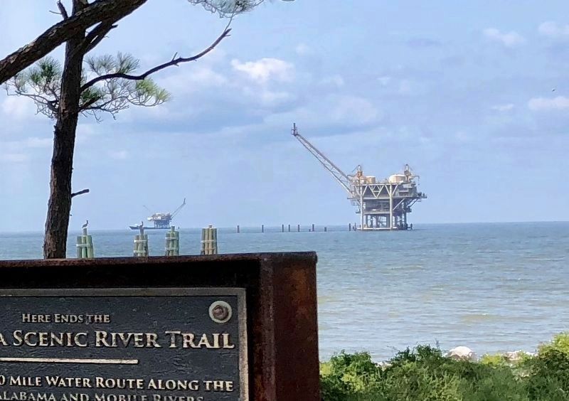
 
View from Fort Morgan of the same platforms as in photo # 2. image. Click for full size.
Photographed by Mark Hilton, August 22, 2018
3. View from Fort Morgan of the same platforms as in photo # 2.
 
 
Credits. This page was last revised on January 10, 2020. It was originally submitted on August 27, 2018, by Mark Hilton of Montgomery, Alabama. This page has been viewed 564 times since then and 25 times this year. Photos:   1, 2, 3. submitted on August 27, 2018, by Mark Hilton of Montgomery, Alabama.

m=122548

CeraNet Cloud Computing sponsors the Historical Marker Database.
This website earns income from purchases you make after using our links to Amazon.com. We appreciate your support.
Paid Advertisement
Jul. 20, 2026