Near Helen in Union County, Georgia — The American South (South Atlantic)
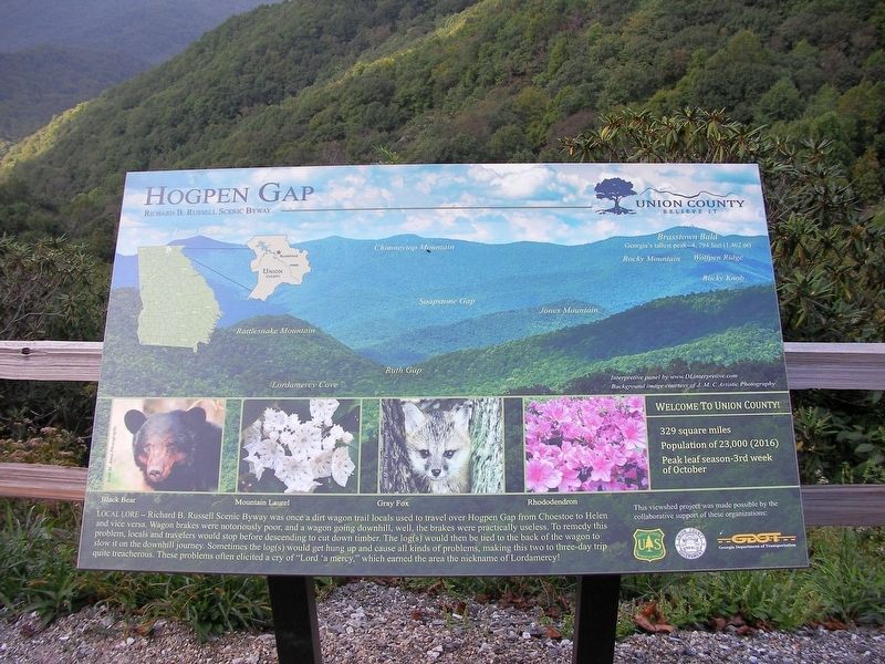
Hogpen Gap
Richard B. Russell Scenic Byway
Local Lore – Richard B. Russell Scenic Byway was once a dirt wagon trail locals used to travel over Hogpen Gap from Choestoe to Helen and vice versa. Wagon brakes were notoriously poor, and a wagon going downhill, well, the brakes were practically useless. To remedy this problem, locals and travelers would stop before descending to cut down timber. The log(s) would then be tied to the back of the wagon to slow it on the downhill journey. Sometimes the log(s) would get hung up and cause all kinds of problems, making this two to three-day trip quite treacherous. These problem often elicited a cry of “Lord ‘a mercy.” Which earned the are the nickname of Lordamercy!
This viewshed project was made possible by the collaborative support of these organizations:
Interpretive panel by www.DLinterpretivecom
Background image courtesy of J.M.C. Artistic Photography
Welcome to Union County!
329 square miles
Population of 23, 000 (2016)
Peak leaf season – 3rd week of October
Erected by USFS, Union County, GDOT.
Topics. This historical marker is listed in these topic lists: Parks & Recreational Areas • Roads & Vehicles • Settlements & Settlers.
Location. 34° 43.558′ N, 83° 50.389′ W. Marker is near Helen, Georgia, in Union County. Marker is on Richard B. Russell Scenic Highway (Georgia Route 348), on the right when traveling north. Touch for map. Marker is in this post office area: Helen GA 30545, United States of America. Touch for directions.
Other nearby markers. At least 8 other markers are within 8 miles of this marker, measured as the crow flies. Blood Mountain (approx. 4˝ miles away); The Appalachian Trail in North Georgia (approx. 4˝ miles away); Byron Herbert Reece (approx. 5˝ miles away); Ronald H. Glaze - The Distinguished Service Cross (approx. 7.1 miles away); The Unicoi Turnpike (approx. 7.9 miles away); Three Families at the Farm (approx. 7.9 miles away); Welcome to Hardman Farm State Historic Site (approx. 7.9 miles away); Welcome to Hardman Farm (approx. 7.9 miles away).
Credits. This page was last revised on November 9, 2018. It was originally submitted on September 23, 2018, by David Tibbs of Resaca, Georgia. This page has been viewed 370 times since then and 27 times this year. Photos: 1. submitted on September 23, 2018, by David Tibbs of Resaca, Georgia. 2. submitted on September 24, 2018, by David Tibbs of Resaca, Georgia. 3. submitted on September 23, 2018, by David Tibbs of Resaca, Georgia. • Bill Pfingsten was the editor who published this page.


