Near Almo in Cassia County, Idaho — The American West (Mountains)
Distant Views
Photographed by Barry Swackhamer, May 14, 2018
1. Distant Views Marker
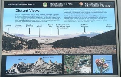
Captions: (panorama at the center, left to right) Greene Mountain, Jim Sage Mountains, Black Pine Mountains, Lower Narrows, Upper Raft River Valley, Strevell Pass, Bear River Mountains of the Wasatch Range (100 miles away), Raft River Mountains, S
The land would also tell of a century past when the pinyon-juniper foothills below were more open, and the herbs and grassed sustained the livestock of emigrants, stage runners, cattle and sheep drives, and sellers. The sagebrush expanse before you was also dry-land farmed through the 1920s.
The hills speak of a northern pinyon pine forest invasion 2,700 years ago into present-day Idaho. Older still are the ancient Albion Mountains on which you stand, uplifted to expose a grant pluton from the most ancient days. This story is best revealed along the 1/4-mile self-guided geology trail that begins at the trailhead behind you. Come, let the land
this page online
Erected by National Park Service, Idaho Department of Parks and Recreation.
Topics and series. This historical marker is listed in these topic lists: Natural Features • Roads & Vehicles. In addition, it is included in the California Trail series list.
Location. 42° 4.422′ N, 113° 41.421′ W. Marker is near Almo, Idaho, in Cassia County. It is on Circle Creek Overlook Road near City of Rocks Road (Highway 3075 S), on the left when traveling west. Touch for map. Marker is in this post office area: Almo ID 83312, United States of America. Touch for directions.

Regionally, this marker is in Idaho’s Magic Valley. It is also in the American Mountain West. Globally, it is in North America, the Western Hemisphere, the Western World, and the Anglosphere.
Other nearby markers. At least 8 other markers are within 4 miles of this marker, measured as the crow flies: Fading Away (within shouting distance of this marker); California Trail -- Silent City of Rocks (approx. ¼ mile away); A Pleasant Place (approx. 0.3 miles away); Pinnacle Pass (approx.
Photographed by Barry Swackhamer, May 14, 2018
2. Distant Views Marker
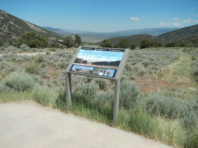
More about this marker. This marker is located at Circle Creek Overlook.
Credits. This page was last revised on September 28, 2018. It was originally submitted on September 28, 2018, by Barry Swackhamer of Brentwood, California. This page has been viewed 389 times since then and 23 times this year. Photos: 1, 2. submitted on September 28, 2018, by Barry Swackhamer of Brentwood, California.
