Accokeek in Prince George's County, Maryland — The American Northeast (Mid-Atlantic)
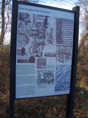
First People of the Potomac
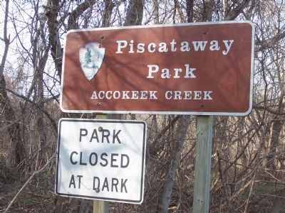
Piscataway Park
Inscription.
When Europeans first arrived on the shores of North America, they found a continent inhabited by perhaps tens of millions of people! These people had arrived more than 10,000 years earlier, and through many generations had created complex societies, formed viable political systems, built monumental structures in the Mississippi River valley, and farmed the land long the Potomac River.
The Piscataway people have lived in southern Maryland for close to a thousand years. Their language and heritage were related to those of over one hundred other tribes spread across the country, indicating an adaptable and productive culture. They farmed this land, growing corn, beans and squash, and they fished in the plentiful waters nearby.
The Piscataway welcomed the English settlers as military allies. However, with the English settlers came new diseases and social upheaval. Attacks by northern tribes—the Susquehannocks and Iroqouis—further reduced the Piscataway from 5,000 people in a confederation of 11 tribes to less than 500 in just one generation. Today, the Piscataway people continue to practice many of the traditions and customs of their ancestors who lived here.
Erected by National Park Sevice, U.S. Department of the Interior.
Topics and series. This historical marker is listed in these topic lists: Cemeteries & Burial Sites • Exploration • Native Americans • Settlements & Settlers. In addition, it is included in the National Historic Landmarks series list.
Location. 38° 40.741′ N, 77° 5.289′ W. Marker is in Accokeek, Maryland, in Prince George's County. Marker can be reached from Accokeek Creek Trail, half a mile north of Bryan Point Road. The Marker is in the Accokeek Creek area of Piscataway National Park (designated a National Historic Landmark, July 19, 1964), approximately 3.25 miles west of the Indian Head Highway (MD 210) along Bryan Point Road. Follow the National Park Service signage toward the National Colonial Farm and look for the sign reading “Piscataway Park, Accokeek Creek” on the right—about half way between Hard Bargain Farm and the the National Colonial Farm. Touch for map. Marker is in this post office area: Accokeek MD 20607, United States of America. Touch for directions.
Other nearby markers. At least 8 other markers are within 2 miles of this marker, measured as the crow flies. Marshall Hall (approx. half a mile away); Piscataway Park (approx. 0.6 miles away); American Milking Devon Cattle
(approx. 1.4 miles away); Hog Island Sheep (approx. 1.4 miles away); Heritage Breeds (approx. 1.4 miles away); Leaf, Land, and People (approx. 1.4 miles away); Science and History Together (approx. 1.4 miles away); The National Colonial Farm (approx. 1.6 miles away). Touch for a list and map of all markers in Accokeek.
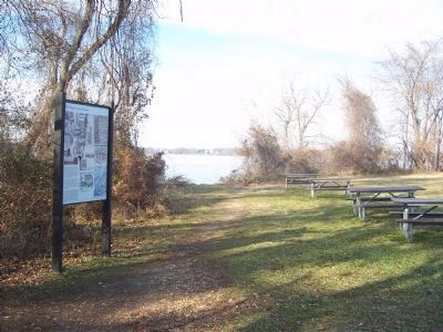
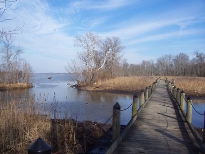
More about this marker. Marker is in a cleared area, a few yards inland from the wooded bank of the Potomac River. It is reached by driving to a parking area approximately 0.2 miles north of Bryan Point Road and then hiking approximately 0.3 miles along a scenic foot trail to the north end of a boardwalk over the Accokeek Creek marsh.
The marker shows illustrations by Theodor de Bry (after drawings of John White) in Thomas Harriot’s “A Briefe and true report of the new found land of Virginia,” (1590 edition):
“Xiii. Their manner of fishynge in Virginia.”
“Xiiii. The brovvyllinge of their fifhe ouer the flame.” (detail)
“XX. The tovyne of Secota.” (detail)
Detail of map produced by John Smith indicates the density
of Native American settlements in the early 17th century.
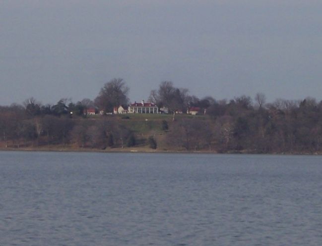
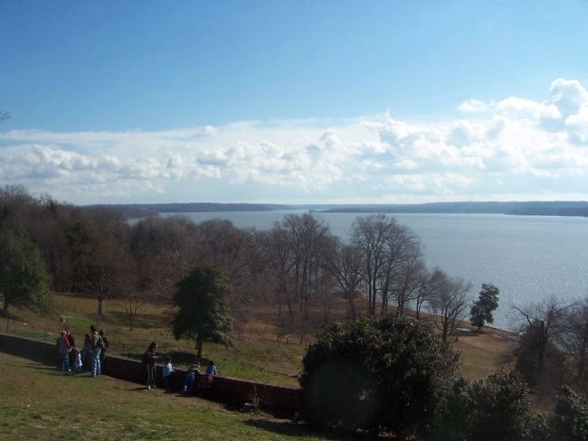
Regarding First People of the Potomac. Piscataway Park was originally established to preserve the pristine view enjoyed by George Washington in the 18th century from his estate at Mount Vernon on the opposite side of the Potomac River. Nevertheless, it was always known that the landscape included the prehistoric Moyaone ossuary near Accokeek Creek and an abundance of other Piscataway cultural artifacts.
The historical record has held that the last few members of the Piscataway nation officially abandoned their Maryland homes around 1695-1700, relocating on their own initiative in a last ditch effort to preserve their sovereignty and way of life in lands to the north that had yet to be encroached upon by the English colonists. It seems clear, however, that a small number of tribespeople either returned soon thereafter or never left southern Maryland at all. As often was the case in other English colonies, the descendants of any such survivors mostly became associated with the larger community’s mixed-race, “free people of color,” remaining isolated in small pockets on the fringes of rural, Anglo-American society for nearly three centuries.
In the mid-20th century a leader emerged who claimed to be the 27th hereditary chief of the Piscataway Nation;
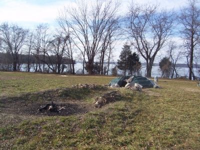
Photographed By Richard E. Miller, January 12, 2008
4. Ceremonial Sweat Lodge near Marker, Piscataway Park.
This traditional structure was adjacent to the Turkey Tayac grave and recently used by contemporary Piscataways. The Mount Vernon estate is located across the Potomac but is blocked from view by Bryan Point in the upper left of the photo.
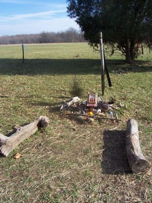
Applications filed by his followers for official recognition as a bona fide American Indian tribe were always rejected by state and national authorities. However, Turkey and his son, Billy Redwing Tayac were supported by other, fully-recognized tribal leaders from around the country in councils of the emerging American Indian Movement during the 1970s; and supportive, mainstream politicians pushed through special legislation after his death in 1978 that authorized Turkey’s re-burial in Piscataway Park — over-riding the strong initial objections of the National Park Service.
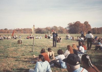
The Tayac grave site is near the “First People of the Potomac” marker; and in recent years this area has been the frequent scene of Native ceremonies and cultural activities (including major, inter-tribal pow-wows) hosted by Maryland Native American organizations.
Also see . . .
1. Piscataway Nation and Tayac Territory.
Website associated with the Tayac family and possibly the best-known of the contemporary Piscataway organization. (Submitted on January 26, 2008, by Richard E. Miller of Oxon Hill, Maryland.)
2. Piscataway Park. National Park Service website. (Submitted on January 26, 2008, by Richard E. Miller of Oxon Hill, Maryland.)
Additional commentary.
1. The Piscataway Nation
The Piscataway Nation relocated to Pennsylvania, it would seem, to preserve their sovereignty and way of life in Pennsylvania lands that were administered under the treaty with William Penn to protect refugee tribes. The Maryland Archives clearly report that a small number of Piscataway returned to the Chaptico Reservation to join surviving members of allied tribes near present-day Port Tobacco. As often was the case in other English colonies, the descendants of any such survivors mostly became associated with and classified by census records as the larger community’s mixed-race, “free people of color,” remaining isolated in small pockets on the rural fringes of Anglo-American society for nearly three centuries. Church documents, as well as anthropological findings, from the 19th century define these descendant families as Indians, and specifically
as having heritage from the Piscataway chiefdom tribes.
By the 1920s a leader named Turkey Tayac emerged who identified as the 27th hereditary chief of the Piscataway Nation. Turkey Tayac, an acclaimed traditional medicine practitioner, proudly asserted his Piscataway name and title over his “Christian” name, Philip S. Proctor. In this and in other ways, he was very much in the advanced guard of early 20th century Indian efforts to reorganize communities on the Atlantic Coast. Chief Tayac was installed by other surviving families as their leader. His family had continued to visit the old village location at Accokeek to gather traditional medicines as well as to pay their respects to ancestors buried in the ossuaries. Other Piscataway families also lived in the vicinity of Accokeek, in locations including Oxon Hill and Indian Head. By the early 1970s, due to the rise of involvement in the broader American Indian Movement, Piscataway Park, where this marker is located, become center stage in the late-century rebirth of Native American identity in general and of Piscataway ethnicity in particular.
— Submitted February 11, 2008, by Gabrielle Tayac of Port Tobacco, Maryland.
Additional keywords. Accokeek, Conoy, Tayac, Piscataway
Credits. This page was last revised on November 6, 2018. It was originally submitted on January 26, 2008, by Richard E. Miller of Oxon Hill, Maryland. This page has been viewed 4,441 times since then and 15 times this year. Last updated on October 7, 2018, by Brian Smith of Waldorf, Maryland. Photos: 1, 2, 3, 4, 5, 6, 7, 8. submitted on January 26, 2008, by Richard E. Miller of Oxon Hill, Maryland. 9. submitted on February 22, 2008, by Richard E. Miller of Oxon Hill, Maryland. • Bill Pfingsten was the editor who published this page.
