
Elena Gallegos Grant in Albuquerque in Bernalillo County, New Mexico — The American Mountains (Southwest)
Doña Elena Gallegos
⎯⎯⎯
Elena Gallegos Land Grant
c. 1680 - c.1731

Photographed by Maribeth Robison, October 13, 2018
1. Doña Elena Gallegos Marker
Doña Elena Gallegos was a daughter of early seventeenth - century Hispanic colonists, Antonio Gallegos and Catalina Baca. They fled New Mexico with their newborn daughter during the 1680 Pueblo Revolt, and she returned in 1693 with two brothers and an uncle. Elena wed Santiago Gurulé, a tattooed Frenchman, born Jacques Grolet, a member of the ill-fated La Salle expedition. Everyone with the Hispanic form of his surname, Gurulé, has roots in New Mexico. After her husband's death in 1711, Captain Diego Montoya conveyed to Elena the vast landholding that has since borne her name.
Elena Gallegos Land Grant. From the crest of the Sandia Mountains to the Rio Grande Valley lies the Elena Gallegos Land Grant. It covered 70,000 acres, approximately the northern half of Albuquerque up to Sandia Pueblo. The extent of the grant—some felt its eastern border was the foothills—was uncertain until a nineteenth-century court interpreted the word “sierra” in the original document as the crest of the mountains. The adjudication helped make it possible to preserve part of the land grant as open space and provide a picnic area for the enjoyment
this page online
Erected by New Mexico Historic Preservation Division.
Topics. This historical marker is listed in these topic lists: Hispanic Americans • Settlements & Settlers • Women. A significant historical year for this entry is 1680.
Location. 35° 9.796′ N, 106° 28.21′ W. Marker is in Albuquerque, New Mexico, in Bernalillo County. It is in Elena Gallegos Grant. It is on Simms Park Road. Touch for map. Marker is in this post office area: Albuquerque NM 87122, United States of America. Touch for directions.

Regionally, this marker is in the American Southwest. Globally, it is in North America, the Western Hemisphere, the Western World, and the Anglosphere. Historically, it finds itself in what was once New Spain and also the Republic of Texas.
Other nearby markers. At least 8 other markers are within 8 miles of this marker, measured as the crow flies: The Green Chair at Santa Fe Ski Basin (approx. 2 miles away); The View from the Top (approx. 3 miles away); Wild at Heart (approx. 3 miles away); Ben and Pat Abruzzo (approx. 3 miles away); Sandia Peak Ski Area (approx. 3 miles away); John B. Robert Dam (approx. 3.1

Photographed by J. Makali Bruton, December 12, 2025
2. Doña Elena Gallegos / Elena Gallegos Land Grant Marker

Photographed by J. Makali Bruton, December 12, 2025
3. Doña Elena Gallegos / Elena Gallegos Land Grant Marker
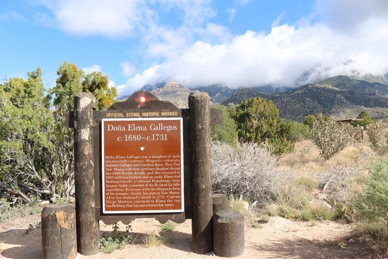
Photographed by Maribeth Robison, October 13, 2018
4. Doña Elena Gallegos Marker
Credits. This page was last revised on December 15, 2025. It was originally submitted on October 15, 2018, by Maribeth Robison of Moriarty, New Mexico. This page has been viewed 4,757 times since then and 265 times this year. Photos: 1. submitted on October 15, 2018, by Maribeth Robison of Moriarty, New Mexico. 2, 3. submitted on December 15, 2025, by J. Makali Bruton of Washington, District of Columbia. 4. submitted on October 15, 2018, by Maribeth Robison of Moriarty, New Mexico. • Andrew Ruppenstein was the editor who published this page.
