Marker Logo HMdb.org THE HISTORICAL
MARKER DATABASE
“Bite-Size Bits of Local, National, and Global History”
Georgesville in Grove City in Franklin County, Ohio — The American Midwest (Great Lakes)
 

Big Darby and Little Darby Creeks

A Feature of Ohio’s Scenic Rivers


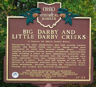
Big Darby and Little Darby Creeks Marker image. Click for full size.
Photographed By William Fischer, Jr., October 14, 2008
1. Big Darby and Little Darby Creeks Marker
Inscription. Recognized for their biodiversity and high quality aquatic habitat, Big Darby Creek and Little Darby Creek were designated as state and national scenic rivers. These riparian ecosystems provide modern recreational opportunities while allowing a sense of their appearance centuries ago. Nearby Indian mounds indicate that the Darby creeks have been important food and transportation resources for thousands of years. More than 100 species of fish and 40 species of freshwater mollusks have been recorded within these watersheds. Several, including the indigenous Scioto Madtom, are locally and federally endangered.
 
Erected 2003 by The Ohio Bicentennial Commission, Ohio Department of Natural Resources, The International Paper Company Foundation, and The Ohio Historical Society. (Marker Number 47-25.)
 
Topics and series. This historical marker is listed in these topic lists: Native AmericansNatural FeaturesNatural ResourcesWaterways & Vessels. In addition, it is included in the Ohio Historical Society / The Ohio History Connection series list.
 
Location. 39° 53.669′ N, 83° 12.989′ W. Marker is in Grove City, Ohio, in Franklin County. It is in Georgesville. Marker is
Paid Advertisement
Click on the ad for more information.
Please report objectionable advertising to the Editor.
Click or scan to see
this page online
at the intersection of Alkire Road and Gardner Road (County Route 281), on the left when traveling west on Alkire Road. Marker is near creek at canoe access dropoff. Touch for map. Marker is in this post office area: Grove City OH 43123, United States of America. Touch for directions.
 
Other nearby markers. At least 8 other markers are within 2 miles of this marker, measured as the crow flies. Ice Over Ohio (approx. 0.4 miles away); Big Darby Creek (approx. 0.4 miles away); A Valley Is Born (approx. half a mile away); A Valley is Born (approx. 0.8 miles away); The Voss Site (approx. one mile away); Stories in the Sediments (approx. 1.3 miles away); The Glaciers Did It (approx. 1.3 miles away); Back to the Same Old Grind (approx. 1.3 miles away).
 
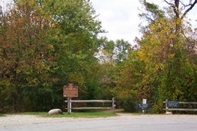
Big Darby and Little Darby Creeks Marker at Canoe Access image. Click for full size.
Photographed By William Fischer, Jr., October 14, 2008
2. Big Darby and Little Darby Creeks Marker at Canoe Access
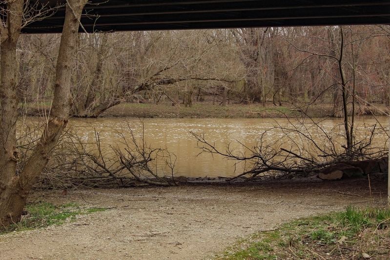
View of Big Darby and Little Darby Creeks from the marker spot. image. Click for full size.
Photographed By Alex Krempasky, April 2, 2023
3. View of Big Darby and Little Darby Creeks from the marker spot.
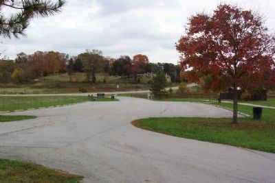
View East From Big Darby and Little Darby Creeks Marker image. Click for full size.
Photographed By William Fischer, Jr., October 14, 2008
4. View East From Big Darby and Little Darby Creeks Marker
Oak Grove Cemetery is on hill at distant center.
 
 
Credits. This page was last revised on June 16, 2023. It was originally submitted on October 15, 2008, by William Fischer, Jr. of Scranton, Pennsylvania. This page has been viewed 1,248 times since then and 33 times this year. Photos:   1, 2. submitted on October 15, 2008, by William Fischer, Jr. of Scranton, Pennsylvania.   3. submitted on May 14, 2023, by Alex Krempasky of Obetz, Ohio.   4. submitted on October 15, 2008, by William Fischer, Jr. of Scranton, Pennsylvania. • Craig Swain was the editor who published this page.
Share this page.  
Share on Tumblr
m=12514

CeraNet Cloud Computing sponsors the Historical Marker Database.
This website earns income from purchases you make after using our links to Amazon.com. We appreciate your support.
Paid Advertisement
May. 5, 2024