North Sandwich near Waterville Valley in Grafton County, New Hampshire — The American Northeast (New England)
How Sabbaday Falls Got Its Name
Photographed by Cosmos Mariner, July 24, 2008
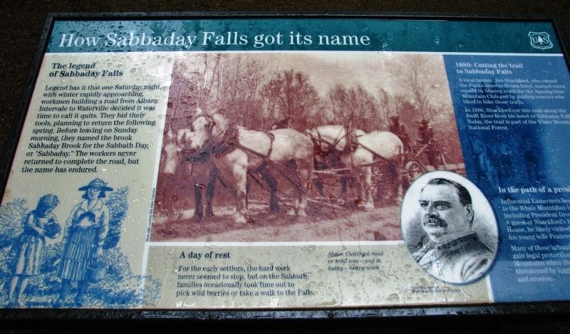
1. How Sabbaday Falls Got Its Name Marker
The legend of Sabbaday Falls
Legend has it that one Saturday night, with winter rapidly approaching, workmen building a road from Albany Intervale to Waterville decided it was time to call it quits. They hid their tools, planning to return the following spring. Before leaving on Sunday morning, they named the brook Sabbaday Brook for the Sabbath Day or “Sabbaday.” The workers never returned to complete the road, but the name has endured.
A day of rest
For the early settlers, the hard work never seemed to stop, but on the Sabbath, families occasionally took time out to pick wild berries or take a walk to the to the Falls.
1880: Cutting the trail to Sabadday Falls
A local farmer, Jim Shackford, who owned the Passaconaway House hotel, earned extra money by blazing trails for the Appalachian Mountain Club and by guiding tourists who liked to hike those trails.
In 1880, Shackford cut this trail along the Swift River from his hotel to Sabbaday Falls. Today, the trail is part of the White Mountain National Forest.
In the path of a president
Influential Easterners began traveling to the White Mountains in the
this page online
Many of those urbanite visitors united to gain legal protection for the White Mountains when the forests were threatened by logging interests and erosion.
Erected by Forest Service, United States Department of Agriculture.
Topics and series. This historical marker is listed in these topic lists: Environment • Natural Features • Parks & Recreational Areas. In addition, it is included in the Former U.S. Presidents: #22 and #24 Grover Cleveland series list.
Location. 43° 59.833′ N, 71° 23.583′ W. Marker is near Waterville Valley, New Hampshire, in Grafton County. It is in North Sandwich. It can be reached from Kancamagus Highway (State Highway 112) 20 miles east of Daniel Webster Highway (U.S. 3), on the right when traveling east. Marker is located on the south side of the highway, at the Sabbaday Falls Trailhead. Touch for map. Marker is in this post office area: Waterville Valley NH 03215, United States of
Photographed by Cosmos Mariner, July 24, 2008
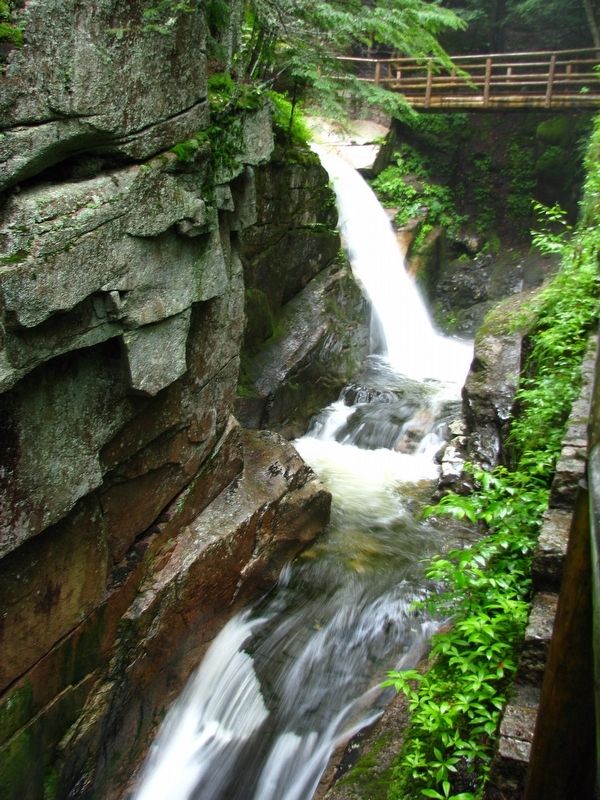
2. Sabbaday Falls (on trail beyond marker)

Regionally, this marker is in the White Mountains. It is also in the American Northeast and in New England. Globally, it is in North America, the Great North Woods, the Western Hemisphere, the Western World, and the Anglosphere. Historically, it finds itself in what was once one of the original Thirteen Colonies.
Other nearby markers. At least 8 other markers are within 8 miles of this marker, measured as the crow flies: By Foot and Horseback, Stagecoach and Car (a few steps from this marker); Rocky Gorge: a favorite stop since the Civil War (approx. 5.8 miles away); Crawford Notch Road (approx. 6.3 miles away); Sawyer's Rock (approx. 6.3 miles away); Chinook Kennels (approx. 6.9 miles away); Lower Falls (approx. 7½ miles away); Cart Roads and Wagon Paths Connect a Community (approx. 7.6 miles away); How the Covered Bridge was Built (approx. 7.6 miles away).
More about this marker. This marker is a large composite plaque mounted horizontally on waist-high posts.
Regarding How Sabbaday Falls Got Its Name. The falls were originally named Churches Falls by Moses Sweetser in honor of
Photographed by Cosmos Mariner, July 24, 2008
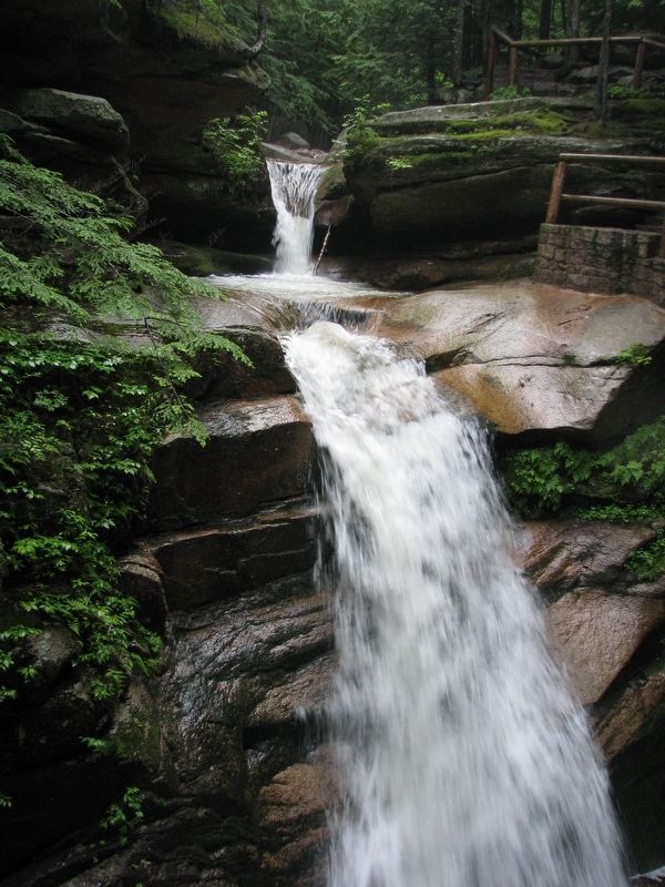
3. Sabbaday Falls (on trail beyond marker)
Also see . . . Sabbaday Falls: Kancamagus Waterfalls HN. Kancamagus Highway entry (Submitted on February 11, 2021, by Larry Gertner of New York, New York.)
Photographed by Cosmos Mariner, July 24, 2008
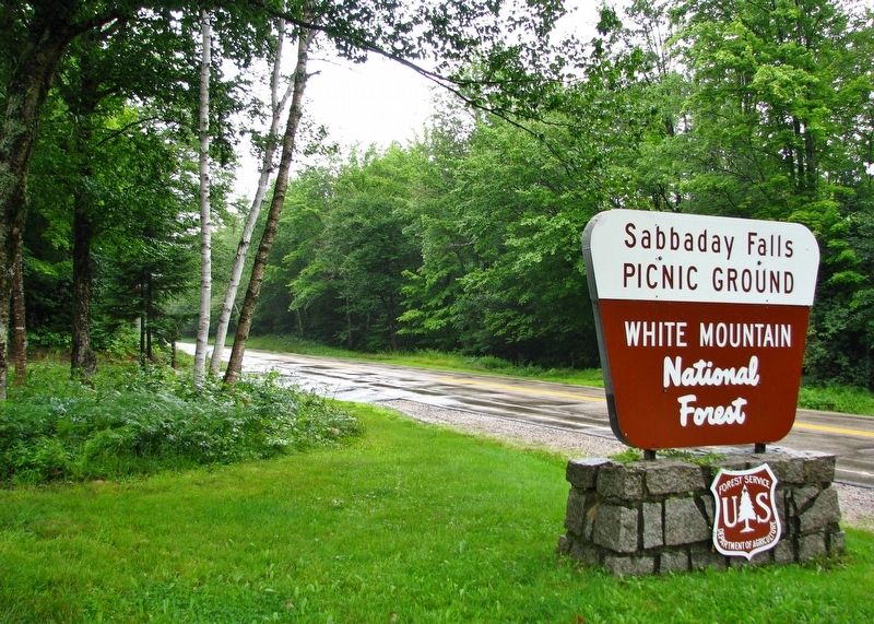
4. Sabbaday Falls Sign (turn here to access the trailhead parking lot and marker)
Credits. This page was last revised on July 8, 2025. It was originally submitted on October 18, 2018, by Cosmos Mariner of Cape Canaveral, Florida. This page has been viewed 1,980 times since then and 87 times this year. Last updated on October 20, 2018, by Cosmos Mariner of Cape Canaveral, Florida. Photos: 1, 2, 3, 4. submitted on October 19, 2018, by Cosmos Mariner of Cape Canaveral, Florida. • Andrew Ruppenstein was the editor who published this page.
