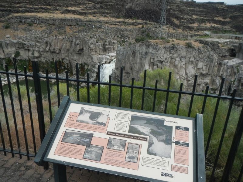
Near Kimberly in Twin Falls County, Idaho — The American West (Mountains)
History Through the Eyes of a Camera
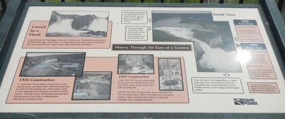
(This marker is composed of photographs and the captions associated with them.)
(top left)
Carved by a Flood
Lake Bonneville, the bigger ancestor of Salt Lake, flooded this area about 15,000 years ago. Twin Falls, so named because of the pair of cataracts than once poured over these rocks, was formed by that flood.
(bottom left)
1935 Construction
In 1935 Idaho Power began construction on the original dams and power plant. Because there was no road into the building site, crews used a "skip" to haul equipment and supplies into and out of the canyon. The skip was an electrically powered deck that traveled up and down a well-greased, 260-foot-long wooden ramp.
(bottom center)
1995 Construction
(top photo) The new power plant on the floor of the Snake River below Twin Falls. Large cranes were used at the building site.
(right photo) The generator rotor is lowered into the new power plant. When the water turns the plant's turbine, it also turns this rotor which provides the magnetic field, creating electricity.
(upper right)
Aerial View
Twin Falls Reservoir is a great place to boat, swim and fish. Have a picnic in the park and enjoy the beautiful canyon.
The arch dam is 789 feet long. It was built in 1935 along with the non-overflow dam and powerhouse.
1935 Power Plant
* generates 9 megawatts
* used when water flows are 100 to 1,000 cfs (cfs - cubic feet per second)
* built in one year
* uses a Francis turbine
1995 Power Plant
* generates 43.5 megawatts
*used when water flows are 1,000 to 4,000 cfs (both plants used at the same time for flows above 4,000 cfs)
* built in two years
* uses a Kaplan turbine with blades that change pitch for the best efficiency at varied water flows
The two power plants are capable of generating enough power to provide electricity for approximately 31,900 homes.
Erected by Idaho Power.
Topics. This historical marker is listed in these topic lists: Arts, Letters, Music • Industry & Commerce • Natural Features • Waterways & Vessels. A significant historical year for this entry is 1935.
Location. 42° 35.328′ N, 114° 21.45′ W. Marker is near Kimberly, Idaho, in Twin Falls County. Marker is on Twin Falls Grade near 4050 North Road, on the right when traveling north. Touch for map. Marker is at or near this postal address: 3593 Twin Falls Grade, Kimberly ID 83341, United States of America. Touch for directions.
Other nearby markers. At least 8 other markers are within 4 miles of this marker, measured as the crow flies. Before there were potatoes, there was GOLD (here, next to this marker); Snake River Canyon Gold Rush (within shouting distance of this marker); Shoshone Falls (approx. 2.3 miles away); a different marker also named Shoshone Falls (approx. 2.3 miles away); Clarence Bisbee (approx. 2.3 miles away); a different marker also named Shoshone Falls (approx. 2.3 miles away); Shoshone Falls Project (approx. 2.4 miles away); The Desert Bloomed (approx. 3.3 miles away). Touch for a list and map of all markers in Kimberly.
More about this marker. This marker is found at the overlook of the Twin Falls Power Plant.
Credits. This page was last revised on August 25, 2020. It was originally submitted on October 28, 2018, by Barry Swackhamer of Brentwood, California. This page has been viewed 283 times since then and 27 times this year. Photos: 1, 2. submitted on October 28, 2018, by Barry Swackhamer of Brentwood, California.

