Ninety Six in Greenwood County, South Carolina — The American South (South Atlantic)
The Rifle Tower
June 13, 1781
Photographed by Brian Scott, May 13, 2010
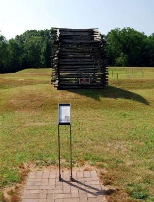
1. Current The Rifle Tower Marker and Reconstructed Tower
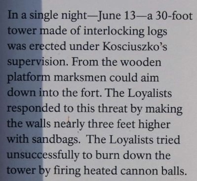
In a single night -- June 13 -- a 30-foot tower made of interlocking logs was erected under Kosciuszko's supervision. From the wooden platform marksmen could aim down into the fort. The Loyalists responded to this threat by making the walls nearly three feet higher with sandbags. The Loyalists tried unsuccessfully to burn down the tower by firing heated cannon balls.
Erected 2009 by National Park Service.
Topics. This historical marker is listed in these topic lists: Colonial Era • Forts and Castles • Man-Made Features • War, US Revolutionary.
Location. 34° 8.793′ N, 82° 1.137′ W. Marker is in Ninety Six, South Carolina, in Greenwood County. It can be reached from South Cambridge Street. Marker is on the grounds of Ninety Six Historic Park, battlefield. Touch for map. Marker is in this post office area: Ninety Six SC 29666, United States of America. Touch for directions.

Regionally, this marker is in Upstate. It is also in the American South and specifically in the Deep South. Globally, it is in North America, the Western Hemisphere, the Western
this page online
Other nearby markers. At least 8 other markers are within walking distance of this marker: The Mine (within shouting distance of this marker); Second Approach Trench (within shouting distance of this marker); Second Parallel (within shouting distance of this marker); The Attack (within shouting distance of this marker); The Forlorn Hope (within shouting distance of this marker); Approach Trench (within shouting distance of this marker); The Star Fort (about 300 feet away, measured in a direct line); The Well (about 300 feet away). Touch for a list and map of all markers in Ninety Six.
More about this marker. Marker shown in Photo 1 is the current version of the marker.
Also see . . . Ninety Six National Historic Site. Here settlers struggled against the harsh backcountry to survive, Cherokee Indians hunted and fought to keep their land, two towns and a trading post were formed and abandoned
Photographed by Brian Scott, May 13, 2010
2. Current The Rifle Tower Marker
Photographed by Brian Scott, September 5, 2008
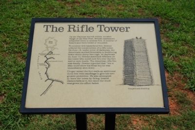
3. Previous The Rifle Tower Marker
As the Patriots moved within musket range of the Star Fort, British marksmen subjected them to intense fire. A number of Americans were killed or wounded.
To counter this hazardous fire, Greene ordered the construction of a rifle tower. On June 13, under cover of darkness, the Americans worked feverishly to build a log tower about thirty feet high. At daybreak on June 14, Greene stationed riflemen on the tower who could now fire over the fort wall at men inside. The American rifle fire was deadly. Greene reported that "not a Man could show his Head but he was immediately shot down..."
Cruger raised the fort walls an additional three feet with sandbags to give his men greater protection. He also attempted to burn the tower by firing heated cannonballs at it, but since the wood was green the effort failed.
To counter this hazardous fire, Greene ordered the construction of a rifle tower. On June 13, under cover of darkness, the Americans worked feverishly to build a log tower about thirty feet high. At daybreak on June 14, Greene stationed riflemen on the tower who could now fire over the fort wall at men inside. The American rifle fire was deadly. Greene reported that "not a Man could show his Head but he was immediately shot down..."
Cruger raised the fort walls an additional three feet with sandbags to give his men greater protection. He also attempted to burn the tower by firing heated cannonballs at it, but since the wood was green the effort failed.
Photographed by Brian Scott, May 13, 2010
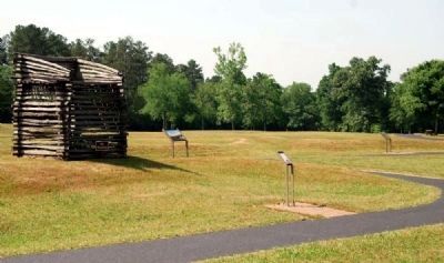
4. Current Marker and Rifle Tower Reconstruction
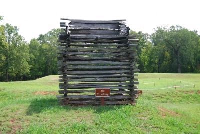
Photographed by Brian Scott, September 5, 2008
5. Reconstructed Rifle Tower, Facing East
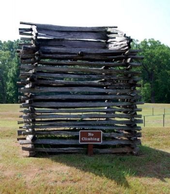
Photographed by Brian Scott, May 13, 2010
6. Reconstructed Rifle Tower
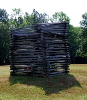
Photographed by Brian Scott, May 13, 2010
7. Reconstructed Rifle Tower
Credits. This page was last revised on November 2, 2018. It was originally submitted on September 8, 2008, by Brian Scott of Anderson, South Carolina. This page has been viewed 1,376 times since then and 23 times this year. Last updated on October 30, 2018, by Bruce Guthrie of Silver Spring, Maryland. Photos: 1, 2. submitted on July 12, 2010, by Brian Scott of Anderson, South Carolina. 3. submitted on September 8, 2008, by Brian Scott of Anderson, South Carolina. 4. submitted on July 12, 2010, by Brian Scott of Anderson, South Carolina. 5. submitted on September 8, 2008, by Brian Scott of Anderson, South Carolina. 6, 7. submitted on July 12, 2010, by Brian Scott of Anderson, South Carolina. • Andrew Ruppenstein was the editor who published this page.
