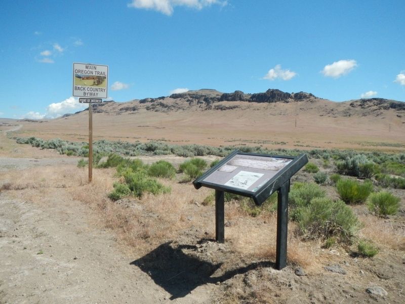
Near Mountain Home in Elmore County, Idaho — The American West (Mountains)
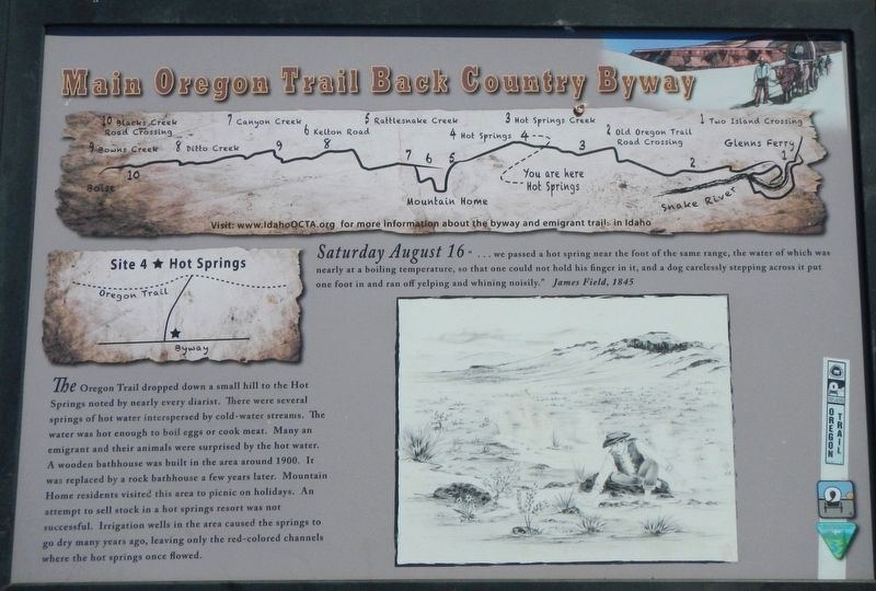
Site 4 ★ Hot Springs
Main Oregon Trail Back County Byway
Inscription.
Saturday August 16 "...we passed a hot springs near the foot of the same range, the water of which was nearly at a boiling temperature, so that one could not hold is finger in it, and a dog careless stepping across it put one foot in and ran off yelping and whining noisily." James Field, 1845
The Oregon Trail dropped down a small hill to the Hot Springs noted by nearly every diarist. There were several springs of hot water interspersed by cold-water streams. The water was hot enough to boil eggs or cook meat. Many an emigrant and their animals were surprised by the hot water. A wooden bathhouse was built in the area around 1900. It was replaced by a rock bathhouse a few years later. Mountain Home residents visited this area to picnic on holidays. An attempt to sell stock in a hot springs resort was not successful. Irrigation wells in the area caused the springs to go dry many years ago, leaving only the red-colored channels where the hot sprigs once flowed.
Erected by Bureau of Land Management; Oregon-California Trails Association, Idaho Chapter. (Marker Number 4.)
Topics and series. This historical marker is listed in these topic lists: Natural Features • Roads & Vehicles • Settlements & Settlers. In addition, it is included in the Oregon Trail series list. A significant historical date for this entry is August 16, 1845.
Location. 43° 9.228′ N, 115° 31.356′ W. Marker is near Mountain Home, Idaho, in Elmore County. Marker is on Northeast Teapot Road near Worth Lee Road, on the right when traveling west. Touch for map. Marker is in this post office area: Mountain Home ID 83647, United States of America. Touch for directions.
Other nearby markers. At least 8 other markers are within 9 miles of this marker, measured as the crow flies. Site 3 ★ Hot Springs Creek (approx. 2.6 miles away); Oregon Trail 1864 (approx. 3˝ miles away); Site 5 ★ Rattlesnake Creek (approx. 6.9 miles away); Rattlesnake Station (approx. 6.9 miles away); Mountain Home Irrigation District (approx. 7.2 miles away); Toll Gate (approx. 7.3 miles away); Site 6 ★ Kelton Road (approx. 8.8 miles away); Mountain Home Arrives in a 50-pound Soapbox (approx. 8.9 miles away). Touch for a list and map of all markers in Mountain Home.
More about this marker. Should anyone wish to follow this portion of the Oregon Trail, I suggest they obtain a copy of the Main Oregon Trail Back Country Byway brochure by the BLM and OCTA. It is generally available at local visitors centers.
Credits. This page was last revised on November 1, 2018. It was originally submitted on November 1, 2018, by Barry Swackhamer of Brentwood, California. This page has been viewed 309 times since then and 38 times this year. Photos: 1, 2. submitted on November 1, 2018, by Barry Swackhamer of Brentwood, California.

