
Croton-on-Hudson in Westchester County, New York — The American Northeast (Mid-Atlantic)
Treaty Oak Site
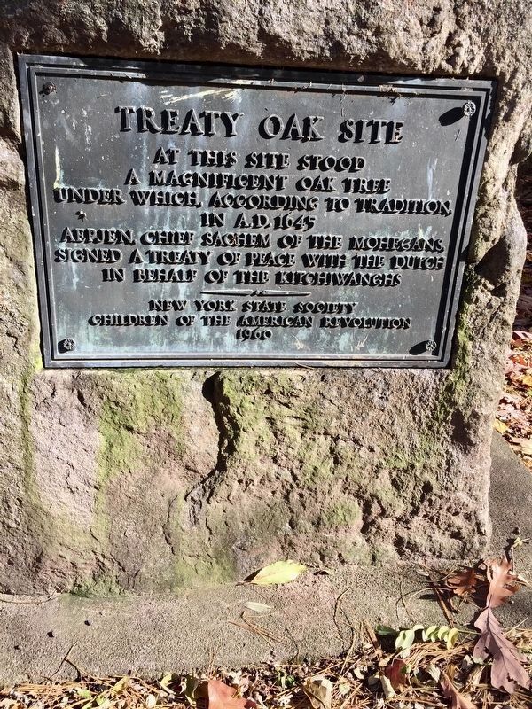
November 10, 2018
1. Treaty Oak Site Marker
Erected 1960 by New York State Society Children of the American Revolution.
Topics. This historical marker is listed in these topic lists: Colonial Era • Indigenous Peoples and Communities • Peace • Settlements & Settlers. A significant historical year for this entry is 1645.
Location. 41° 10.754′ N, 73° 53.671′ W. Marker is in Croton-on-Hudson, New York, in Westchester County. It is on Croton Point Park. By entrance to campground area. Touch for map. Marker is in this post office area: Croton on Hudson NY 10520, United States of America. Touch for directions.

Regionally, this marker is in the Hudson Valley and in the New York City Metropolitan Area. It is also in the American Northeast, in the Mid-Atlantic, and on the Eastern Seaboard. Globally, it is in the North Atlantic Region, North America, the Western Hemisphere, the Western World, and the Anglosphere. Historically, it finds itself in what
this page online
Other nearby markers. At least 8 other markers are within 2 miles of this marker, measured as the crow flies: Commemorating the Defense of Teller's Point (approx. half a mile away); COVID-19 Grove (approx. 1.9 miles away); Dale Cemetery (approx. 2 miles away); The Superintendent's Cottage (approx. 2 miles away); Sing Sing Marble (approx. 2 miles away); The Double Arch / El Doble Arco (approx. 2 miles away); Lower Main Street Ossining / Ossining de la Calle Lower Main (approx. 2 miles away); Bella Vista and the Secor Road Stone Wall / Bella Vista y la Pared de Piedra de Secor Road (approx. 2 miles away). Touch for a list and map of all markers in Croton-on-Hudson.
Credits. This page was last revised on November 16, 2018. It was originally submitted on November 13, 2018. This page has been viewed 735 times since then and 24 times this year. Photo 1. submitted on November 13, 2018. • Bill Pfingsten was the editor who published this page.
