Gainesville in Alachua County, Florida — The American South (South Atlantic)
A Cattle Economy
Five Centuries of Ranching on the Prairie
Hacienda de la Chua
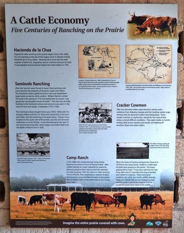
Organized cattle ranching at the prairie began here in the 1600s. You are standing at the site of the largest ranch in Spanish Florida, Hacienda de Ia Chua (right). Hacienda de la Chua was the main supplier of beef to St. Augustine, and an unknown amount to Cuba. It was attacked and burned by English-led Creek Indians in 1705.
Seminole Ranching
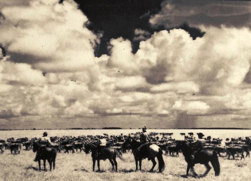
After the Spanish were forced to leave, free-roaming scrub cows became the property of whoever could catch them. The Seminole Indians gathered these cows and established large herds envied by white settlers. William Bartram visited this area in the spring of 1774 and stated that the prairie “was grazed by innumerable droves of cattle.” The vital role of cattle herding to the Seminole culture and economy was seen in the name of one local leader, Cowkeeper (1710-1783).
The Seminole Indians fought three wars (1818-1858) with the Georgia militias and the U.S. Army over ownership of the land and cattle, and the harboring of escaped slaves. Paynes Town, located on the south side of the prairie, was the last Seminole settlement in north Florida. It was abandoned by the start of the Second Seminole War, which began near Bolen Bluff with the Battle of Black Point in 1835.
Cracker Cowmen
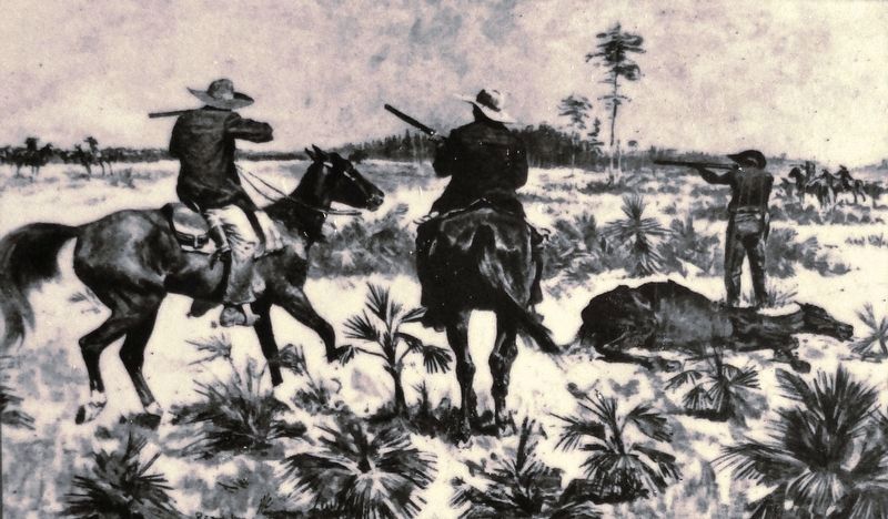
After the Seminole Indians were forced to retreat south, cattlemen from Alabama, Georgia and the Carolinas seized range territory that the Seminole Indians had relinquished. These cracker cowmen or cowhunters, named for the crack of their whips, survived difficult conditions. They spent weeks or months driving cattle across marshes and woods, and fighting off panthers, bears and cattle rustlers.
Camp Ranch
In the 1890s, the entrepreneurial Camp Family became the owners of most of Paynes Prairie. After a failed attempt to create hydroelectric power by damming Alachua Sink, they turned their attention to cattle ranching. With the intent to make ranching more profitable, they established a network of dikes and canals to control the flow of water on the prairie. Each of today's trails in the prairie basin is on a Camp Ranch dike.
When the State of Florida purchased the Preserve in 1970 from the Camp family, 10,000 to 15,000 head of cattle were grazing on the prairie. This heavy grazing left its mark—it has been said that the only thing taller than 6” had either four legs or barbed wire nailed to it (above). These were good conditions for cattle, but not for wildlife diversity. Today, the Florida Park Service manages a small herd of cracker cattle at the Preserve, and has turned the prairie basin back to the wildlife.
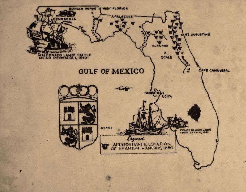
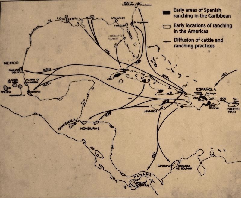
2. Marker detail: Location of Spanish Ranchos, 1680
Hacienda de la Chua at Paynes Prairie and other cattle ranches in North Florida provided hides, tallow, and sun-dried beef for the Spanish garrison in St. Augustine and for export. Source: Florida Cowman, A History of Florida Cattle Raising, by Joe A. Akerman
Erected by Alachua County Board of County Commissioners, Alachua County Tourist Development Council, and Friends of Paynes Prairie, Inc.
Topics. This historical marker is listed in these topic lists: Agriculture • Native Americans • Settlements & Settlers • Wars, US Indian. A significant historical year for this entry is 1705.
Location. 29° 36.45′ N, 82° 18.197′ W. Marker is in Gainesville, Florida, in Alachua County. Marker can be reached from Southeast 15th Street (Camp Ranch Road), 0.4 miles south of Southeast 41st Avenue when traveling south. Marker is located on the La Chua Trail, in Paynes Prairie Preserve State Park, 1/4 mile south (by foot only) of the La Chua Trailhead. Touch for map. Marker is at or near this postal address: 4270 Southeast 15th Street, Gainesville FL 32641, United States of America. Touch for directions.
Other nearby markers. At least 8 other markers are within 3 miles of this marker, measured as the crow flies. Living Links to Florida's Past (a few steps from this marker); Alachua Sink (about 300 feet away, measured in a direct line); Trains Rumbled Overhead (about 400 feet away); Gainesville’s Only Artesian Spring
(approx. 0.9 miles away); Boulware Springs Water Works Building (approx. one mile away); Jesse Johnson Finley (approx. 1.6 miles away); Evergreen Cemetery (approx. 1.8 miles away); Serenola Plantation (approx. 2.4 miles away). Touch for a list and map of all markers in Gainesville.
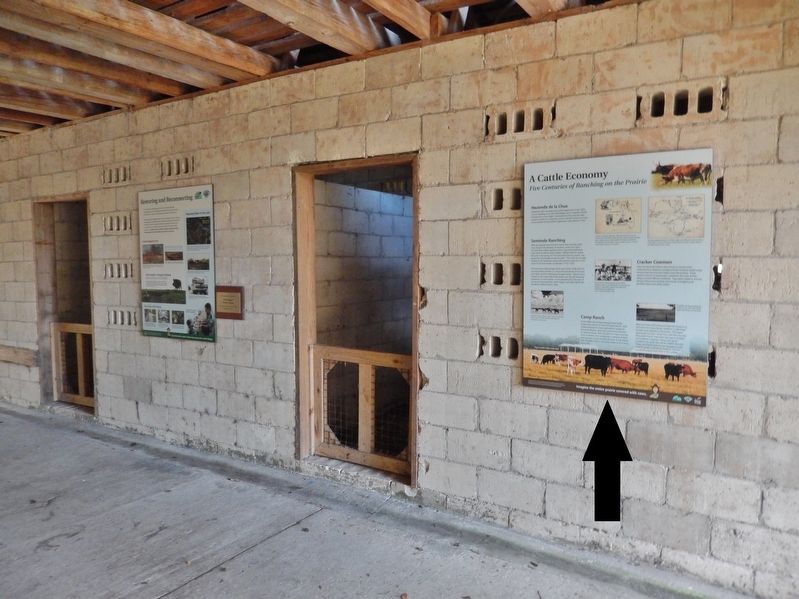
More about this marker. This marker is a large composite plaque, mounted on the old horse barn outside wall, alongside the La Chua Trail.
Credits. This page was last revised on November 21, 2018. It was originally submitted on November 18, 2018, by Cosmos Mariner of Cape Canaveral, Florida. This page has been viewed 547 times since then and 107 times this year. Photos: 1, 2, 3, 4, 5, 6. submitted on November 18, 2018, by Cosmos Mariner of Cape Canaveral, Florida. • Andrew Ruppenstein was the editor who published this page.
