Near Dunnellon in Marion County, Florida — The American South (South Atlantic)
Rest for the Weary
Florida De Soto Trail
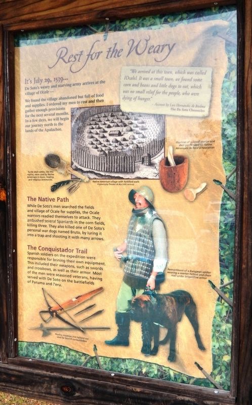
— July 29, 1539 —
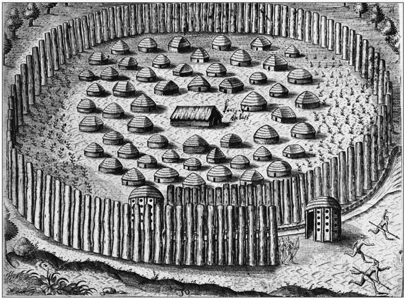
De Soto’s weary and starving army arrives at the village of Ocale -
We found the village abandoned but full of food and supplies. I ordered my men to rest and then gather enough provisions for the next several months. In a few days, we will begin our journey north to the lands of the Apalachee.
”We arrived at this town, which was called [Ocale]. It was a small town; we found some corn and beans and little dogs to eat, which was no small relief for the people, who were dying of hunger.”
- Account by Luis Hernández de Biedma
The De Soto Chronicles
The Native Path
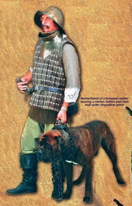
While De Soto’s men searched the fields and village of Ocale for supplies, the Ocale warriors readied themselves to attack. They ambushed several Spaniards in the cornfields, killing three. They also killed one of De Soto’s personal war dogs named Bruto, by luring it into a trap and shooting it with many arrows.
The Conquistador Trail
Spanish soldiers on the expedition were responsible for bringing their own equipment. This included their weapons, such as swords and crossbows, as well as their armor. Most of the men were seasoned veterans, having served with De Soto on the battlefields of Panama and Peru.
Erected by Florida De Soto Trail, Florida Department of Transportation, the Florida Park Service, and the National Park Service. (Marker Number 16.)
Topics. This historical marker is listed in these topic lists: Colonial Era • Exploration • Native Americans • Notable Events. A significant historical date for this entry is July 29, 1539.
Location. 29° 2.293′ N, 82° 17.78′ W. Marker is near Dunnellon, Florida, in Marion County. Marker can be reached from State Road 200, 1½ miles south of County Road 484, on the left when traveling south. Marker is located at the north end of the Marjorie Harris Carr Cross Florida Greenway Ross Prairie Trailhead main parking lot. Touch for map. Marker is at or near this postal address: 10660 SW State Road 200, Dunnellon FL 34432, United States of America. Touch for directions.
Other nearby markers. At least 8 other markers are within 10 miles of this marker, measured as the crow flies. Ross Prairie (here, next to this marker); Shangri-La Diggings (approx. 3.4 miles away); Pruitt Trailhead (approx. 5 miles away); Marjorie Harris Carr Cross Florida Greenway (approx. 7.7 miles away); Landbridge West (approx. 7.7 miles away); Florida Honors and Remembers our POW’s and MIA’s (approx. 7.8 miles away); Landbridge East (approx. 7.8 miles away); Rainbow Springs (approx. 9.6 miles away). Touch for a list and map of all markers in Dunnellon.
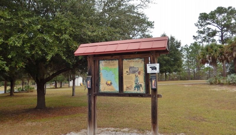
More about this marker. Marker is a large,
composite plaque mounted vertically within a heavy-duty wooden kiosk.
Related markers. Click here for a list of markers that are related to this marker. Florida De Soto Trail
Also see . . . De Soto’s Expedition to North America. In 1536, de Soto obtained a royal commission to conquer and settle the region known as La Florida (now the southeastern United States), which had been the site of earlier explorations by Juan Ponce de León and others. De Soto set out from Spain in April 1538, set with 10 ships and 700 men. After a stop in Cuba, the expedition landed at Tampa Bay in May 1539. They moved inland and eventually set up camp for the winter at a small Indian village near present-day Tallahassee. (Submitted on November 5, 2018, by Cosmos Mariner of Cape Canaveral, Florida.)
Photographed By Cosmos Mariner, November 2, 2018
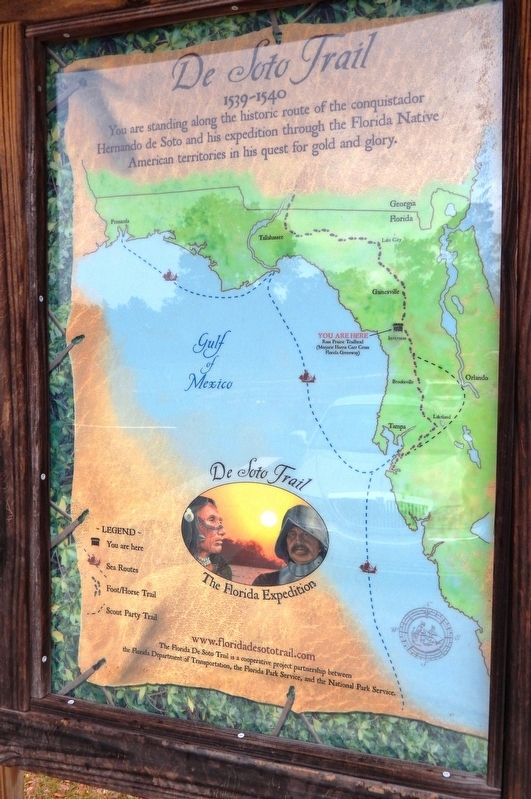
4. Florida De Soto Trail Map (panel to the left of marker in kiosk)
1539-1540
Credits. This page was last revised on December 30, 2020. It was originally submitted on November 5, 2018, by Cosmos Mariner of Cape Canaveral, Florida. This page has been viewed 307 times since then and 27 times this year. Last updated on November 21, 2018, by Cosmos Mariner of Cape Canaveral, Florida. Photos: 1, 2, 3, 4, 5. submitted on November 5, 2018, by Cosmos Mariner of Cape Canaveral, Florida. • Bernard Fisher was the editor who published this page.
