Leesburg in Loudoun County, Virginia — The American South (Mid-Atlantic)
Mt. Zion United Methodist Church
Photographed by Craig Swain, July 14, 2018
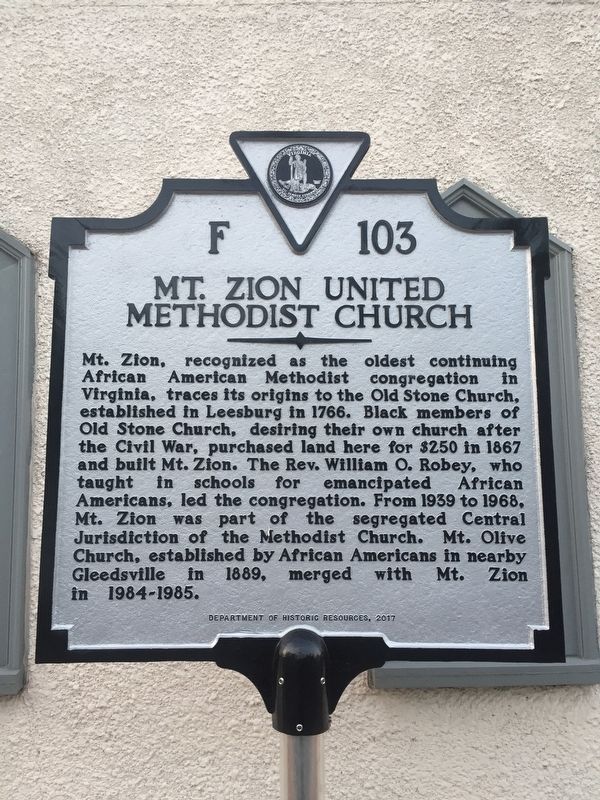
1. Mt. Zion United Methodist Church Marker
Erected 2017 by Department of Historical Resources. (Marker Number F-103.)
Topics and series. This historical marker is listed in these topic lists: African Americans • Civil Rights • Religion & Religious Structures. In addition, it is included in the Virginia Department of Historic Resources (DHR) series list. A significant historical year for this entry is 1766.
Location. 39° 7.026′ N, 77° 33.76′ W. Marker is in Leesburg, Virginia, in Loudoun County. It is on North Street, on
this page online

Regionally, this marker is in the Washington Metropolitan Area and in Northern Virginia. It is also in the American South, specifically in the Upper South, and in the Mid-Atlantic. Globally, it is in North America, the Western Hemisphere, the Western World, and the Anglosphere. Historically, it finds itself in what was once the territory of the Mississippian Culture, one of the original Thirteen Colonies, one of the Confederate States of America, and the Antebellum South.
Other nearby markers. At least 8 other markers are within walking distance of this marker: Lee Comes to Leesburg (about 400 feet away, measured in a direct line); Glenfiddich House (about 400 feet away); Lafayette’s Tour (about 600 feet away); Vietnam Memorial (about 700 feet away); Courthouse Yard (about 700 feet away); In Honor of The Loudoun Citizens… (about 700 feet away); Our Glorious Dead (about 700 feet away); In Memory of the Heroic Dead (about 700 feet away). Touch for a list and map
Photographed by Craig Swain, July 14, 2018
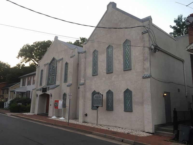
2. Mt. Zion United Methodist Church Marker
Other markers no longer nearby. Confederate Soldiers (was about 700 feet away but has been permanently removed); Loudoun County Court Square (was about 700 feet away but has been replaced with another marker now near it).
Related markers. Click here for a list of markers that are related to this marker. Markers for the Old Stone Church and Mt. Zion Cemetery
Photographed by Craig Swain, July 14, 2018
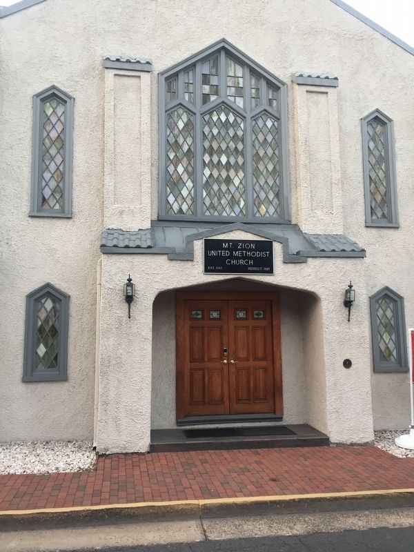
3. Mt. Zion United Methodist Church Entrance
Photographed by Craig Swain, July 14, 2018
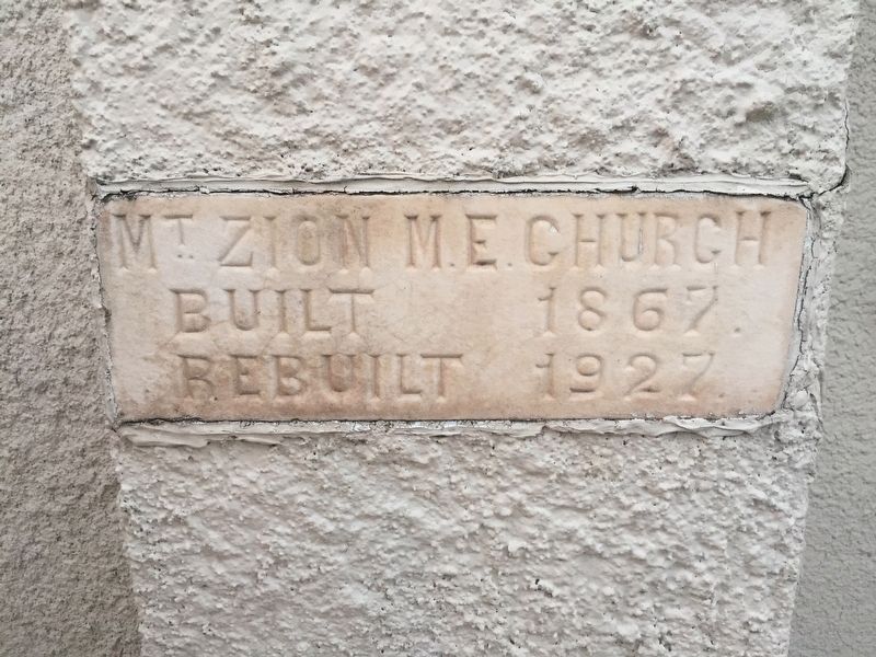
4. Church Cornerstone
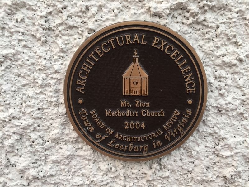
Photographed by Craig Swain, July 14, 2018
5. Architectural Excellence
The church was recognized in 2004 as a structure of architectural excellence by the Town of Leesburg's Board of Architectural Review.
Credits. This page was last revised on September 19, 2021. It was originally submitted on August 13, 2018, by Craig Swain of Leesburg, Virginia. This page has been viewed 704 times since then and 38 times this year. Last updated on November 21, 2018, by Devry Becker Jones of Washington, District of Columbia. Photos: 1, 2, 3, 4, 5. submitted on August 13, 2018, by Craig Swain of Leesburg, Virginia. • Andrew Ruppenstein was the editor who published this page.
