Marker Logo HMdb.org THE HISTORICAL
MARKER DATABASE
“Bite-Size Bits of Local, National, and Global History”
Citronelle in Mobile County, Alabama — The American South (East South Central)
 

Surrender Site


Surrender Site Marker image. Click for full size.
Photographed By Karl Stelly, May 17, 2011
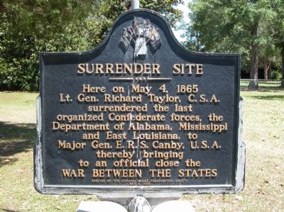
1. Surrender Site Marker
Inscription. Here on May 4, 1865 Lt. Gen. Richard Taylor, C.S.A. surrendered the last organized Confederate forces, the Department of Alabama, Mississippi and East Louisiana, to Major Gen. E.R.S. Canby, U.S.A. thereby bringing to an official close the War Between the States.
 
Erected 1965 by The Historic Mobile Preservation Society.
 
Topics. This historical marker is listed in this topic list: War, US Civil. A significant historical date for this entry is May 4, 1865.
 
Location. 31° 4.512′ N, 88° 14.023′ W. Marker is in Citronelle, Alabama, in Mobile County. Marker is on Center Street (County Route 41) 0.3 miles north of Boy Scout Road, on the right when traveling north. The marker is at the site of Camp Pushmataha, a Boy Scout camp. There is a sign just off Center Street, telling you where to turn. The camp area next to the road is parklike, and is set up like a roadside rest area. Touch for map. Marker is in this post office area: Citronelle AL 36522, United States of America. Touch for directions.
 
Other nearby markers. At least 4 other markers are within 18 miles of this marker, measured as the crow flies. "Having Surrendered Their Arms, the War, to Them, Was Over" (a few steps from this marker); MOWA Band of Choctaw Indians (approx. 11.1 miles away); Andrews Chapel (approx. 17.7 miles away); Town of McIntosh (approx. 17.9 miles away).
 
Related markers.
Paid Advertisement
Click on the ad for more information.
Please report objectionable advertising to the Editor.
Click or scan to see
this page online
Click here for a list of markers that are related to this marker. Citronelle, Alabama Surrender Site
 
Surrender Site Marker image. Click for full size.
Photographed By Karl Stelly, May 17, 2011
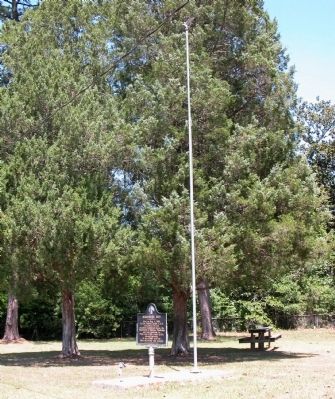
2. Surrender Site Marker
A pulled-back view showing its location next to a flagpole
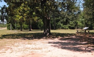
Surrender Site Area image. Click for full size.
Photographed By Karl Stelly, May 17, 2011
3. Surrender Site Area
This view shows part of the park area. The marker and flagpole are at the left; Near the right edge of the photo there is a wayside exhibit marker that explains the surrender scenario in more detail.
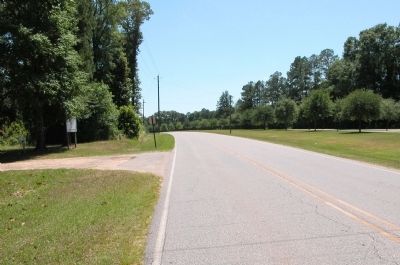
Surrender Site image. Click for full size.
Photographed By Karl Stelly, May 17, 2011
4. Surrender Site
This is a view looking south along Center Street/County Road 41. The entrance into the surrender site area can be seen in the left area of the photo.
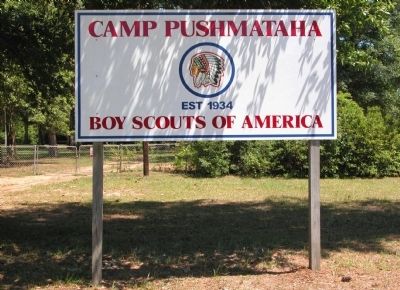
Scout Camp Sign image. Click for full size.
Photographed By Karl Stelly, May 17, 2011
5. Scout Camp Sign
This sign is located off to the right of the driveway/park entrance
 
 
Credits. This page was last revised on July 27, 2019. It was originally submitted on May 31, 2011, by Karl Stelly of Gettysburg, Pennsylvania. This page has been viewed 1,939 times since then and 53 times this year. Last updated on November 25, 2018, by Cosmos Mariner of Cape Canaveral, Florida. Photos:   1, 2, 3, 4, 5. submitted on May 31, 2011, by Karl Stelly of Gettysburg, Pennsylvania. • Andrew Ruppenstein was the editor who published this page.
Share this page.  
Share on Tumblr
m=126730

CeraNet Cloud Computing sponsors the Historical Marker Database.
This website earns income from purchases you make after using our links to Amazon.com. We appreciate your support.
Paid Advertisement
Apr. 25, 2024