
Natchez in Adams County, Mississippi — The American South (East South Central)
Intersection of Washington and South Wall Streets
Natchez Trails
Photographed by Cosmos Mariner, May 22, 2014
1. Intersection of Washington and South Wall Streets Marker
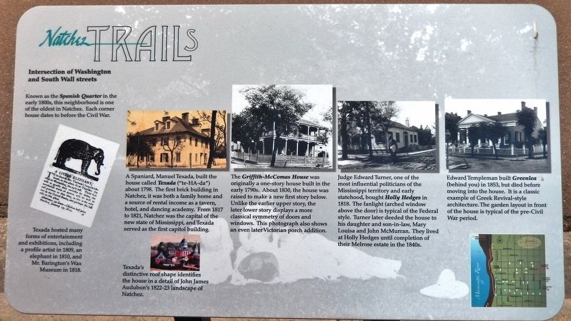
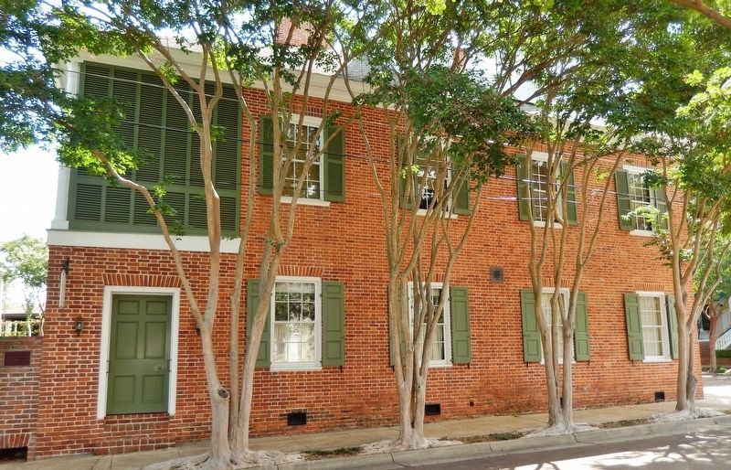
A Spaniard, Manuel Texada, built the house called Texada (“te-HA-da”) about 1798. The first brick building in Natchez, it was both a family home and a source of rental income as a tavern, hotel, and dancing academy. From 1817 to 1821, Natchez was the capital of the new state of Mississippi, and Texada served as the first capitol building.
Texada hosted many forms of entertainment and exhibitions, including a profile artist in 1809, an elephant in 1810, and Mr. Barington's Wax Museum in 1818.
Texada's distinctive roof shape identifies the house in a detail of John James Audubon's 1822-23 landscape of Natchez.
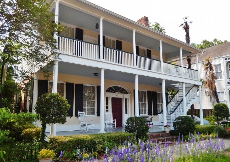
The Griffith-McComas House was originally a one-story house built in the early 1790s. About 1830, the house was raised to make a new first story below. Unlike the earlier upper story, the later lower story displays a more classical symmetry of doors and windows. This photograph also shows an even later Victorian porch addition.
Judge Edward Turner,
this page online
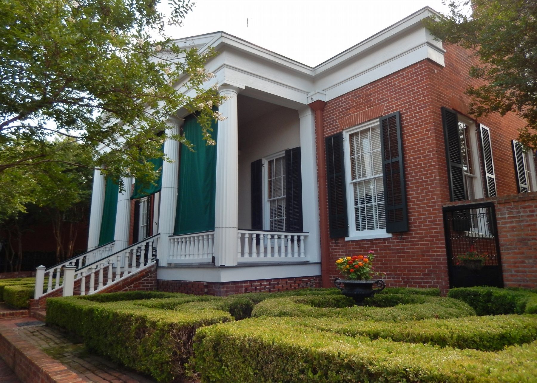
Edward Templeman built Greenlea (behind you) in 1853, but died before moving into the house. It is a classic example of Greek Revival-style architecture. The garden layout in front of the house is typical of the pre-Civil War period.
Erected by City of Natchez, Mississippi.
Topics and series. This historical marker is listed in these topic lists: Animals • Architecture • Arts, Letters, Music • Colonial Era • Entertainment • Hispanic Americans • Horticulture & Forestry • Settlements & Settlers. In addition, it is included in the Mississippi - Natchez Trails series list. A significant historical year for this entry is 1798.
Location. 31° 33.545′ N, 91° 24.356′ W. Marker is in Natchez, Mississippi, in Adams County. It is at the intersection
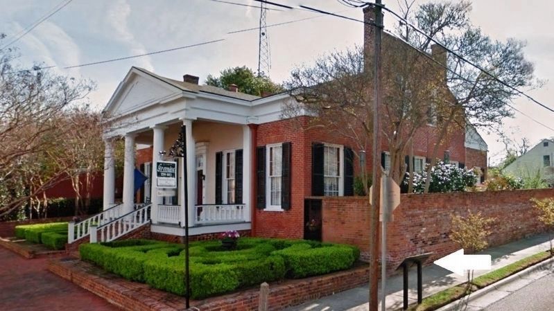
2. Greenlea House (corner view; marker visible beside Washington Street stop sign on right)

Regionally, this marker is in Southwest Mississippi and in Natchez Trace Corridor. It is also in the American South, specifically in the Deep South, and in the Great River Road Region. Globally, it is in North America, a Gulf of Mexico state, the Western Hemisphere, the Western World, and the Anglosphere. Historically, it finds itself in what was once New Spain, the Viceroyalty of New France, the territory of the Mississippian Culture, one of the Confederate States of America, and the Antebellum South.
Other nearby markers. At least 8 other markers are within walking distance of this marker: Texada (within shouting distance of this marker); Intersection of State and South Wall streets (about 300 feet away, measured in a direct line); The William Johnson House (about
Photographed by Cosmos Mariner, May 22, 2014
3. Texada, Natchez, Mississippi (view from Washington Street)
Photographed by Cosmos Mariner, May 22, 2014
4. The Griffith-McComas House, Natchez, Mississippi (view from near marker)
Photographed by Cosmos Mariner, May 22, 2014
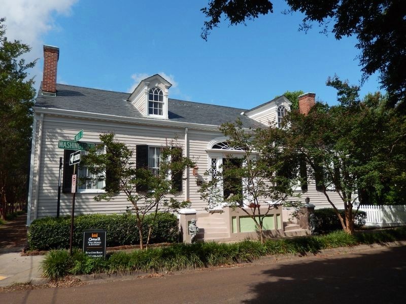
5. Holly Hedges, Natchez, Mississippi (view from Washington Street)
Photographed by Cosmos Mariner, May 22, 2014
6. Greenlea, Natchez, Mississippi (view from near marker; showing pre-Civil War garden layout)
Credits. This page was last revised on February 2, 2020. It was originally submitted on December 4, 2018, by Cosmos Mariner of Cape Canaveral, Florida. This page has been viewed 925 times since then and 43 times this year. Photos: 1, 2, 3, 4, 5, 6. submitted on December 4, 2018, by Cosmos Mariner of Cape Canaveral, Florida. • Bernard Fisher was the editor who published this page.
