Near Toomsboro in Wilkinson County, Georgia — The American South (South Atlantic)
The Defense of Ball's Ferry
"General Howard, how can we get any further?"
— March to the Sea Heritage Trail —
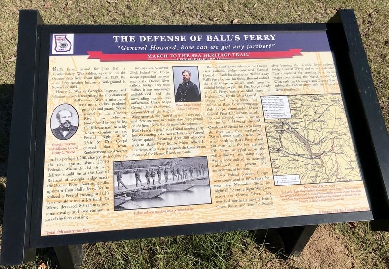
Henry C. Wayne, Georgia's Inspector and Adjutant General, recognized the importance of Ball's Ferry. With a mixture of state units, cadets, pardoned prisoners and guards Wayne arrived at the Oconee River on Monday, November 21st on the last Confederate train to safely depart Gordon as the Federal "Right Wing" (15th & 17th Corps) entered that town Reinforcements raised Wayne's total to perhaps 1,200, charged with defending the river against about 27,000 Federals. Wayne decided his main defense should be at the Central Railroad of Georgia bridge across the Oconee River, about eight miles upstream from Ball's Ferry. Yet he realized a Federal crossing at Ball's Ferry would turn his left flank. So Wayne detached 80 infantrymen, some cavalry and two cannon to guard the ferry crossing.
Two days later, November 23rd, Federal 17th Corps troops approached the west end of the Oconee River railroad bridge. They soon realized it was surprisingly well-defended and the surrounding terrain was unfavorable. Union Major General Oliver O. Howard, commander of the Right Wing reported, "the [river's] current is very swift, and there are some two miles of swampy ground on the [west] bank but the immediate approach to [Ball's Ferry] is good." So a Federal scouting party forced a crossing of the river at Ball's Ferry. General Wayne quickly dispatched about 200 additional men to Ball's Ferry led by Major Alfred L. Hartridge. After a sharp skirmish the Confederates re-secured the Oconee River's east bank.
The stiff Confederate defense at the Oconee River railroad bridge convinced General Howard to flank his adversaries. Within a day Ball's Ferry became his focus. Howard ordered the 17th Corps to march south from the railroad bridge to join the 15th Corps already at Ball's Ferry, having marched there from Irwinton. Yet by the 25th General Wayne had strengthened his defense at Ball's Ferry, prompting 15th Corps commander, Major General Peter J. Osterhaus to ask, "General Howard, how can we get any further?" Howard directed Osterhaus to extend his corps along the river until they out-flanked Wayne's much smaller force. Two miles north of Ball's Ferry about 200 men from the just arriving 17th Corps struggled across the swiftly-flowing river using ropes. Wayne soon ordered an overnight withdrawal to prevent the encirclement of his men.
Two Federal pontoon bridges were constructed at Ball's Ferry the next day, November 26th. By nightfall the entire Right Wing was across the Oconee River. They marched
northeast toward Irwin's Cross Roads and Tennille Station after burning the Oconee River railroad bridge General Wayne had so well defended. This completed the crossing of a second major river during the March to the Sea. With both the Ocmulgee and Oconee Rivers behind the Federal army, only the Ogeechee River remained.
[Photo captions]
Background: Typical 19th century river ferry
Left: Georgia Inspector and Adjutant General Henry C. Wayne
Middle top: Union Major General Oliver O. Howard
Middle bottom: Federal soldiers standing on a pontoon bridge
Bottom right map: November 24 & 25, 1864 The Federal "Right Wing" confronts Confederate General Henry C. Wayne's mixed force at both Ball's Ferry and the Central Railroad bridge across the Oconee River while Confederate Major General Joseph Wheeler's cavalry rides north to skirmish with the Federal "Left Wing" in Sandersville the next day
Erected 2018 by Georgia Civil War Heritage Trails, Inc. (Marker Number R14.)
Topics and series. This historical marker is listed in these topic lists: War, US Civil • Waterways & Vessels. In addition, it is included in the Georgia Civil War Trails, and the Sherman’s March to the Sea series lists. A significant historical month for this entry is November 1864.
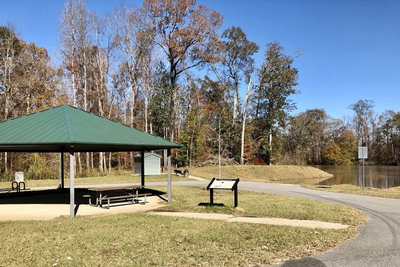
Location. 32° 47.012′ N, 82° 57.527′ W. Marker is near Toomsboro, Georgia, in Wilkinson County. Marker can be reached from Balls Ferry Road, 0.4 miles east of Georgia Route 57. Located in Ball's Ferry Park next to the boat ramp at the Oconee River. Touch for map. Marker is in this post office area: Toomsboro GA 31090, United States of America. Touch for directions.
Other nearby markers. At least 8 other markers are within 8 miles of this marker, measured as the crow flies. Ball's Ferry (within shouting distance of this marker); a different marker also named Ball's Ferry (approx. 0.3 miles away); a different marker also named Ball's Ferry (approx. 0.7 miles away); Jefferson Davis (approx. 1.9 miles away); Sherman's Right Wing (approx. 3.1 miles away); The Defense of the Oconee Bridge (approx. 5 miles away); Toomsboro (approx. 7˝ miles away); Robert Toombs (approx. 7.6 miles away). Touch for a list and map of all markers in Toomsboro.
Credits. This page was last revised on May 14, 2020. It was originally submitted on December 7, 2018, by Mark Hilton of Montgomery, Alabama. This page has been viewed 797 times since then and 89 times this year. Photos: 1, 2, 3, 4. submitted on December 7, 2018, by Mark Hilton of Montgomery, Alabama.


